A somewhat surprisingly wild evening south and east of Houston tonight. As I’m writing this, strong to severe thunderstorms are clobbering Galveston and Jamaica Beach, heading offshore. Lingering storms continue to the west from Texas City across League City into Pearland and Missouri City.
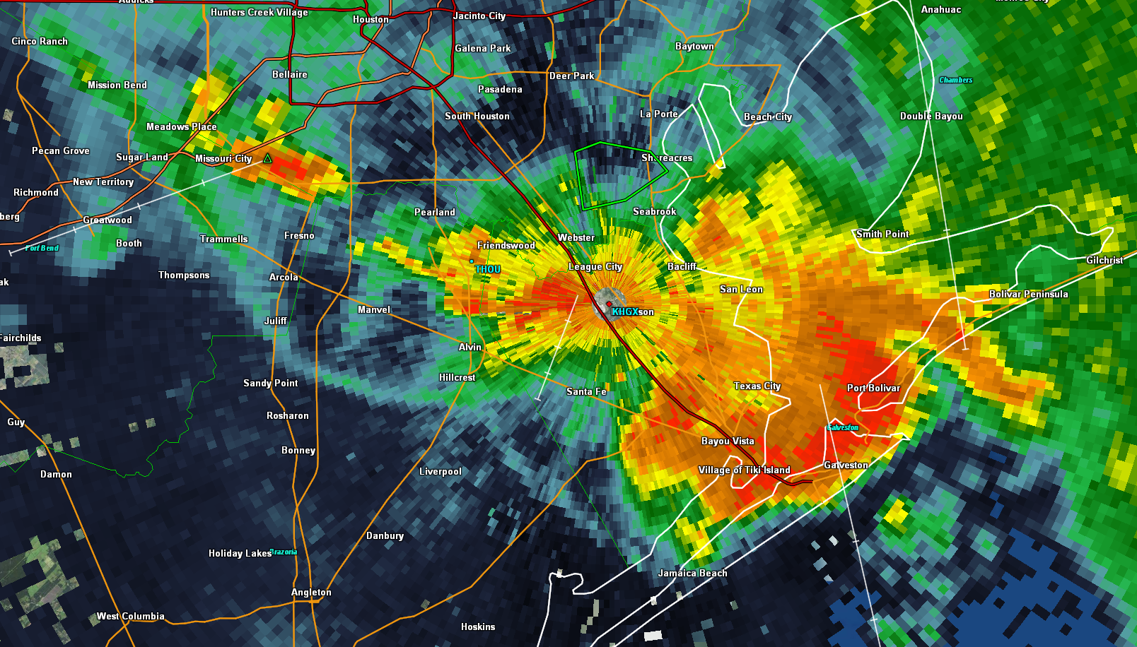
Total rainfall has been impressive near NASA, Shoreacres, and El Lago, with three inches falling in an hour in a few spots.
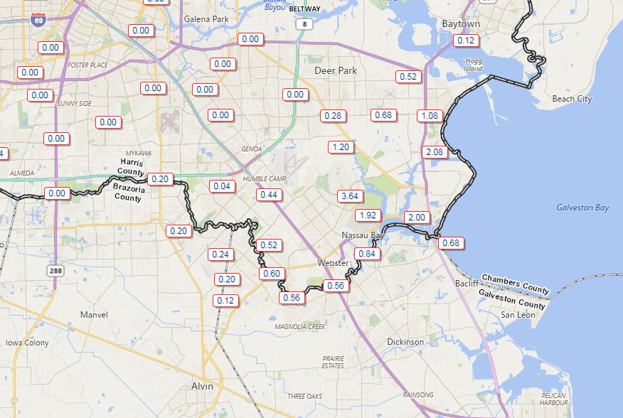
That has prompted a flash flood warning until 11:45 in that area. Use caution if you’re traveling in that region, as some residual street flooding could occur through midnight.
The storms also produced some awesome skies in the Houston area.
@mattlanza Apricot? pic.twitter.com/mBBMrUEZe2
— Chris Graczyk (@13PhotogChris) July 4, 2018
Well, #ForeverOrange. 🤷♂️ pic.twitter.com/b0LdV1n1rr
— Houston Dynamo FC (@HoustonDynamo) July 4, 2018
So what’s next?
Weather modeling is actually in decent agreement that this cluster of storms will move offshore and fester for much of the night, before we see things rekindle onshore toward sunrise. Showers and storms should increase in coverage after 3-5 AM as our disturbance swings into Texas. We’ll probably be at peak for coverage of showers and storms in the morning, before everything shifts toward San Antonio in the afternoon.
The best chances and coverage of storms will likely be south of I-10 tomorrow.
So bottom line for the Fourth of July:
- Heavy rain in the morning, especially south of I-10.
- More flash flooding of streets possible in the JSC/Webster/Seabrook area.
- Storms will be noisy with potentially a good deal of lightning once again.
- Rain ends from east to west by early afternoon for most of us.
- Late afternoon and evening plans look dry (except well west of Houston toward Brenham and Columbus, where showers will linger til late day).
- Folks north of Houston may miss out on a lot of the additional rainfall.
- Additional rainfall: 0.25″ to 0.75″ or less in Montgomery, Liberty, and Grimes Counties and north.1-3″ in Harris, Chambers, Wharton, and Fort Bend Counties. A general 1-3″ with isolated pockets of 3-5″ possible in Galveston and Brazoria Counties.
- There’s still a degree of uncertainty to this forecast, as modeling could be wrong. Check back in the morning for an update.
More in the morning.

My house (Ellington area) nearly got hit by lightning, think it bagged the light pole across the street. Definite popping sound overhead right after the strike. No trees vaporized, burned, or bifurcated.
We sure could use more wind information for the Galveston Bay Area. We had a wild could of hours!
Thanks, Matt! Happy 4th!!
Beautiful update! I was just wondering if we’d get an update on this string of storms.
Thank you! I have an activity in Willis tomorrow morning, and it’s looking better! I appreciate greatly your willingness to share your expertise.
Thanks Matt for being there for us…kinda noisey around here, Eldorado and Space Center Blvd’s…
Cornered area of Ft. Bend toll rd. And Hwy 90 south, Westbury- we got a good 1 ” 1-1/2″ rain, no flooding. Some thunder and lighting like in a fast moving Spring storm. Sky is very overcast n pressure is building. Definitly the rain bird is singing for more at sunrise in an hr. Happy 4th Matt and thanx for the updates!
What about Bush airport around 6:00??????