Good morning, and happy Friday! This will be a relatively brief post, as we have a limited amount of weather issues to discuss for once.
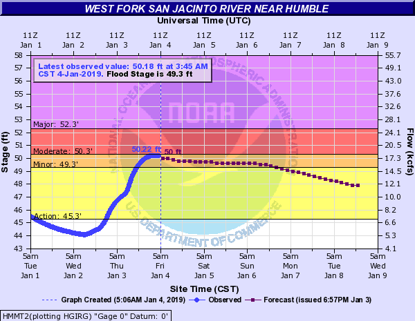
First, let’s do some quick housekeeping on flooding on some of the larger rivers in the region. The West Fork of the San Jacinto River near Humble appears to be cresting this morning on the threshold of moderate flooding. It will recede over the next couple days.
The East Fork will see minor flooding, while the Trinity River at Liberty continues to see major flooding.
Along the Brazos, minor to just shy of moderate flooding is expected near Hempstead, while a slow rise downstream at Richmond should push the river to near or just below minor flooding levels by midweek next week.
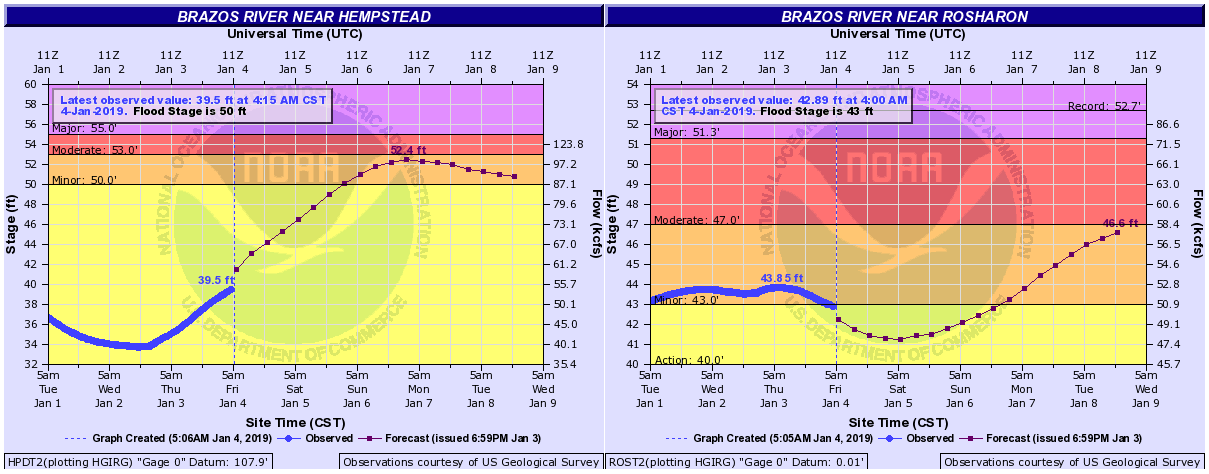
Further downstream at Rosharon, minor to borderline moderate flooding is expected next week as well. Flooding along the Brazos is being fed by inflows from the Navasota River, which is in moderate flood north of College Station.
Today through Sunday
Mostly sunny skies will prevail on each of the next three days across all of Southeast Texas. The only blemish here may be some patchy fog on each of the next few mornings, especially later in the weekend. We’ll shift to sunshine quickly through each morning.
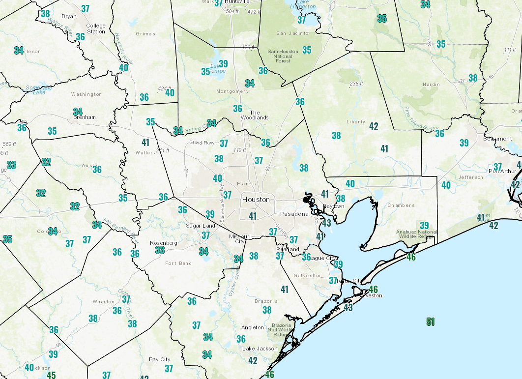
We’re starting today in the 30s in much of the area, the coldest morning for Houston since December 11th, when we hit 34° officially. Temperatures will warm and top off in the mid- to upper-50s today, mid-60s tomorrow, and near 70 on Sunday. Morning lows will be chilly again tonight, with low-40s. Onshore flow slowly increases a bit on Saturday night and Sunday, so low temperatures Sunday morning will be milder, in the mid- to upper-40s.

Monday
A weak cold front is poised to move through the region Monday night. This one will lack much in the way of moisture and punch, so expect a mostly uneventful front passage Monday night. We’ll be mild on Monday ahead of the front, with highs topping off in the low-70s with enough sunshine. If we see a stray shower with the front, it would likely be from midday through early evening Monday.
Rest of next week
Tuesday into early Wednesday sees residual clouds, some sun, and a slight rain chance. The best chance of any rainfall would likely be south of the Houston area, more toward Matagorda Bay or perhaps near Galveston. We’ll keep an eye on this, but as of right now I don’t think any meaningful rain comes of this. Our next worthwhile rain event will likely come with a cold front around Friday or Saturday of next week. It looks fairly mild next week, as we expect highs in the 60s and lower 70s on most days.
Appreciate the updates on river flooding, especially what the Brazos is doing in my particular situation. Whenever there are rain events that precipitate flooding stages of rivers it is obviously of interest to most of us in and around Houston.
I’m one of those weirdos that likes the hot. So 70s will have to keep me till Spring! 😁
Great weather ahead – – and a chance for my yard to dry out.
Any Artic air on the horizon in the 14 day outlook????
Not much, but I think beyond that period we’ll begin to start talking a bit more about cold.
It’s as though winter begins and ends in December for this city.