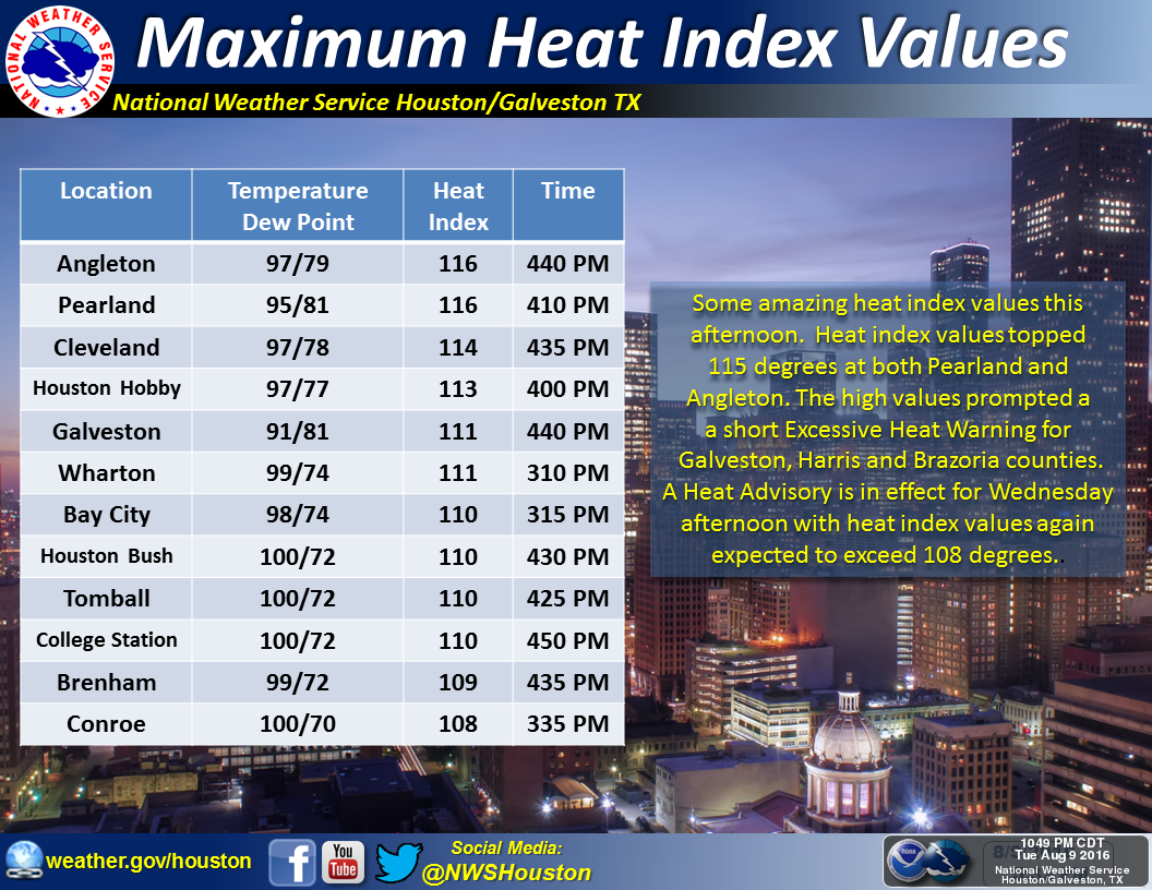
The greater Houston region saw a rare “excessive heat warning” on Tuesday as low-level moisture stayed put during the afternoon hours, allowing heat indices to briefly exceed 113 degrees. Such conditions will remain for a couple of more days before clouds and increasing rain chances finally bring some relief to the area.
Today
Houston remains under a heat advisory today—one step below the excessive heat warning level—and its possible some sites could reach the 113-degree heat index threshold again. In short, it’s going to be extremely hot out again this afternoon, with only some scattered showers developing.
Thursday through Saturday
A combination of retreating high pressure and increasing atmospheric moisture will combine to bring more clouds into the forecast for the second half of the week. This is unlikely to translate into widespread showers, at least not yet. Temperatures should also remain in the mid- to upper-90s as there will be some sunshine, but we hopefully will remain below the heat advisory level for most days.
Sunday through Tuesday
This is when rain becomes more likely, and thunderstorms possible as moisture levels continue to rise across the area. Highs will likely fall back into the low- to mid-90s thanks to the cloud cover, too. I think it’s reasonable to think most of the area will see 0.5 to 2 inches of rain during the first half of next week, a most welcome reprieve from the August heat and drought doldrums.
Tropics
Please note that while it’s going to be very hot this week for Houston, just to our east a major rainfall event is likely to unfold.
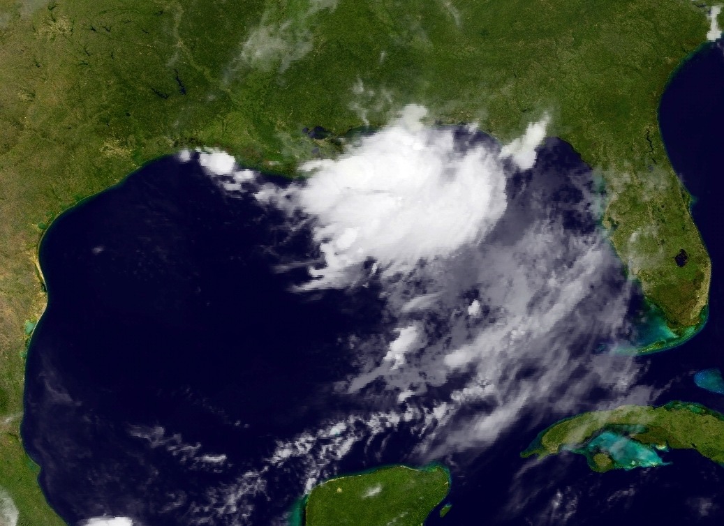
A large area of low pressure near the northern Gulf of Mexico coast is continuing to produce heavy rain showers, and as it slowly meanders west it is likely to produce 12 or more inches of rain over some areas from the Florida panhandle through Southern Louisiana this week. At this time some of the heaviest rains appear bound for New Orleans, so take care if these locations are in your travel plans during the next several days.
Eric, this may be something very elementary but it seems contradictory to me. Could you briefly explain
“A combination of retreating high pressure and increasing atmospheric pressure will combine to bring more clouds into the forecast for the second half of the week. “
Doh! Meant atmospheric moisture. Thanks for catching that.
Excited about these “cooler” low 90s next week…only in Houston.
Why thunderstorms and not just rain, Eric?
Hi Eric:
“A large area of low pressure near the northern Gulf of Mexico coast is continuing to produce heavy rain showers, and as it slowly meanders west it is likely to produce 12 or more inches of rain over some areas from the Florida panhandle through Southern Louisiana this week. At this time some of the heaviest rains appear bound for New Orleans, so take care if these locations are in your travel plans during the next several days. ”
Will New Orleans experience flooding similar to what we in Houston did back on August 18th?
It’s possible the situation in New Orleans could get pretty serious. We shall see.