Good morning. After several days of calm weather and sunshine, Houston’s forecast will soon turn a bit more dynamic for the rest of the week. We could see some storms with a frontal passage on Wednesday, and then more inclement weather with a front coming this weekend. With the latter front we think there is even a slight chance of wintry precipitation, including possibly snow, which we’ll discuss below.
Tuesday
This morning we have some fog issues for coastal areas, but this should clear up pretty quickly. Highs will reach about 70 degrees later today under mostly sunny skies. As winds come from the southeast later today, tonight will be the warmest one of the year so far, and probably for at least the next week. Lows probably will only drop into the mid-50s for much of the region.
Wednesday
We still have some questions about the timing and speed of the front, but the most likely time for its passage is around sunset in Houston, and a little bit later along the coast. Daytime temperatures therefore should reach about 70 degrees, with mostly cloudy skies and scattered showers. A line of storms is expected to move along with the front, and how fast the front moves will determine rainfall amounts. We probably will see accumulations of about 1 inch or so north of Interstate 10, and approximately 0.5 to 1 inch closer to the coast. Rains will end quickly with the front’s passage, as cooler and drier air moves in during the evening and overnight hours.
Thursday and Friday
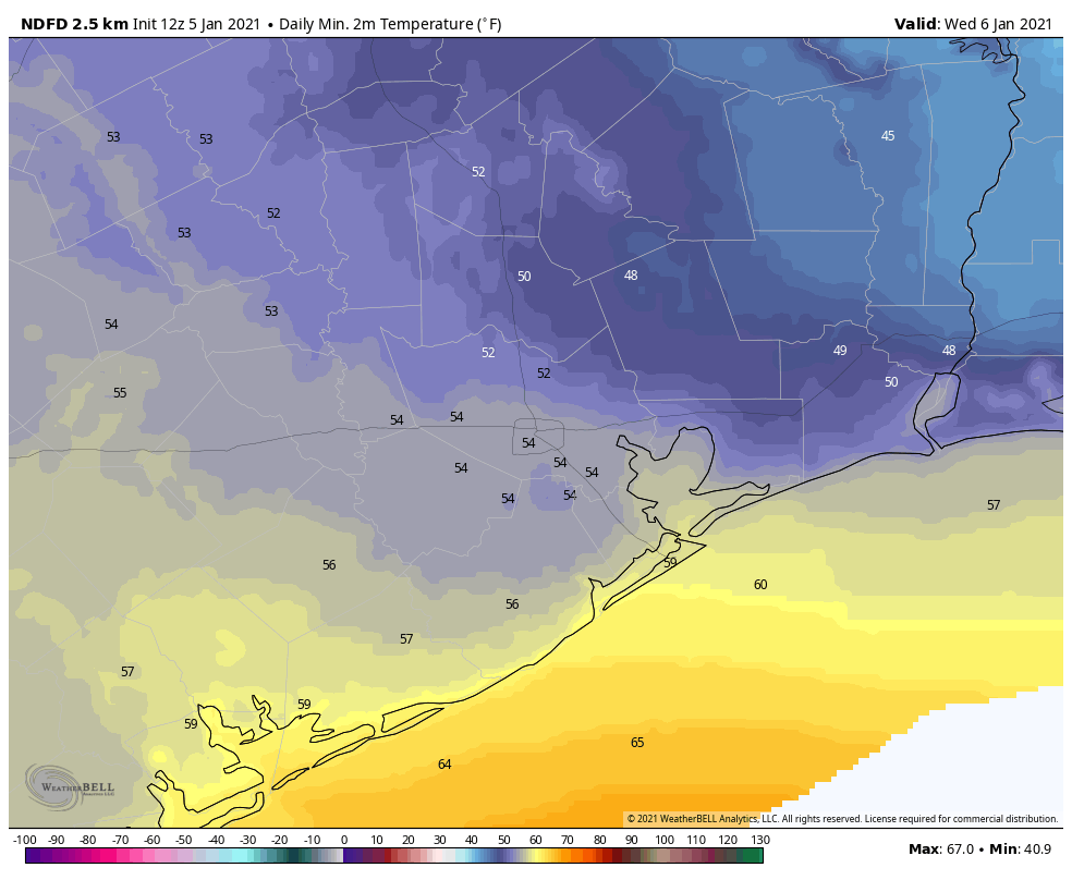
The end of the week will be sunny and cool, with highs of around 60 degrees and lows near 40 in the city of Houston—cooler inland and warmer along the coast.
Saturday
The first half of the weekend should be similarly pleasant, with highs of around 60 degrees and partly to mostly sunny skies.
Sunday and beyond
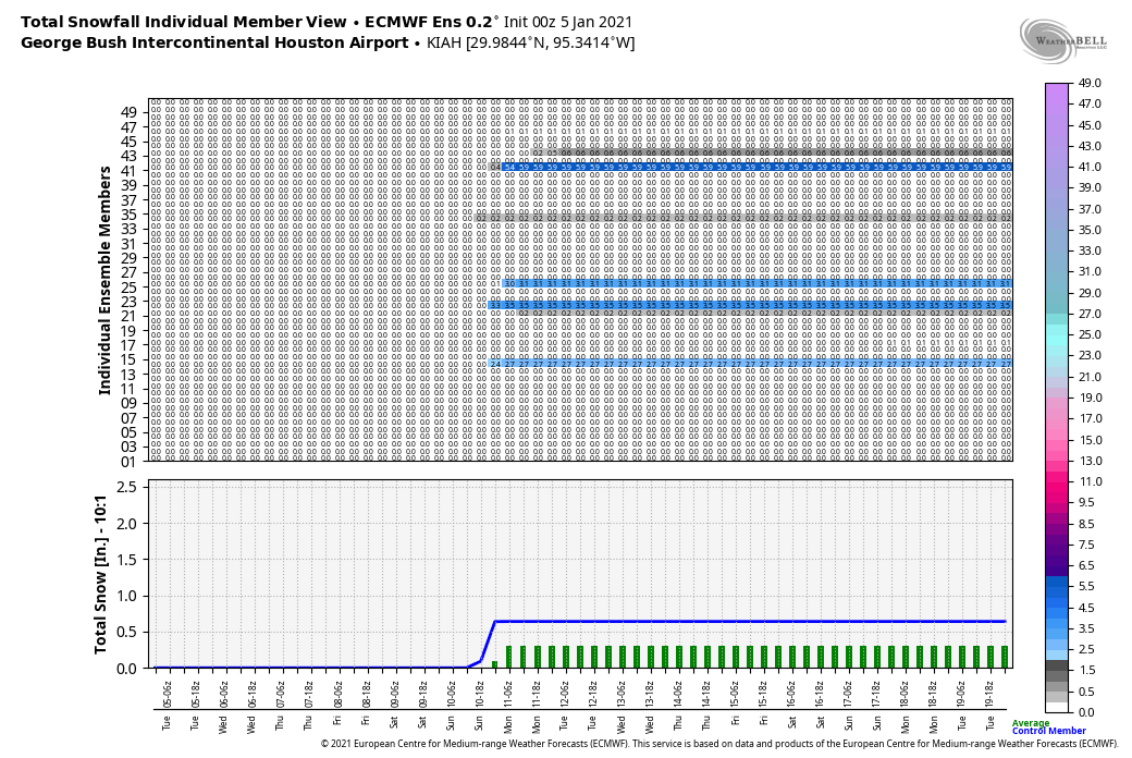
The next front looks set to arrive on Sunday. The details are sketchy, but there is at least the potential for some wintry precipitation. As the front pushes into Houston there will be plenty of moisture along with a southerly storm track, and enough lift to generate precipitation. (Rain accumulations with the front probably will be on the order of 0.5 to 1 inch). The question is whether there will be enough really cold air in the atmosphere for freezing conditions almost all the way to the surface. That’s more likely the further north along Interstates 45 and 69 one goes. Right now I’d estimate that snow chances are decent for places like Huntsville and Livingston. However, we’re probably still at 20 percent, or less, for the city of Houston itself. But it will be something to watch.
Temperatures should be cold in the wake of Sunday’s front, with daytime highs generally in the 50s, and nighttime lows in the 30s and 40s to start next week.

If we could just keep the weather like this year-round, I’d be a happy camper. Work on it, guys!
In about the Winter of 1997, at Bush Airport, there were several weeks in which each week 6 of the 7 days, the temperatures did not rise above 49 degrees Fahrenheit and in which each week 6 of the 7 mornings, the temperatures did not drop below 40 degrees F. That period of time had the most consistent temperatures of my lifetime.
Let it snow, let it snow, let it snow!!!
#wishfulthinking
I’m good with what we currently got – we can pass the snow showcase to the next contestant.
So happy to have an actual winter – at least Houston style. So much better that the mild / warm ones of past several years…