While we lacked any organized storms on Thursday, there were some neighborhoods that saw a smattering of rain. Other places saw rain or heard thunder in the middle of the night. Rain chances will stick with us through Sunday, but the focus is going to lean more to our south or along the coast.
Today & weekend
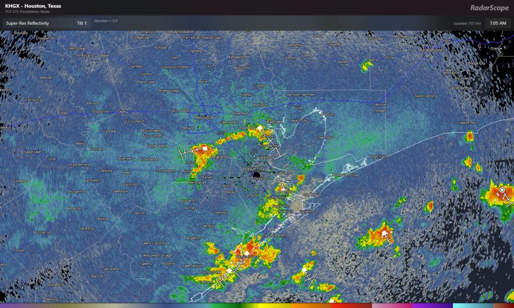
Radar this morning is buzzing from Houston to points southeast. Scattered downpours are with us.

As the day progresses, the focus will continue to likely back down to areas closer to the coast. Inland areas will still carry a chance for rain as well, but most modeling (and the morning radar imagery) suggests the bulk of today’s showers will remain south and east of Houston. Low rain chances doesn’t mean no rain chances, and any rain that does fall could be heavy and add up to an inch or so over a short amount of time.
Highs will be variable today, ranging from the 80s near the coast to the low or mid 90s inland and perhaps near 100 in the Brazos Valley.
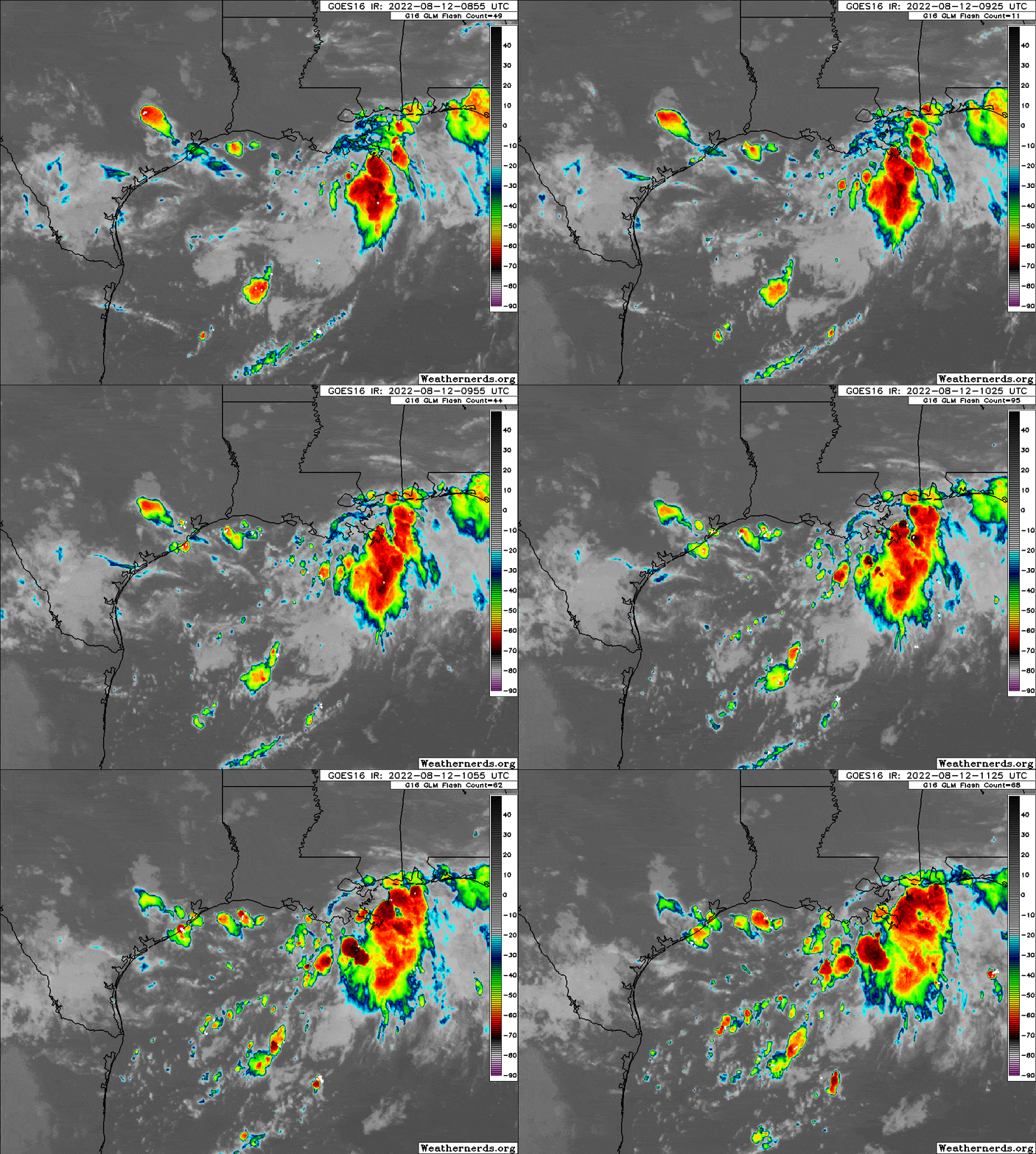
One wild card in the forecast the next few days is what’s happening in the Gulf. Recall from Tuesday’s Eye on the Tropics post, we noted that the Gulf would be the area to at least monitor.

Well, as of Friday morning, there is a disturbance in the Gulf, and while it’s not currently expected to develop, what it may do is focus shower and storm activity offshore at times this weekend. The system itself will track toward Corpus Christi or Brownsville, pushing inland on Sunday. Assuming showers and storms do focus closer to that system, that could mean that we see relatively low rain chances in the Houston area for Saturday.
So, for both weekend days, expect to see sun, clouds, and at least a few showers and storms in the area. The greatest coverage and highest chances will be along the coast, with chances dropping off significantly as you head north or west from Highway 59. All of us have some chance at rain this weekend, but your odds increase south and east of Houston. Sunday could see higher rainfall coverage a little more inland as winds become less parallel to the coast and more onshore. But we’ll assess that through the weekend and keep you posted.
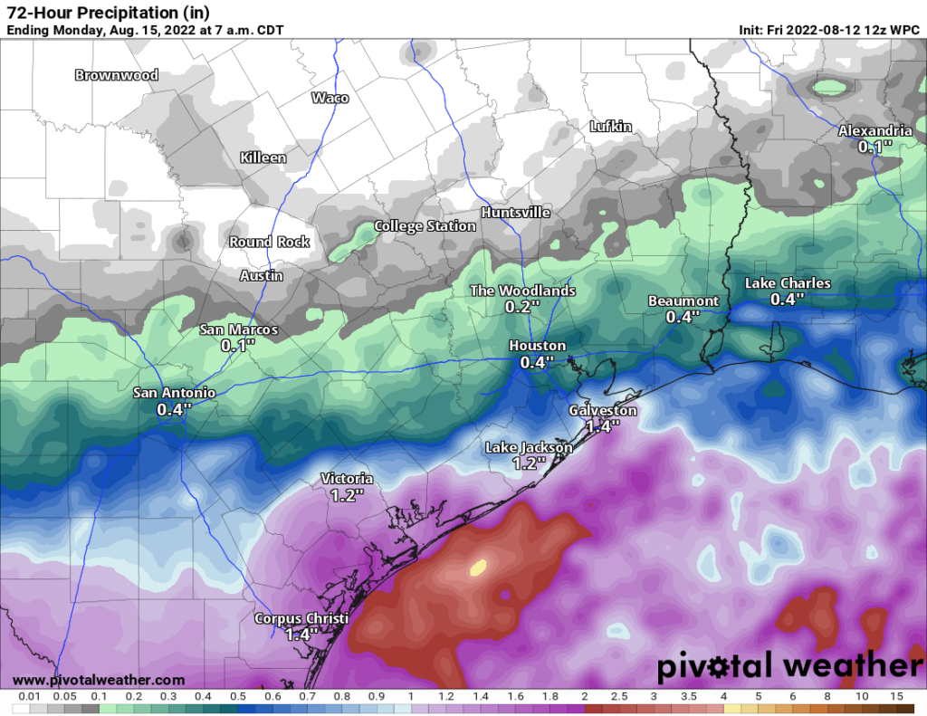
Total forecast rainfall this weekend (ending Monday morning) is shown below. While some areas will see more rain than this and others less, this map is a good average of where we think things will end up over the coming days.

Temperatures will be quite variable this weekend, perhaps only in the low 80s with clouds and showers on the coast, mid-90s in Houston proper, and upper 90s to near 100 well inland.
Early next week
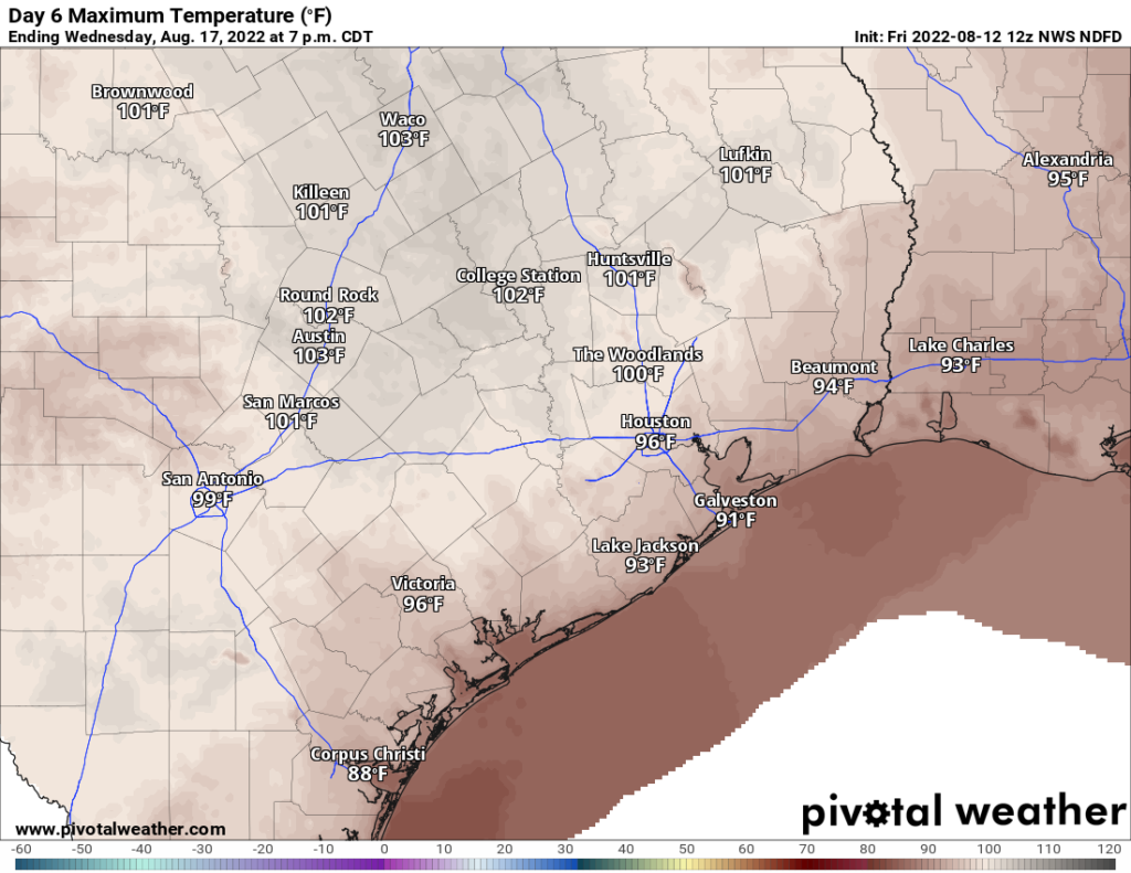
We revert back to the usual Summer 2022 fare Monday through Wednesday of next week. We will likely see mid to upper-90s in Houston, with 100+ farther inland and lower 90s at the coast.

Rain chances should drop to about 10, maybe 20 percent each day.
Later next week
I’ve been watching the weather model forecasts all week with some curiosity for late next week or weekend. There have been hints of a cooler, wetter pattern arriving across all of Texas on both the GFS & European models. While it’s too soon to get into details, it does appear we will see a chance at a front in the area, some “less hot” (not cool) weather, and potentially some higher rain chances than normal by next weekend. We have been burned by these scenarios more than once this summer, so I’m not exactly jumping in with both feet here. But there’s a healthy amount of evidence that rain chances will pick up further in 8 to 10 days. More on this Monday.
We’ll keep you posted on the rain chances this weekend with a post or two tomorrow or Sunday.
How does computer modeling work?
NICE
Often poorly.
Had a quick one inch of rain early this morning which is good.
It started when I was in the check-out lane at HEB, which is bad.