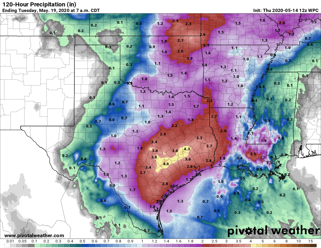
Houston will remain in a fairly wet pattern through the weekend, with the greatest likelihood of rain on Saturday. While we are watching for the potential of widespread, heavy rainfall, right now we think rain totals will be manageable for most over the next four days with amounts probably in the range of 1 to 3 inches. What we’re concerned about is more localized rainfall amounts, which could reach 5 inches or higher.
Thursday
It’s quite the muggy morning for mid-May, with overnight low temperatures not having fallen below 75 degrees for much of the area. We’re seeing some showers develop offshore and these should migrate inland during the daytime—most areas probably have about a 40 percent chance of rain. These should remain fairly scattered and fade out by this evening. Otherwise, skies should see a mix of clouds and sunshine, with highs pushing into the mid- or upper-80s depending on how much sun breaks through this afternoon. Winds will be light, out of the south. Low temperatures Thursday night will again be quite warm.
Friday
On Friday Houston will remain in this pattern where there’s some lingering high pressure, but not enough to stamp out showers. As a result we’re likely to see weather similar to Thursday, with some thunderstorms breaking through, but nothing too widespread or organized. Highs should again be in the upper 80s.

Saturday
We still expect rain chances to peak on Saturday, as moisture levels peak in concert with an upper-level low pressure system that has broken off from the jet stream. This is the kind of scenario for heavy rainfall, but we can’t sure whether this will set up over the Houston region, or further to the west over Central Texas. Right now my best guess for a shot of 5 inches of rain or more is somewhere in between Houston and Austin, but there just isn’t that much clarity in the forecast models. Widespread showers and clouds should limit high temperatures to the low 80s.
Sunday
The spike in rain chances may continue into Saturday morning, but overall rain chances at this point look to be a little less than on Saturday. Clouds should predominate, with highs somewhere in the mid-80s.
Next week
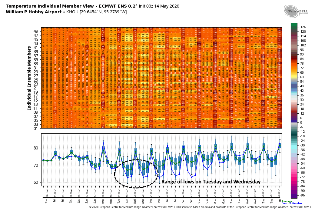
In the wake of this upper-level low pressure system, there is now some support in the operational and ensemble models for bringing through a decent May cool front on Monday. To be clear, this feature didn’t exist in yesterday’s forecasts, so we’re just writing in pencil at this point rather then pen, but now both the European and GFS models are at least suggesting it’s a possibility. If this comes off it would bring some drier air, helping to end rain chances, and probably push nighttime lows into the 60s. Who wouldn’t take that during the second half of May? So—fingers crossed.
“Sunday: The spike in rain chances may continue into Saturday morning, but overall rain chances at this point look to be a little less than on Saturday.”
I think that first Saturday was meant to be Sunday 🙂 Or else, I need stronger coffee this morning 😮 LOL
Give em a break!
I caught that too!
Sorry! Not giving them a hard time! I stumbled reading it prior to coffee and wasn’t sure I was reading it right, LOL