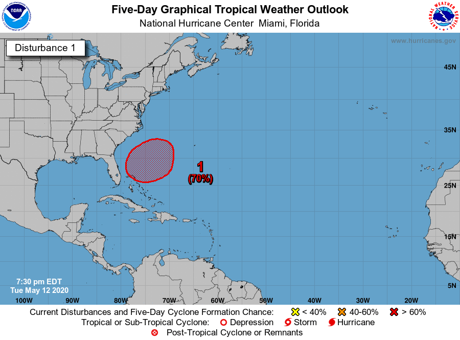
Good morning. You may have seen that a subtropical storm is likely to form off the southeastern United States during the next several days. It presents no threat to land, and it’s not all that uncommon for these kinds of tropical systems to form in May. However, the system should serve as a reminder that Atlantic hurricane season is coming, and forecasters generally believe this season has a good chance of being fairly active. Here is some basic advice from FEMA about making a plan for this year’s season.
Wednesday
If you checked the radar to the west of Houston on Tuesday evening it looked fearsome at times, but the storms waned considerably as they moved into the Houston area. (Well to the southwest of the city, in Jackson County, as much as 8 inches of rain fell in one location). Accumulations across Houston were generally about one-quarter inch, give or take. Some additional rain is possible today, although we think any showers will be fairly scattered. Skies will see a mix of clouds and sunshine, with highs probably pushing up into the mid-80s. Overnight lows will only drop into the low 70s.
Thursday
Thursday should bring more of the same. Although we’re under a moist, southeasterly flow off the Gulf of Mexico, there’s just no great trigger for showers. So while we’ll see some gray skies, we don’t think any showers that pop up will be too organized, or last for too long.

Friday
This probably will be one more day like Wednesday and Thursday—highs in the mid-80s, scattered showers, a mix of sunshine and clouds, and heavy on the humidity.
Saturday and Sunday
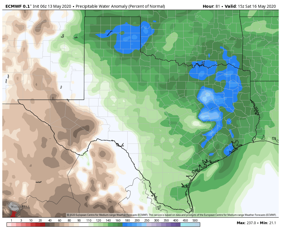
We’re still looking at a fairly wet weekend as an upper-level low pressure system drops into Texas and wobbles around the state. Such a pattern, in concert with the warmer May air and a moist atmosphere, is a good recipe for heavy rainfall during this time of year. However, it’s very difficult to say whether the heaviest rain will come far outside the Houston metro area, or over some part of the city itself. Best guess for these days is widespread totals of 1 to 3 inches of rainfall, with a few bullseyes of 5 inches or more. At this point western parts of the metro area seem likely to see the heavier rain, but we’d like to see a little more consistency in the models before being more specific than that. Highs both days will likely be in the low 80s with plenty of clouds.
Next week
The low should move away early next week and taking the heavy rain chances with it. The pattern still calls for what looks like a fairly typical May week to me, with highs in the mid or upper 80s, or thereabouts.
Notes
Don’t forget that we’ll conduct our Wednesday Weather this afternoon at 2pm on Facebook. I’ll post a link to a YouTube version tomorrow. Also, we kicked off our new AC Giveaway contest on Tuesday. You can enter here.
Keep up the good work. No Hype; Just Truth..
We got .06″ of rain here, not enough. A good soaking rain will do the area well, just not too much.
Yes, rain is needed. It was pleasant listening to the raindrops last night.
Please update us on Friday with the current drought situation in Texas. Perhaps recent storms have improved matters.
Drought information can be found here: US Drought Monitor, and here’s the regional map for the South.