We’ll begin today with the tropics. Colorado State University released their annual April hurricane season forecast yesterday. It was pretty impressive. They call for 23 named storms, 11 hurricanes, and 5 major hurricanes. This is the most active April forecast that they’ve released. This is another signal ahead of the upcoming season that suggests a very busy summer awaits us. I wrote all about the forecast and what you should take from it over at The Eyewall. Busy forecast don’t always translate into busy forecasts for Houston. However, we encourage you to prepare this season, as you should each season.
Today
We’ve got one more spectacular day with low humidity. We’ll warm from the 50s and low-60s this morning well into the 80s this afternoon. It’ll be warm for sure!
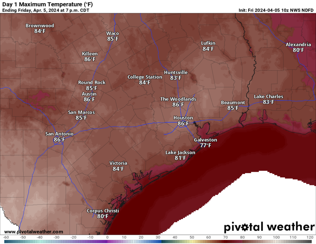
But the humidity will be tolerable. Lots of sun means ozone production, so, yes air quality will be an issue this morning and late this afternoon.
Weekend
We will trade off a couple degrees tomorrow for higher humidity. We’ll also begin to add back some more clouds. Look for highs in the lower half of the 80s after morning lows in the 60s. Expect similar temperatures on Sunday but with more humidity and a slightly warmer morning.
On Sunday, the cold front that will play a role in the eclipse forecast will approach from the west. It should push through the Brazos Valley, and it may even get as far south and east as Brookshire, Cypress, or The Woodlands. From there, it slams on the brakes and throws things into reverse, moving back to our north and west, reaching back to I-35 by Monday morning. Besides clouds, there will probably be at least a few showers in the area Sunday as this front maneuvers.
Monday & solar eclipse outlook
As far as Monday’s eclipse goes, we don’t have any real positive news to share today unfortunately. Here in Houston, we have maybe a 10 to 15 percent chance that skies will be clear enough for good viewing. Those odds may be even lower for Austin and San Antonio.
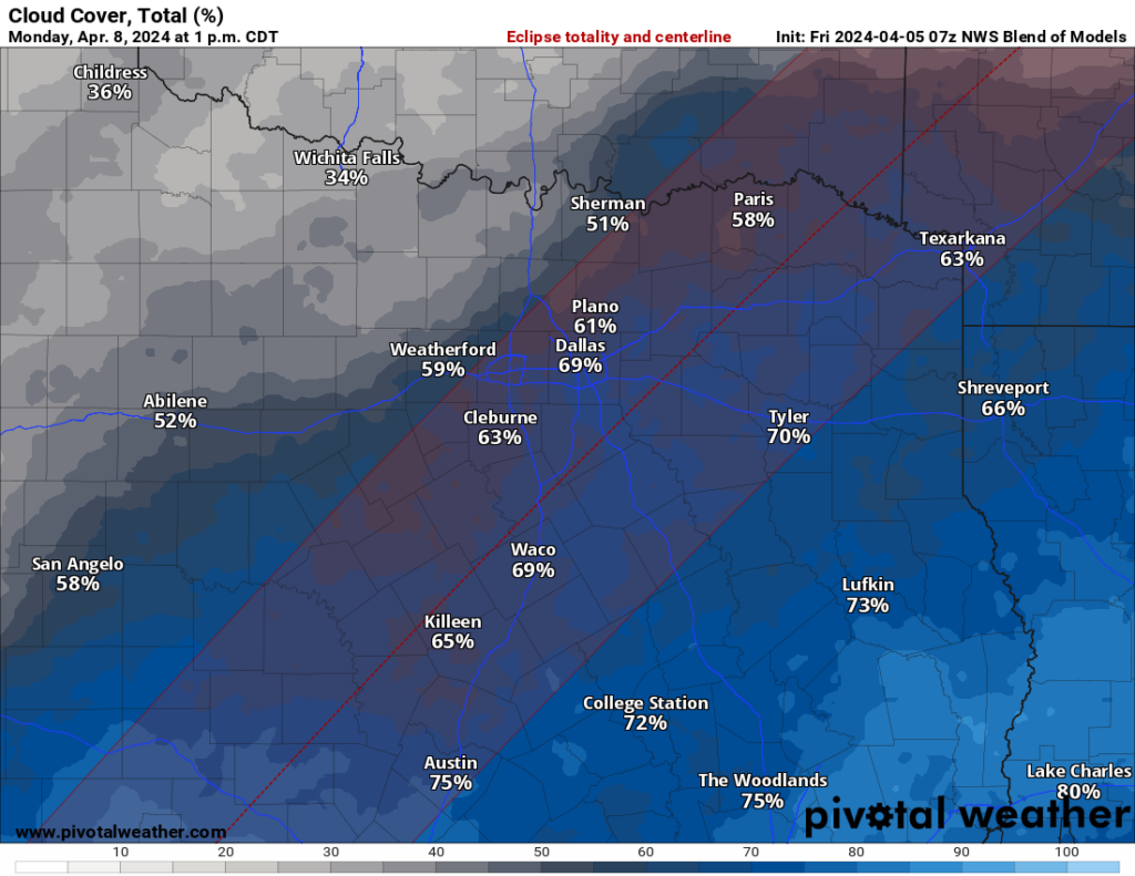
If you absolutely want to chase this thing in Texas, your best bets may be Texarkana or Dallas, where there’s currently about a 30 to 40 percent chance that skies will be favorable. Still not great, but better than much of the rest of the state. Do keep in mind that North Texas is highlighted for potential severe thunderstorms on Monday, however. If you are able to road trip, southeast Missouri or southern Illinois look favorable on Monday. If time, money, and logistics are no object, northern New England or New Brunswick and Quebec in Canada are your best bets.
Weather-wise, locally expect plentiful clouds and isolated to scattered showers Monday. A thunderstorm or two will be possible in the afternoon, especially north of Houston. Highs should be in the low-80s with high humidity.
Rest of next week
The pattern is setting up such that Tuesday looks stormy to our north. Expect a few showers or thunderstorms locally, but I don’t think we’re going to see a whole lot around here Monday night and much of Tuesday.
That could change Wednesday. Somewhere in Texas, we’re likely to see a robust area of thunderstorms (what we call an MCS in meteorology, mesoscale convective system). This would probably develop somewhere in the I-35 corridor on Tuesday night and ride southeast across the eastern half of the state and into Louisiana on Wednesday.
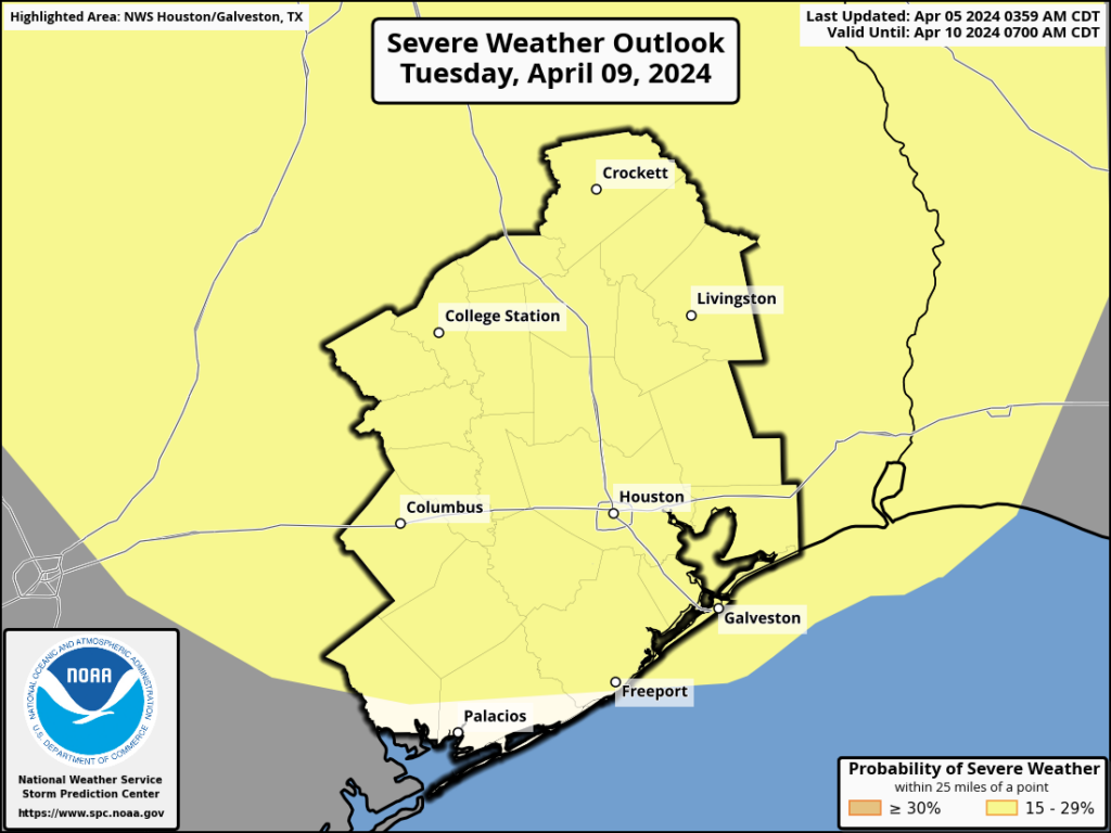
We are highlighted under Tuesday’s severe weather risk for this reason (it would most likely be toward Wednesday morning), as well as Wednesday’s risk. It’s a bit too early to pinpoint details or how much rain we might see, but if you have plans Tuesday night or Wednesday morning, keep an eye on this forecast. Things should calm down a good bit and turn much less humid to close out next week.

How does Indy look for the eclipse? I’m scheduled to “work” there that day.
Ted,
In Indianapolis, there will be partly cloudy skies and zero chances of rain from 11 am to 6 pm per the Weather Channel. I hope this helps!
Ah, can I rely on the Canadian model as a possibility for better eclipse viewing?
Although we will not see the full disk of the eclipse, with the overcast sky it should be very dark in the early afternoon, to the point where you have to turn on your headlights or interior lights at the time.
Re: the eclipse and tides. Hopefully you’ll do a write up on how this particular eclipse affects tidal movements. I think it will a be pretty interesting topic.
It’s true that the sun and the moon will be lined up, so that their tidal effects are added to each other. But that happens every month at the new moon, and at the full moon too for that matter. Why would there happening to be an eclipse make any difference?
Time to take the Lear Jet up to Nova Scotia
About the hurricane season, in the last 10 years, say from 2014, has Houston’s drainage, its ability to absorb and carry away rain, changed?
Yes, certainly on the west side. Lots of draining projects have eliminated – hopefully – the problems we encountered with TS Allison. We still have our house numbers painted on the sides of the garbage cans from when we had to go down to the drainage channel to retrieve them.
Yes certainly, at least on the west side. Lots of drainage project have eliminated (hopefully) the flooding we experienced from TS Allison. But we still have our house numbers sprayed on the side of our garbage cans from when we had to go down to the drainage channel to retrieve them after they floated away.
“On Sunday, the cold front that will play a role in the eclipse forecast will approach from the west. It should push through the Brazos Valley, and it may even get as far south and east as Brookshire, Cypress, or The Woodlands. From there, it slams on the brakes and throws things into reverse, moving back to our north and west, reaching back to I-35 by Monday morning.”
That front is being a real jerk.
Not if it brings much needed rain.
Question really. If a major hurricane does hit Houston, what is the likely impact for homeowners near the downtown area? Flooding, power outage, moderate damage from downed trees or flying debris?
I was here for Garvey but none of the earlier hurricanes.
Four words-a world of hurt. Flooding would be somewhat of an issue, but nothing extreme like Harvey, unless a storm was moving like 5 mph or so. It’s the other three that would be extremely bad. Many people were without power, including a friend of mine that lived close to I 10 and TC Jester at the time, for weeks on end after Ike. And that was with category 1 winds and gusts in Houston (2 at the coast). The damage would be severe for a category 3 and up in this area. Houston hasn’t been really tested since Hurricane Alicia, but still was a small storm. You’d have to go back to Carla 60 years ago, and even that wasn’t a direct hit. A hurricane like Katrina, Andrew or Ian in this area? I shudder the thought.