Good morning. After some slightly drier air brought a pleasant day to the Houston region on Sunday, we should see one more sunny and warm—but not excessively hot—day before the area settles back into a muggy, warm and on-and-off wet pattern.
Monday
Houston will enjoy another mostly sunny day, with highs likely in the upper 80s. Some coastal areas may see showers during the afternoon, with warmer temperatures. But all in all, for the first half of September, today will be a pretty nice day with moderately lower humidity levels.
Tuesday and Wednesday
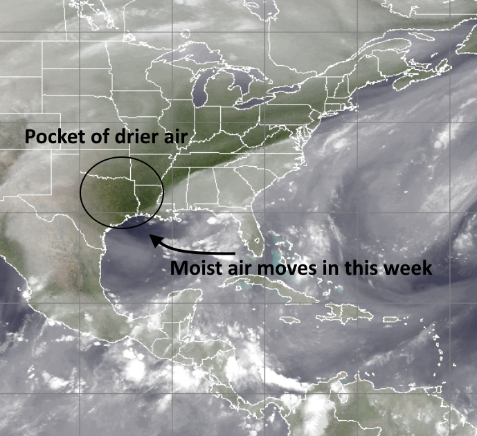
As can be seen in the image above, the drier air over Houston will be steadily replaced by moisture from the Gulf of Mexico this week. I’m not anticipating anything severe, but we are going to move back toward partly cloudy days, with scattered showers and thunderstorms. Expect highs near 90 degrees with lows in the mid-70s. Rain accumulations will probably be in the tenths of inches for most areas.
Thursday through Sunday
Toward the end of the work week a cold front will approach Texas from the northwest, and this should help drive additional showers over the Houston area (it still appears as though the front won’t push into Houston, however). At this point the forecast calls for mostly cloud days from Thursday through the weekend, with highs ranging from the mid-80s to about 90 degrees, depending on the extent of rain.
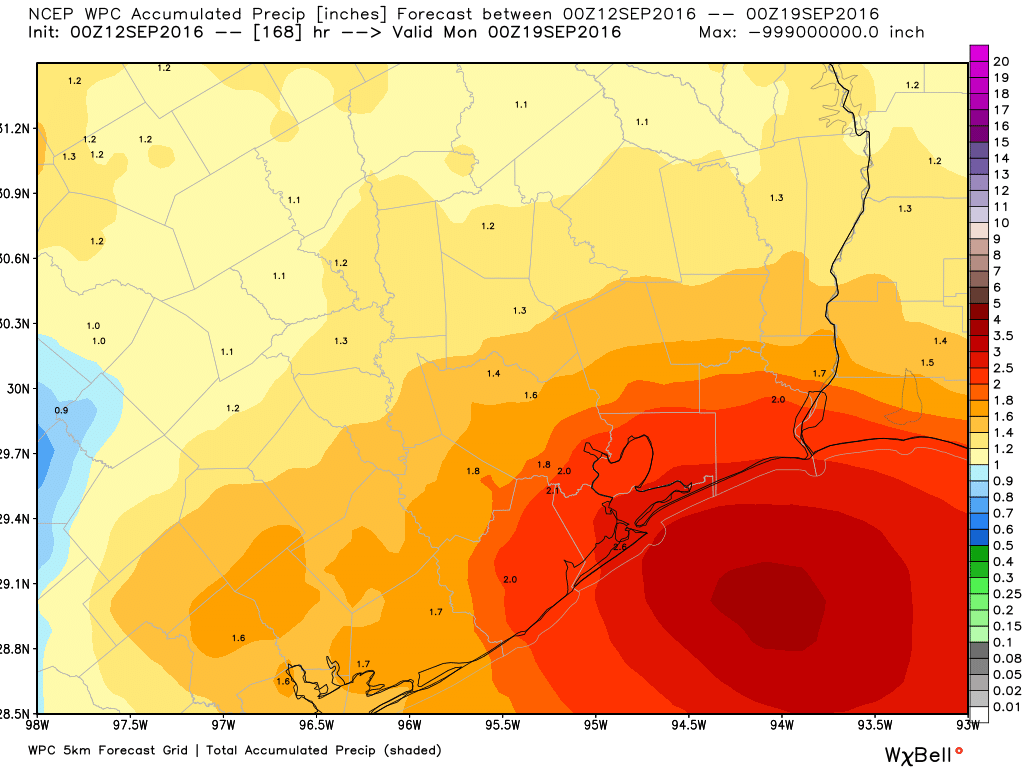
I’m not too concerned about accumulations, but I do think that by the end of the weekend much of the region could see 1 to 2 inches of rainfall, with greater amounts toward the coast.
As for the first real cold front, which usually comes through during the third week of September or so, we’re still watching for it. Nothing concrete, I am afraid.
Posted at 6:30am CT on Monday by Eric
Tomorrow is of course the anniversary of Ike. In addition to the terrible damages which many suffered, the loss of power hit most everyone. But do you recall that we had a few amazingly pleasant days just after the storm? I remember when helping clean my in-laws’ flooded home, a refreshing breeze blew through the open doors and windows of the house, and was a life-saver, as there was of course no AC.
Yes, the saving grace of Ike is that it helped usher in a cold front into Houston in its wake. Made the power loss (a little bit) more bearable.
Can you blog on Ike 8 years later?