Good morning. It’s the eighth anniversary of Hurricane Ike, which made landfall on the eastern end of Galveston Island and moved into the bay. The storm produced a tremendous 15-foot storm surge, and 10 to 20 inches of rain over Harris County. For anyone in the region at the time, it was a harrowing experience. But since then we have largely been free of tropical storms and hurricanes, and it’s looking increasingly likely that will be the case for 2016—although we’re not there quite yet.
In any case, let’s take a look at our rather unsettled weather pattern for the next week or so.
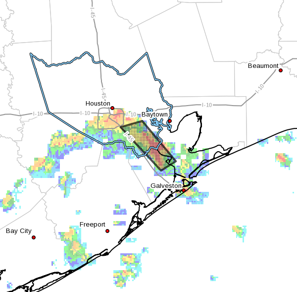
Tuesday and Wednesday
The moisture is back, and we’re seeing evidence of that from a narrow band of thunderstorms that moved in this morning from the Gulf of Mexico, into parts of the southeastern Houston metro area. A flood advisory is in effect for areas just east of Interstate 45 through 7:45 am this morning.
Expect some scattered rains throughout the day. However modestly high pressures today and Wednesday should limit thunderstorm activity from becoming too widespread. Highs will be around 90 degrees, with lows in the mid-70s and partly cloudy skies.
Thursday through Sunday
As pressures fall a little bit toward the end of the work week, we may see an increase in coverage of showers and thunderstorms, but I’m not expecting more than 1 to 2 inches of cumulative rain over the four day period for most areas. Some areas will see less, and some may see more. It should be the kind of unsettled pattern where you need to keep an umbrella handy as about half the region might see some kind of shower activity each day. Highs will remain in the upper 80s to low 90s, with warm nights in the 70s.
Monday and beyond
It looks like we’ll remain in a late-summer like pattern through the early part of next week, but the models continue to flirt with fall’s first real cold front in about 10 days time. That’s a long ways off, but I do believe fall is not that far off.
Posted by Eric at 7:05am CT on Tuesday