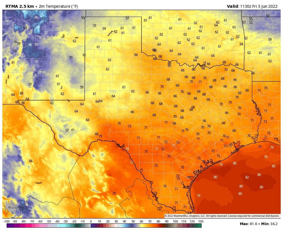
Good morning. You probably didn’t notice it, but a cool front has moved into Houston. This will bring some very, very slight relief today—temperatures and dewpoints may be a few degrees lower than they otherwise would be—but it won’t be much. We’ll have some slight rain chances over the next two days before high pressure takes control and drives our high temperatures into the mid-90s next week.
Friday
Today will be sunny, with highs of around 90 degrees. Winds will actually be out of the north, at 5 to 10 mph, which may be the only sensible way to really detect the aforementioned front. There will be about a 10 to 20 percent chance of rain this afternoon, with the peak of daytime heating. Lows tonight will drop into the mid-70s.
Saturday
The first half of the weekend should see highs creep up into the low 90s. We’ll again see sunny skies, with perhaps a 10 to 20 percent chance of rain during the afternoon hours. If that sounds like a low chance, wait until you read the forecast for next week.
Sunday
As high pressure starts to build we’ll see sunny skies, with highs in the low-90s. The difference on Sunday will be that rain chances fall back to 10 percent or less, and winds will start to pick up out of the south and southwest, perhaps gusting up to 25 mph.
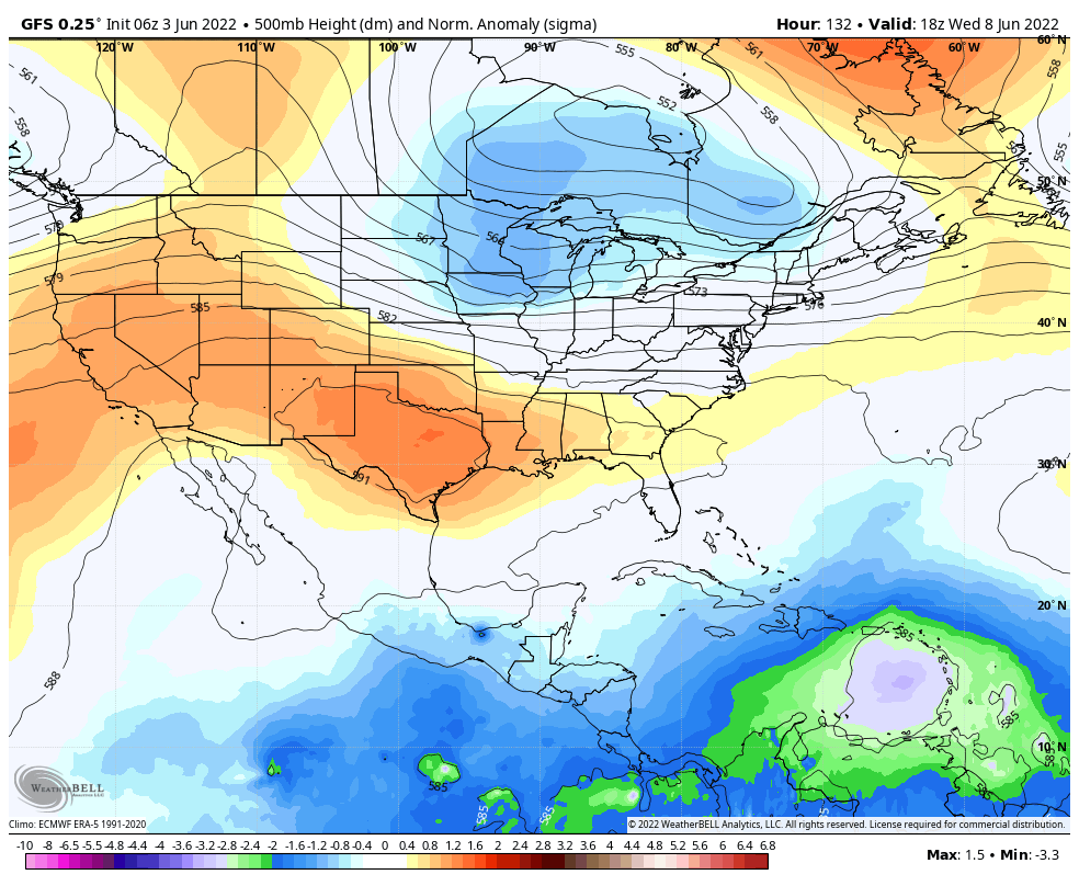
Next week
High temperatures should continue in the low-90s before transitioning to the mid-90s as high pressure asserts control. Rain chances will be effectively zero. The pattern might finally start to transition by Friday or Saturday of next week, as high pressure retreats to the west. This will allow for a slight moderation of temperatures, and the return of thunderstorm chances during the afternoon and evening along the sea breeze. This is summer in Houston doing summer in Houston things. It beats flooding.
I hope everyone has a safe and joyous and healthy weekend in the abundant sunshine. We’ll be back on Monday with the latest forecast, as well as an announcement early next week that I think some of you will like quite a bit.
Ah, the return of the 590+ decameter height contours, ushering in true summer.
What kept the rain at bay/outside the city? Did the front run into a high-pressure ridge? Completely dry yesterday on the southwest side of the city.
Most likely capping that was strong enough that what was left of the approaching front wasn’t strong enough to provide enough precipitation-inducing precip. Sea breeze was fairly weak as well, especially for the area you mentioned.
I thought that Capt. Inversion had something to do with the lack of rain. I’m sure we’ll be seeing a lot more mischief from him in the coming months.
Gahh! That should read “precipitation-inducing lift”. Really have to review better.
It did feel a tiny bit cooler this morning as I went out to get in the car. Glad to know I wasn’t totally going crazy. 😉
Thank you for all of your informative and fun posts !
I came on here just to see if I missed that there was a cold front, so yes I noticed! I notice every bit of humidity and so does my 3rd story HVAC unit. This is