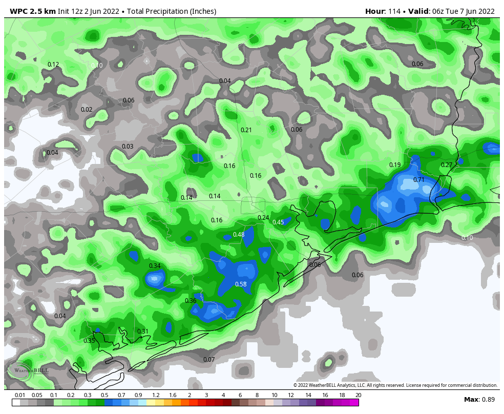
Good morning. Houston will enter a classic summertime pattern next week in which high pressure dominates. This will bring sunny skies and plenty of heat as we get deeper into June. But before this happens we’ll have a puncher’s chance of seeing some much needed rain today and Friday as a weak front sags into the region.
Thursday
Today’s rain chances will be driven by an advancing cold front—please understand this is a cold front in a meteorological sense, in that it is a boundary ahead of an advancing mass of air, but as we’re in June the “cold” air behind the front is not particularly cold—colliding with the sea breeze. The potential for rainfall today is probably greatest along and south of Interstate 10, where these boundaries will meet. I think there’s about a 50 percent chance of showers and thunderstorms today for coastal areas, whereas chances are probably in the 30 percent range north of Interstate 10. These will be the kind of storms where some locations will see downpours while a few streets over there will just be menacing looking clouds and a few drops. A lucky few areas may pick up 1 to 2 inches of rain, but most of the region that receives rain will see a tenth of an inch or two. Otherwise expect partly sunny skies today, with winds turning northwest, and highs in the low 90s.
Friday
Rain will be possible again on Friday as an upper-level system passing through meets the sea breeze, although I’d put chances at a little bit lower than Thursday. It will be the same kind of situation, with passing downpours. Highs on Friday should reach about 90 degrees, or a bit higher, with partly to mostly sunny skies.
Saturday and Sunday
The weekend looks sunny and warm, with highs in the low 90s. We can’t entirely rule out a passing shower on Saturday, but the chances are very low. Winds will be fairly light on Saturday, but should start to blow in a more pronounced manner out of the south on Sunday, perhaps gusting up to 20 mph.
Next week
As high pressure settles in next week, we should mostly see days with highs in the low- to mid-90s, partly to mostly sunny skies, and southerly winds at 5 to 15 mph with higher gusts. After this Friday, there likely won’t be meaningful rain chances for at least a week. Maybe that starts to change by next weekend? But only maybe. It’s summer, baby.
Tropics
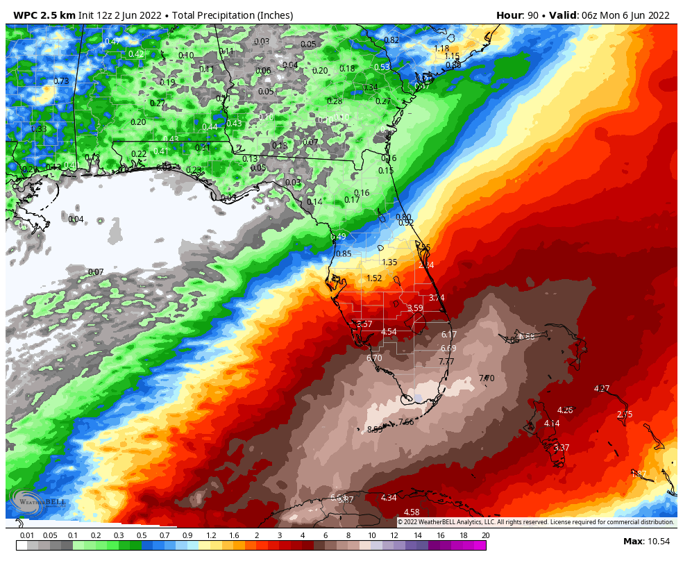
Invest 91L looks to be close to becoming a tropical depression, or even Tropical Storm Alex, later today as it moves into the southern Gulf of Mexico. There doesn’t appear to be a whole lot of potential for development, but the storm should bring a lot of rain to the Florida peninsula from Friday afternoon through Sunday afternoon.
It’s summer, baby? A normal June has about 6 inches of rain. Even July and August have on average about 4 inches of rain. I would love some USUAL early summer weather. This, on the other hand, is the dreaded summer drought.
It’s summer baby
I particularly enjoy reading the comments!