In brief: Showers and thunderstorms will spread into the greater Houston area this morning, and because this is a fairly large system there is the potential for some modest street flooding. A Stage 1 flood alert is in place through the mid-afternoon hours as a result. The weekend still looks sunny and warm as high pressure moves in.
Unsettled environment
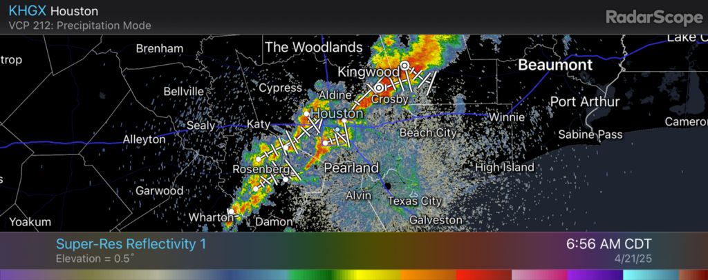
After calmer weather on Tuesday, an unsettled pattern returns today. A fairly robust line of storms lies to the west of Houston, and it is trundling toward the metro area this morning. Although there is a modest capping inversion over the greater Houston area, it probably will break as these storms near by mid-morning. Because our soils are already somewhat sodden after rains on Sunday and Monday, these additional rains could lead to some street flooding due to runoff. For this reason we are putting a Stage 1 flood alert into place through mid-afternoon today.

Wednesday
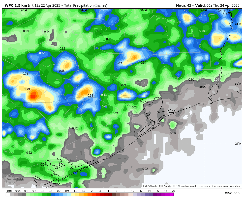
The storms west of Houston should push into Houston between around 9 am and 3 pm CT, with the greater likelihood of heavy rain south of Interstate 10. Although some damaging winds are possible, the overall severe threat is low, and our primary concern is heavy rainfall that may cause some street flooding. Most areas will probably see manageable totals of 0.5 to 2.0 inches, but there could be some higher bullseyes of 3 or more inches before the storms shift eastward this afternoon. I expect road conditions to be fine for the evening commute home.
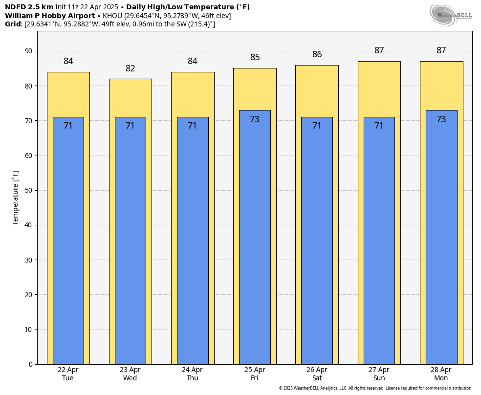
With mostly cloudy skies amid the rain, high temperatures today will likely peak around 80 degrees, or a bit higher, for most of the area. Winds will be from the southeast at about 10 mph, although we could see some higher gusts along with some of the stronger thunderstorms. A few isolated showers will be possible this evening, with lows tonight dropping into the low 70s in the Houston area.
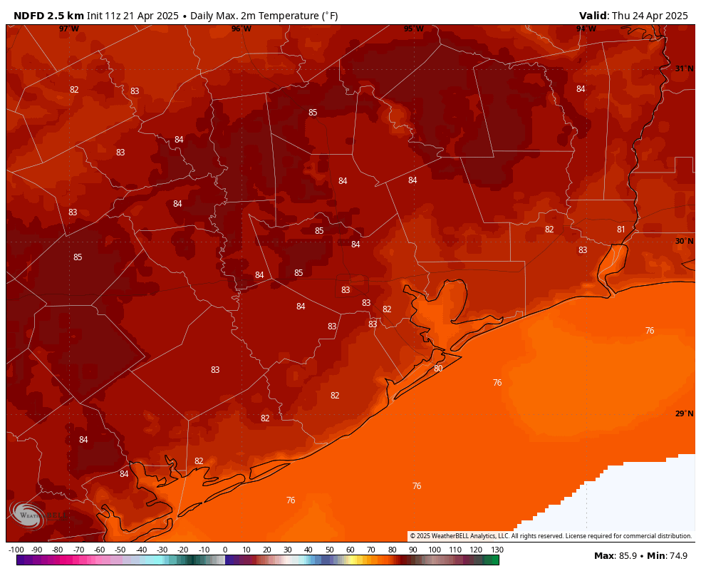
Thursday and Friday
Plenty of moisture remains in the atmosphere on Thursday and Friday to support additional showers and thunderstorms, however we will be lacking a spark. Therefore my best guess is that, overall, rain chances will be quite low, on the order of 20 percent. But if we do see some showers they could be briefly heavy. For the most part I expect these to be partly sunny days, with temperatures in the mid-80s and southerly winds in the vicinity of 15 mph. Nights remain warm, with lows falling to around 70 degrees.
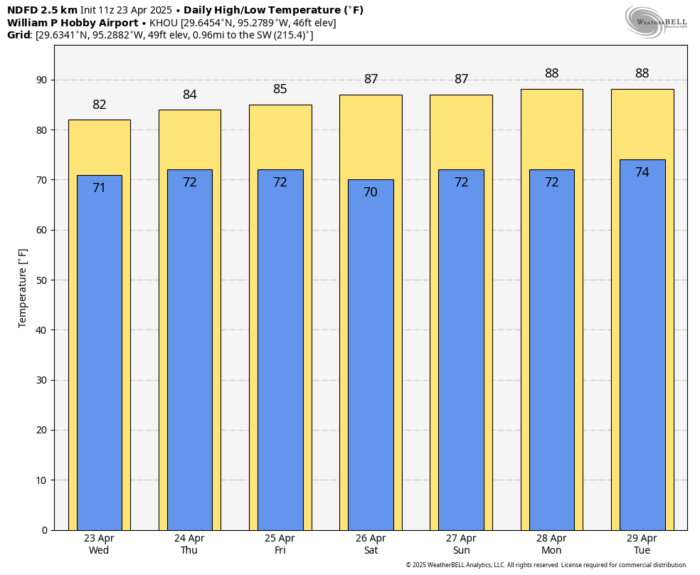
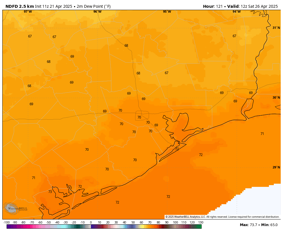
Saturday and Sunday
As anticipated, this weekend should bring mostly sunny skies and an end to rain chances as high pressure builds over the area. Expect high temperatures in the vicinity of the mid-80 to upper-80s both days with warm nights. Winds will come from the southeast at about 15 mph, which will be a boon for MS-150 riders. Alas, dewpoints of around 70 degrees will make it difficult for participants in the IRONMAN event in The Woodlands.
Next week
This pattern more or less continues into the middle of next week until the high pressure shoves off, and we are left with the potential for more unsettled weather. A front will approach the area, and this should generate some healthy rain chances. Whether it pushes all the way to the coast and brings us some drier and cooler air is something we’re just going to have to wait and see.