Summary: After a stormy weekend Houston’s weather takes a turn to the sunny side of things. In fact, we should see rather mild weather for the rest of the month, with only some very sporadic rain chances.
That brief period of Goldilocks weather
It’s March 18. The Houston Livestock Show and Rodeo is over. After living here for decades, my sense is that prior to the rodeo we are still capable of seeing cold, winter-like weather. Then, after the three-week show wraps up, our chances of really cold weather are pretty much over and we’re deep into spring. And that’s certainly the case this year.
Although temperatures tonight are likely to drop into the upper 40s in Houston, the remainder of the month looks fairly mild, with lows generally in the 50s and low 60s, and highs in the 70s. This is the ephemeral period of Houston weather in which we can enjoy a balance between the extremes, the Goldilocks weather that’s not too hot, and not too cold.
Monday
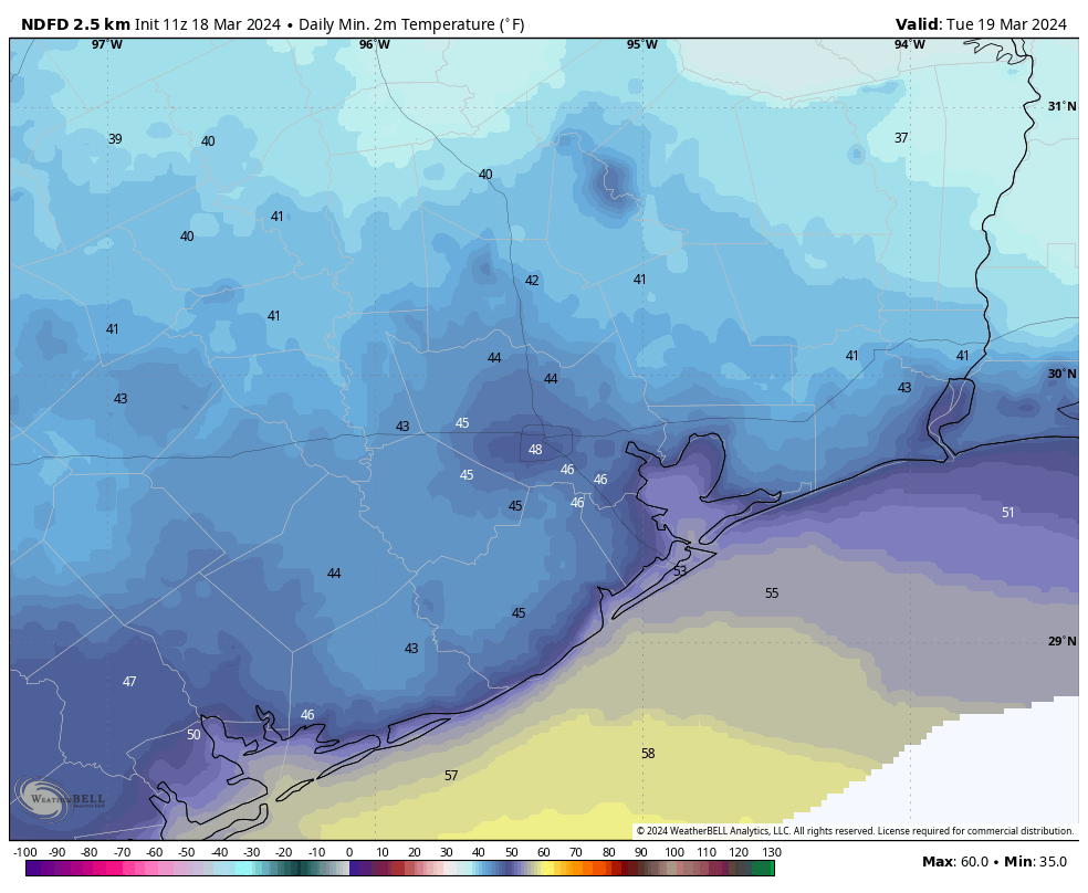
After an at-times turbulent weekend with passing showers and storms, drier air associated with a cool front is finally moving into Houston this morning. We’ll see breezy conditions this afternoon, with gusts up to 25 or 30 mph from the north, as this drier air arrives. Skies, otherwise, will be partly sunny with temperatures in the upper 60s. Tonight will be the chilliest night of the week, as winds slacken and skies clear. Look for Houston to drop into the 40s, albeit precisely where in the 40s will depend on your location.
Tuesday
This will be a banger of a spring-time day, with mostly sunny skies, light winds, dry air, and highs in the mid- to upper-60s. Lows on Tuesday night will drop into the mid-50s as a light southerly flow reestablishes itself.
Wednesday
We’ll be a bit warmer, and a bit more humid on Wednesday as the onshore flow continues. Look for highs of around 70 degrees, with partly sunny skies, and light southeasterly winds. Lows on Wednesday night will drop to around 60 degrees.
Thursday
Somewhat more dynamic weather is possible on Thursday as a coastal low pressure system approaches. This will bring a chunky chance of rain into the area, but the finer details remain elusive. The question is whether the bulk of the precipitation remains offshore, or not. For now I’ll say that if you live inland of Interstate 10, there’s maybe a 40 percent chance of rain, and that becomes increasingly higher as one gets closer to the coast. This is the kind of system that probably will bring 0.25 to 1 inch of rain to most, but again we’re painting with a broad brush here. Highs, otherwise, should be in the low 70s with mostly cloudy skies.
Friday
As the low moves off we should see sunny and mild conditions, with highs in the 70s.
Saturday and Sunday
The weekend looks mild, with partly to mostly sunny skies, and highs in the upper 70s to possibly 80 degrees. Nights will be mild, in the upper 50s to lower 60s. Rain chances, at this point, look low to non-existent. It looks like good bike riding weather to me.
Next week
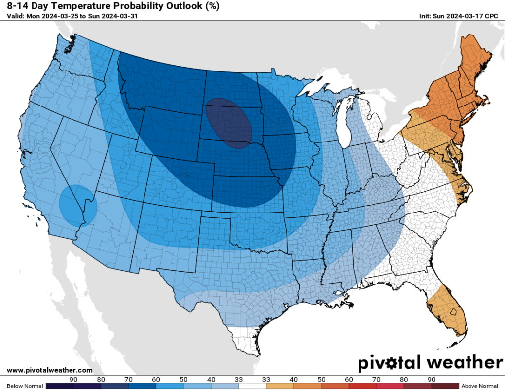
By around Monday or Tuesday of next week the region’s next front should arrive. It may (or may not) bring some rain showers with it. This should carry our mild, spring-like weather through the end of the month, which likely means more highs in the 70s and lows in the 50s.