Summary: Houston will see one more warm day before a front arrives on Wednesday to cool us down for a couple of days. The first half of the weekend looks rather pleasant, but we’re keeping our eye on the potential for the return of some decent rainfall next week.
Before the forecast, two programming notes. First of all, if you missed it, we did our first monthly Q&A feature on Monday, and we hope to do these regularly going forward. Secondly, the Houston Livestock Show and Rodeo begins today, and it’s an iconic event for our region attended by more than 2 million people. Accordingly, we’re going to offer daily forecasts, brought to you by our sponsor Reliant. we’ll share what you need to know about the expected weather before and after the rodeo and concert every day. Additionally, make sure to scroll to the bottom of this post and read Reliant’s fun Rodeo experiences (I’m definitely stopping by the Space City Cowboy photo op!)
Tuesday
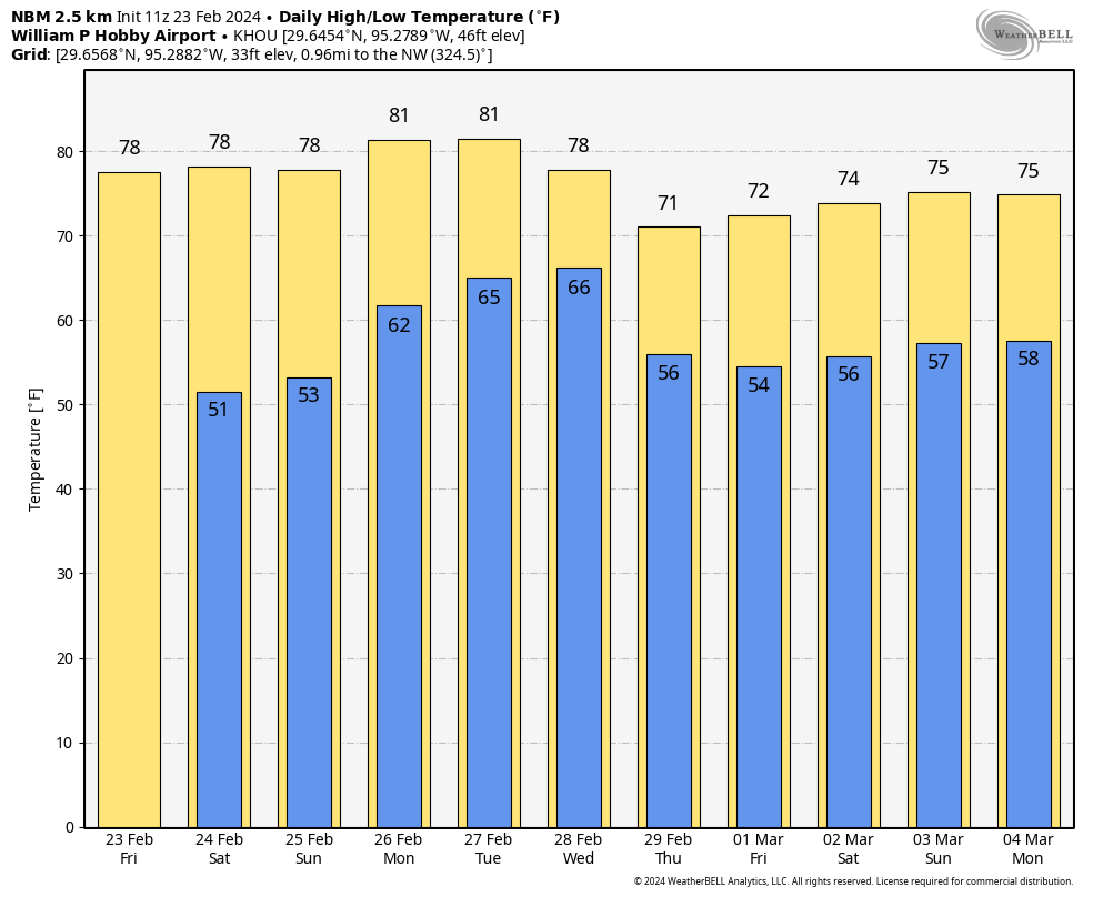
Today will be another warm one, with highs likely topping out in the low 80s across much of the region. There may be a bit more sunshine than on Monday, but I still expect more clouds than not. Winds will be noticeable from the south, gusting up to 30 mph at times.
Rodeo forecast
If you’re heading out to the Blake Shelton concert this evening, hold on to your hat. Actually, the winds should be backing off a little bit later this evening and afternoon, but I just wanted to say ‘hold on to your hat.’ Temperatures will be mild this evening, perhaps about 70 degrees, with moderate humidity. Expect cloudy skies. Temperatures will only be a few degrees cooler after the show, heading down to overnight lows in the mid-60s tonight. Despite the clouds I don’t expect any rain showers today or tonight.
Wednesday
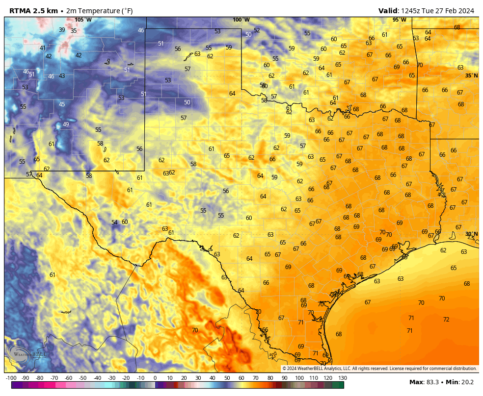
After a warm night a cold front will sweep through Houston on Wednesday morning, and the change will be pretty immediate. I’d expect the front to be near areas like Katy and The Woodlands around sunrise or an hour or two after, and be off the coast by or before noon. In the wake of the front we’ll see gusty northerly winds, mostly cloudy skies, and temperatures in the 60s with much drier air. Lows on Wednesday night will drop down to around 50 degrees in Houston.

Thursday
Here the brief spell of ‘winter’ I mentioned in the post headline. Skies will be cloudy on Thursday, with highs likely only peaking in the upper 50s to lower 60s. Winds will slow down. The air is going to be rather dry, with low dewpoints. However by later Thursday afternoon we’ll see winds turn to come from the south, and this will mark the beginning of an onshore flow. Lows on Thursday night will drop into the low 50s for most away from the coast.
Friday
We’ll see some decent rain chances late Thursday night into Friday morning, but accumulations look rather slight, likely in the hundredths of an inch. Skies, otherwise, will be mostly cloudy with highs in the low- to mid-70s. Lows on Friday night will probably drop down to around 60 degrees.
Saturday and Sunday
The first half of the weekend looks pretty good for outdoor plans. We’ll see highs of around 80 degrees with partly sunny skies. Rain chances look to be close to nil. Lows Saturday night will be mild, in the low 60s.
Sunday will bring more clouds, and a slight chance of rain. Still, anything that falls should be very light. Highs will again be around 80 degrees.
Next week
The forecast for next week is somewhat in flux. However, in general, we can expect warm conditions on Monday and probably Tuesday. At some point a front is going to move toward our area and help generate conditions for rainfall. This will probably our best chance at some decent accumulations of rainfall in a while. This front will be followed by some cooler weather for a couple of days. So, basically, more spring is on the way.
A message from Reliant
This isn’t our first rodeo, and, at Reliant, we’re here for a rootin’ tootin’ time at the Houston Livestock Show and Rodeo, now open today through March 17. Here are a few fun places to stop by:
- Saddle up in Space City at Reliant’s new photo op for Rodeo fans to enjoy, located in the lobby of NRG Center at Hall C. A tip of the cap to Houston’s ‘Space City’ roots, grab your partner and take a trip to the moon in this interactive photo op that makes you and your posse feel like a Space City Cowboy.
- Stop by the Reliant Ranch in NRG Plaza for an interactive experience for rodeo-goers of all ages. Two step on over to enjoy festive games like Get Your Ducks in a Row-deo, Boot Toss, Ring Toss, and a Souvenir Penny Press. And don’t forget to say howdy to our pal Hugo, Reliant’s friendly brand ambassador!
- Hold your horses, we can’t forget the iconic Reliant Big Boot! Standing at 25-feet-tall, this staple of the Rodeo provides visitors with another great Instagram-worthy moment. Grab the whole crew and giddy on up before you head to the concert, carnival, or let’s face it… the Champion Wine Garden!
- While you’re busy snapping pics as a Space City Cowboy or over at the Reliant Big Boot, we also have you covered with free charging stations throughout NRG Park, so you can stay powered up and present! With a valid email and credit card ($1 hold), rodeo-goers can borrow a power pack and return them at any charging station once they are done.
See y’all at the Rodeo!