Summary: A couple more very warm days are upon us before a Thursday night front cools us down just a little for Friday and the weekend, mainly in the mornings. We warm back up again early next week with another possible front after Tuesday. Rain looks to be at a premium over the next week or so.
Before we begin today, there was an article published yesterday by AccuWeather that sounded the alarm on the upcoming hurricane season. It singled out Texas as being at higher risk than normal as well. Over at our companion site, The Eyewall, I have a post up this morning explaining why we think it will be an active hurricane season but also why we believe it’s too soon to be singling out specific places. I have to warn you now: The next few months are going to be chock full of noise about the upcoming hurricane season. It does look setup to be active. We will continue to share what we know and what we think here and over at The Eyewall so you can make sense of what you might hear or see shared on social media.
Today
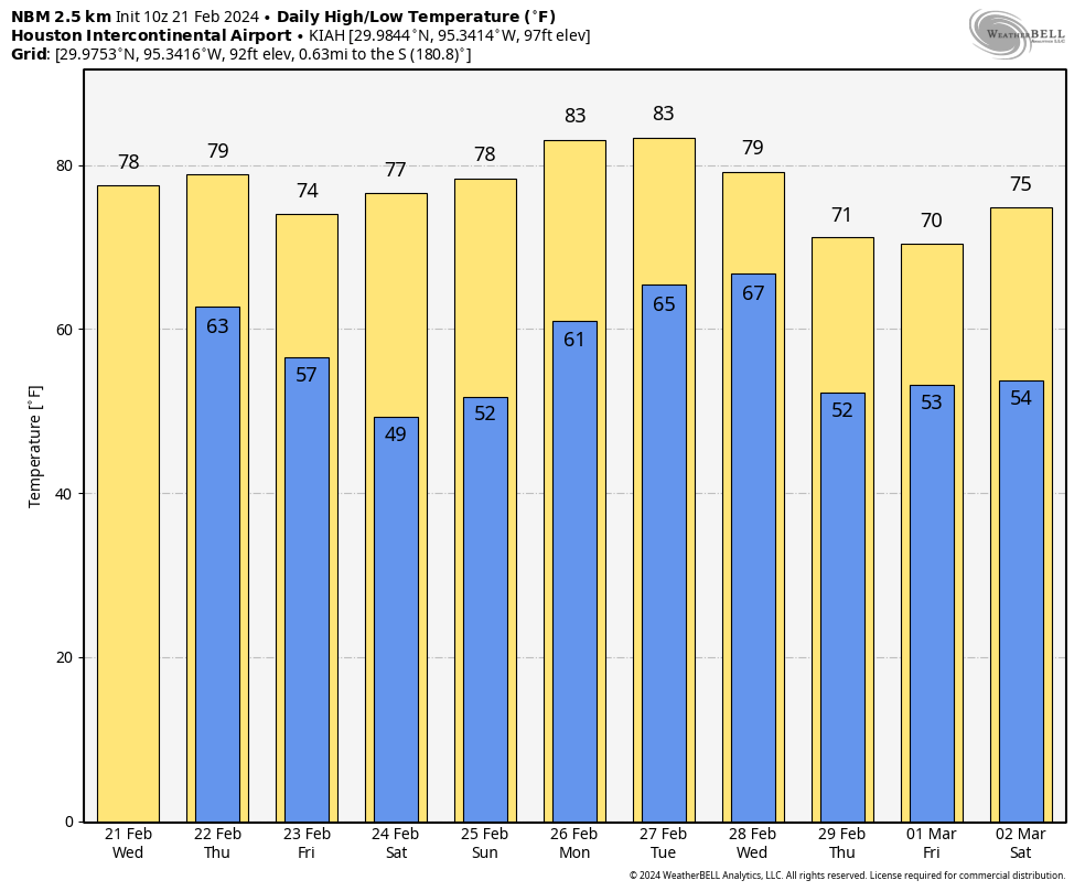
We’ve got some fog out there this morning, so use caution through 8-9 AM or so. Houston officially rocketed to 78 degrees yesterday, oddly the same temperature we hit exactly one year ago. But it likely begins a somewhat lengthy stretch of 70 degree days in Houston. Look for warm temps again today, with a chance at hitting 80 degrees in spots. Winds will be noticeably gustier today, at times 25 to 30 mph. Overall, a windy, mild day. For those of you that suffer from seasonal allergies, get ready.
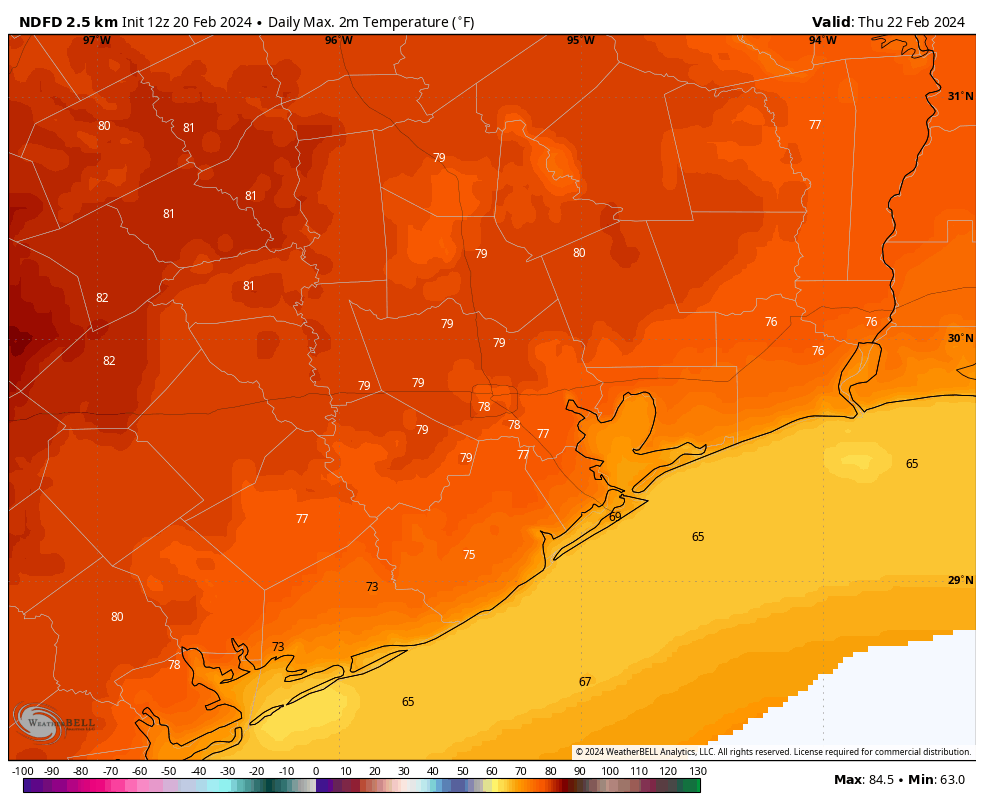
Thursday
Expect a few more clouds tomorrow with morning lows in the 60s and daytime highs around 80 degrees or so. I don’t know if “humid” is the right word, but it will feel a little “thicker” outside.
Our next cold front will be moisture-starved and hit right around midnight tomorrow night. Maybe a few raindrops could get squeezed out ahead of the front Thursday afternoon, but I’d probably be more likely to bet on the Oakland A’s to win the World Series this season.
Friday
With the front past us on Friday, expect a lovely day: Sunny, with morning lows in the 50s, warming into the 70s.
Weekend
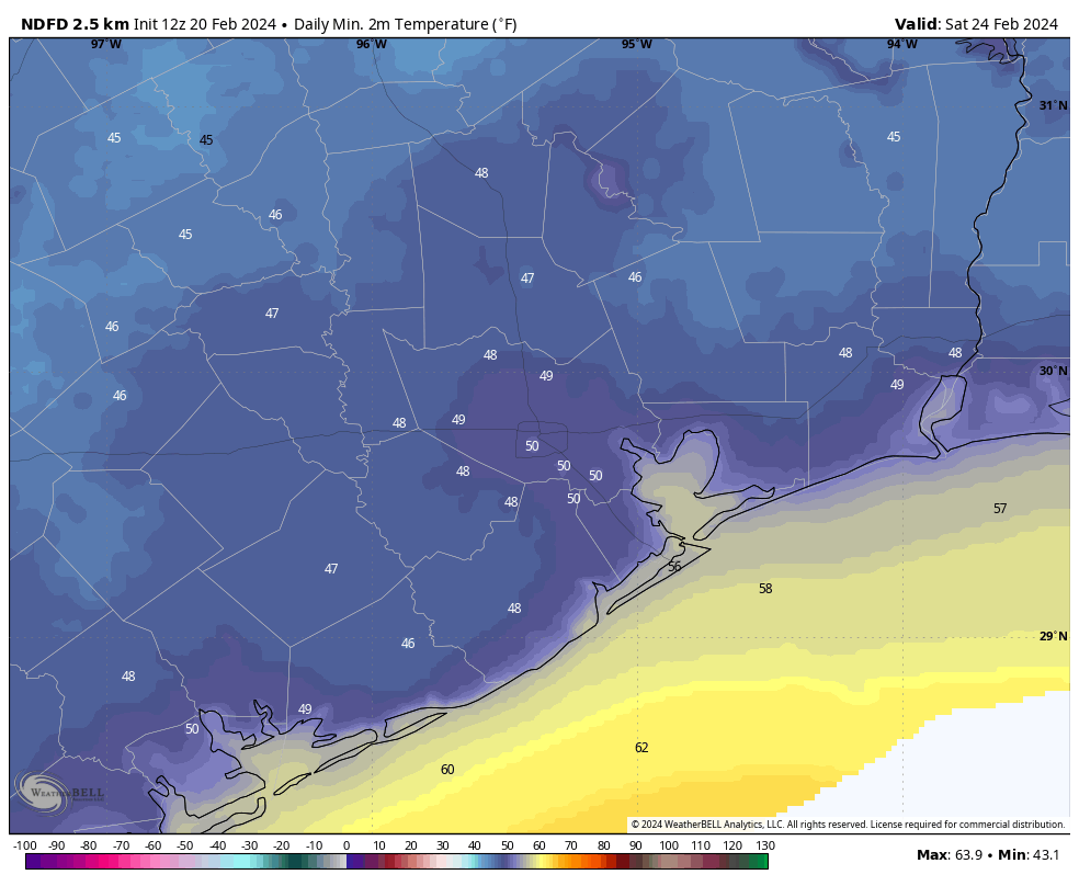
If you want stereotypical spring weather, this is absolutely your weekend. The streak of rainy weekends is in the past. Look for morning lows in the 40s and 50s with daytime highs in the 70s Saturday and upper-70s Sunday.
Early next week
I’d expect a pair of warm days Monday and Tuesday with increasing cloud cover. A slight chance of rain may enter the picture midweek with our next front knocking at the door. But details on that one are TBD right now. Either way, expect a slight cooldown after next Tuesday or Wednesday.