Summary: Houston will see rather warm, spring-like weather for a couple of days before a front arrives on Wednesday to cool the region down. The weekend looks pleasant again, with highs in the upper 70s to 80 degrees. Some slight rain chances do return Friday, but overall accumulations look very light. Don’t expect much sunshine this week.
Texas heat
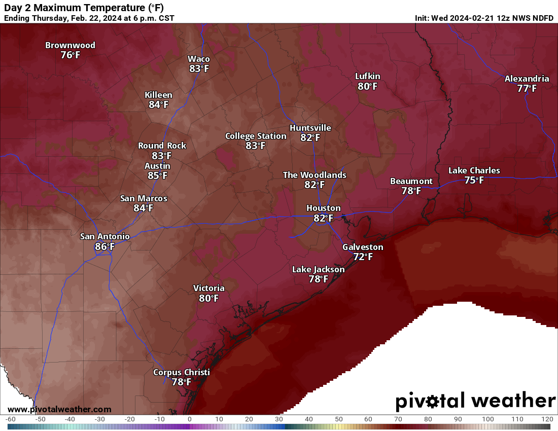
Good morning. Houston will see moderately warm weather this week, but if we pull back across Texas some northern parts of the state are going to see very warm temperatures in the low 90s. The high temperature today in Dallas, for example, is 93 degrees. This statewide heat is being driven by several factors, including drier air over the northern part of the state, a warm southwesterly flow, and a warm air mass (for February) over much of the continental United States. A front will arrive mid-week to cool the state off.
Before jumping into the forecast I want to share a couple of programming notes. Check back at 10 am this morning for a new feature, a monthly Q&A post in which Matt and I answer your questions. Also, you can see our final sponsorship video with Reliant here, in which talk with Elizabeth Killinger about what not having to worry about ‘clicks’ means for Space City Weather.
Monday
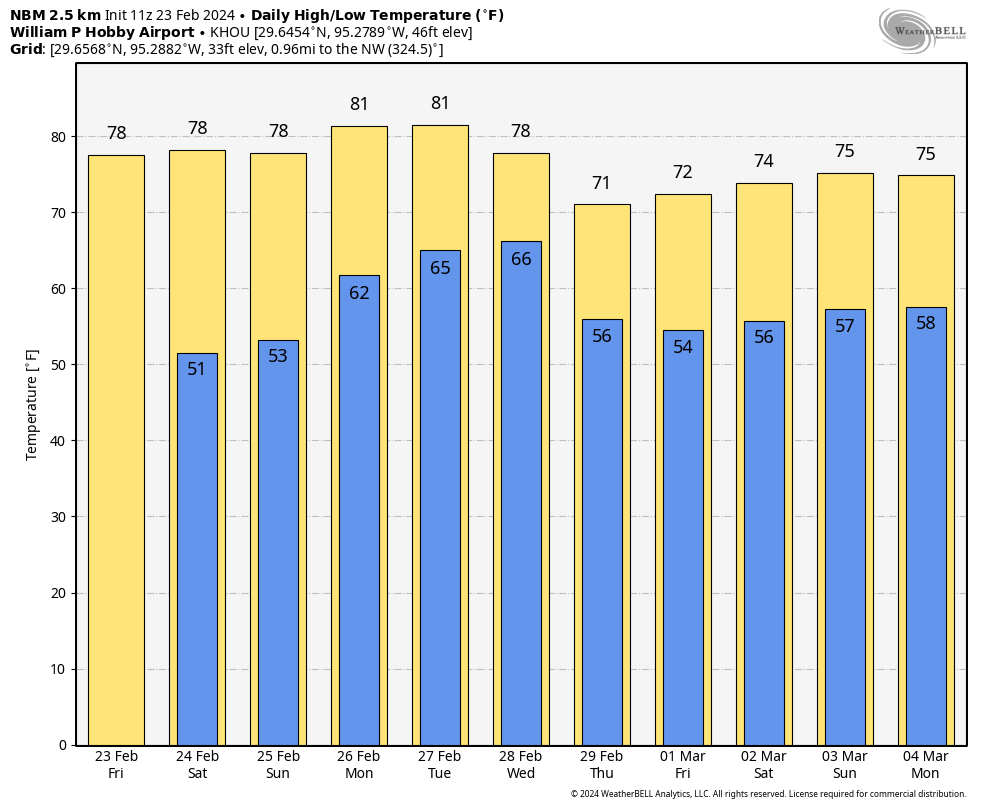
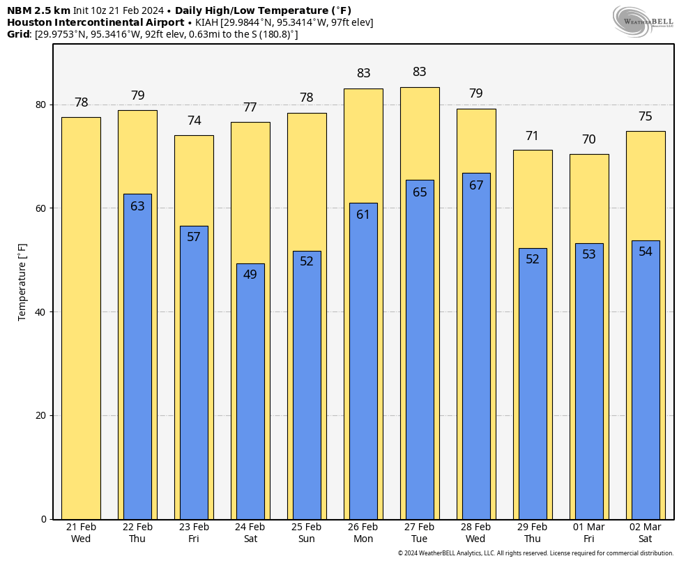
Houston experienced its first 80-degree weather of 2024 this past weekend, with highs of 80 and 82 degrees, respectively, on Saturday and Sunday. We’ll likely be there again today and Tuesday before a front arrives on Wednesday. Skies will be partly to mostly cloudy today, with highs in the low 80s. Winds will be from the southwest at 10 to 15 mph. Lows on Monday night will drop into the mid- to upper-60s with cloudy skies. Winds will pick up some from the south overnight.
Tuesday
This will be another warm day, with a decent amount of humidity as dewpoints push into the mid-60s. Highs will again be in the low 80s. Southerly winds become particularly notable midday, perhaps gusting up to about 30 mph. Expect mostly cloudy skies. Lows Tuesday night will likely only drop into the upper 60s.
Wednesday
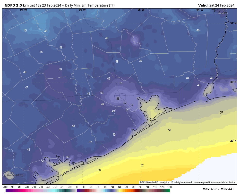
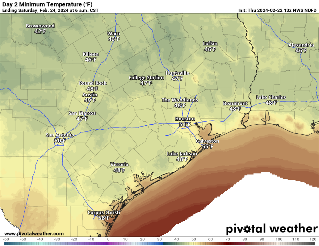
Change arrives on Wednesday when a front blows into Houston, likely during the mid-morning hours. Highs will likely peak ahead of the front, in the 70s, before dropping during the afternoon hours. Winds on Wednesday afternoon and evening will be fairly strong, from the north, gusting to about 30 mph. At this point I think the front will bring little to no rain with it. Low temperatures on Wednesday night will drop to about 50 degrees, with cooler conditions inland.
Thursday
This day will be mostly cloudy and cooler, with highs of about 60 degrees. Winds will be much less than on Wednesday, with overnight lows about the same, dropping to around 50 degrees or a bit lower in Houston.
Friday, Saturday, and Sunday
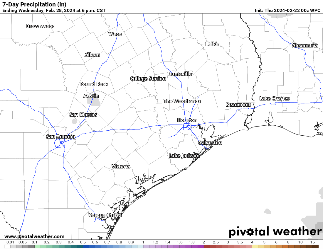
We’ll see two trends this weekend. The first is gradually warming temperatures, from 70 degrees on Friday to the upper 70s to 80 degrees this weekend. We’ll also see the return of some slight rain chances beginning later on Thursday or Thursday night and lasting through Sunday. When I say light, I mean light. Although the weekend will see about a 20 percent chance of rain each day, overall accumulations are expected to be measured in hundredths of an inch. If you’re looking for some sunshine, Saturday afternoon probably has the best chance of it this weekend, but even then I’m not promising anything.
Next week
Monday should be warm again before some sort of front arrives on Tuesday. The details are still fuzzy, but it does appear as though this next front will bring with it a slightly better chance of rain. We shall see.