Summary: Dense fog this morning will give way to some clearing. Rain arrives tonight, heavy at times after midnight and early Saturday morning. Thunder and lightning are likely, and a couple storms could be strong to severe. After an inch or two of rain and some ponding, we’ll see much nicer weather Saturday afternoon, followed by a windy Sunday. Some cooler weather arrives early next week.
Also, we’re going through one of those phases like in December where we have had enough high clouds to occasionally allow for spectacular sunrises and sunsets.

You can always email us or message us photos on Instagram or Twitter or whatnot!
Today
We’ve got a generally nice, calm day ahead. There is some dense fog this morning, so through about 9 AM or so, you may need to contend with that. Tomball visibility is a quarter-mile as I write this, as is Conroe, Wharton, and Colorado County. So give yourself a minute or two extra getting out the door. Otherwise, we’ll see sun and clouds with highs in the low to mid-70s today and a bit of humidity. Clouds become a little more common later, and some showers may begin as early as sunset.
Tonight and Saturday
Look for rain to become a little more persistent or heavier after midnight tonight. Periods of rain and embedded thunderstorms will continue overnight into Saturday morning, and most of it will actually be done before Noon tomorrow. We may even see a return to sunshine tomorrow afternoon.
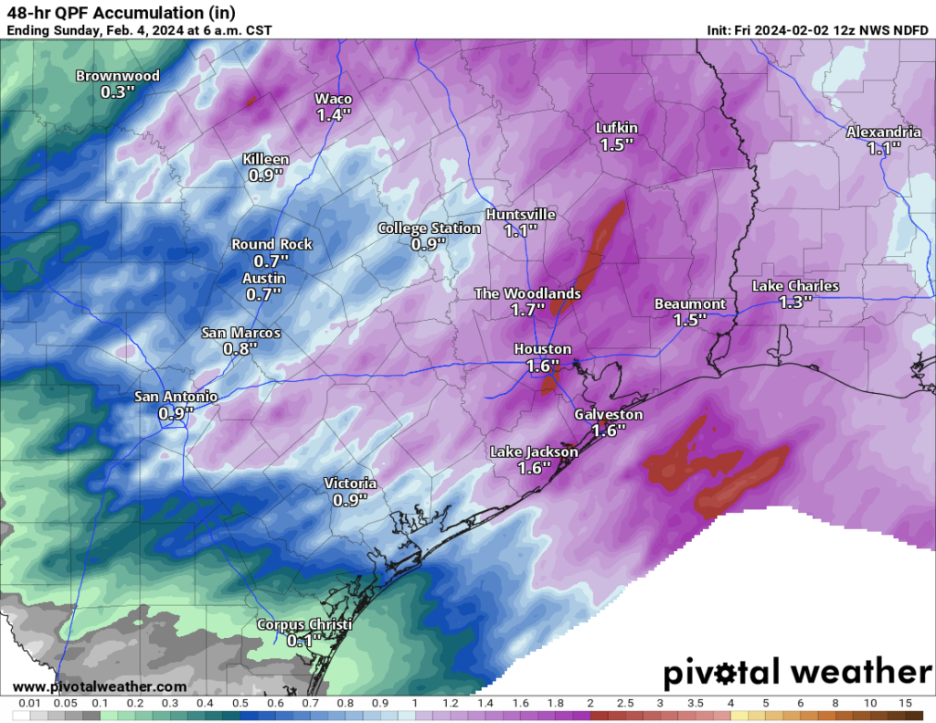
In terms of rain totals, most will see 1 to 2 inches on average. The Matagorda Bay and Corpus Christi areas will probably see less than that. But this will be another healthy rainmaker for most of the region. We don’t expect much in the way of severe weather right now, but a storm or two could become strong to severe early Saturday. The main issue would be strong winds briefly in those storms. We’ll probably have a fair bit of lightning and thunder though.
Low temps tonight will dip into the low-60s, with highs tomorrow in the 70s. Overall, your morning plans will be dicey tomorrow, but the afternoon looks perfectly fine we think.
Sunday and Monday
Both Sunday and Monday should see a good deal of sunshine, though a few extra clouds may pepper the sky Monday. The big thing you’ll notice are winds and cooler temperatures. Highs will be in the 60s on Sunday and lower-60s Monday, with lows in the 40s and 50s. So we take a step back cooler here. But the wind will be whipping a bit on Sunday. Look for west to northwest winds of 15 to 25 mph and gusts to 30 mph or a bit stronger. Monday should be calmer, though there will be lingering wind over the water.
Rest of next week
After a cool start to the week, we’ll warm back up later next week with temps back into the 70s by Wednesday or Thursday. Our next chance at rain probably arrives next Thursday or Friday. It does appear that a generally wet pattern is expected heading into the second week of the forecast.
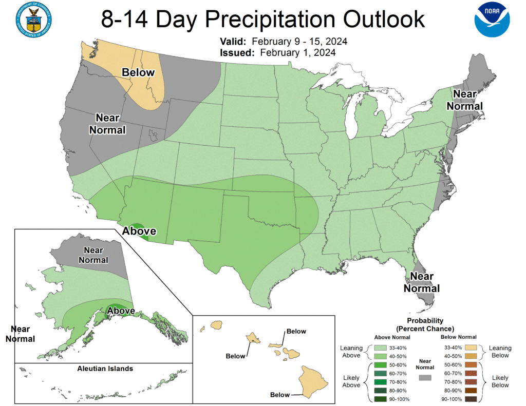
Exactly what it means is TBD, as these are probabilistic maps, which say that the forecast leans above normal. But in general, it looks like next Friday or Saturday-ish will be our next decent chance at rain. We continue to get questions about mid-month cold chances. As of now, we don’t think anything significant will impact Texas, but we’ll keep watching.