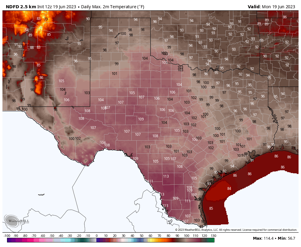
Not going to lie, we did not expect this to happen this evening. A storm system that developed near the Dallas metro area on Wednesday afternoon moved quickly southward, pushing through the Houston metro area during the late evening hours. To our surprise, instead of weakening as this system pushed southward, it maintained its intensity.
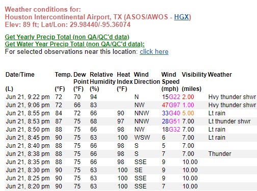
As of this writing nearly 100,000 customers are without power in Montgomery County, and nearly 240,000 in Harris County. This is mostly due to the very strong wind gusts that accompanied these storms. An unconfirmed wind gust of 97 mph was recorded at Bush Intercontinental Airport as this line of storms passed through. To be clear, these winds were wholly unexpected even as of a few hours ago. I’d expect it to take at least a few hours for crew to get out and about and address fallen trees and other issues.
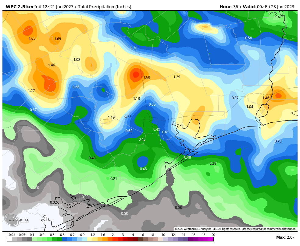
On the upside, the system dropped 0.5 to 1.0 inch of rain across much of the area, which was badly needed after 10 days of sunshine and hot weather. Temperatures have also dropped below 75 degrees across most of Houston, a place they’ve not been in more than a week. I realize that is no small comfort if the power dropped out at your house this evening.
In terms of the near-term forecast, once the storms pass through your area this evening, that’s probably it for tonight. Tomorrow morning looks fairly calm, and we’re probably looking at high temperatures in the low- to mid-90s. At this point I’d expect storm chances to start spinning back up in the afternoon hours, probably peaking again during the early evening. Hopefully we can nail that forecast a little better for you in tomorrow morning’s post.
Now I’m going to go back to my late dinner—of humble pie.