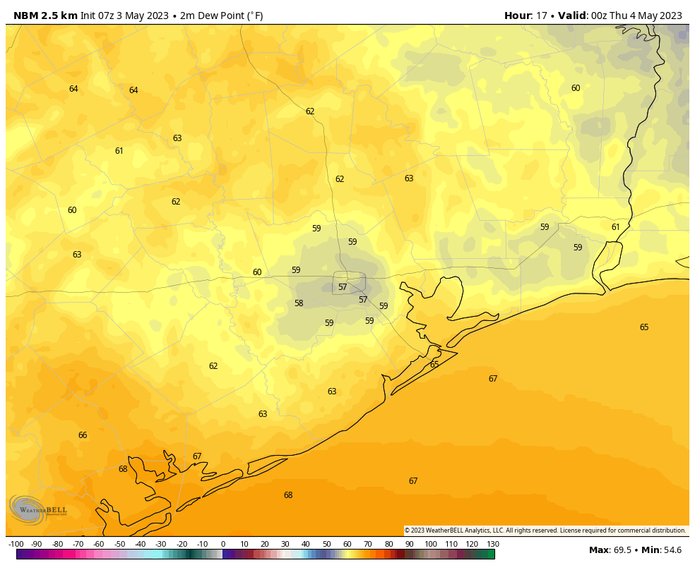
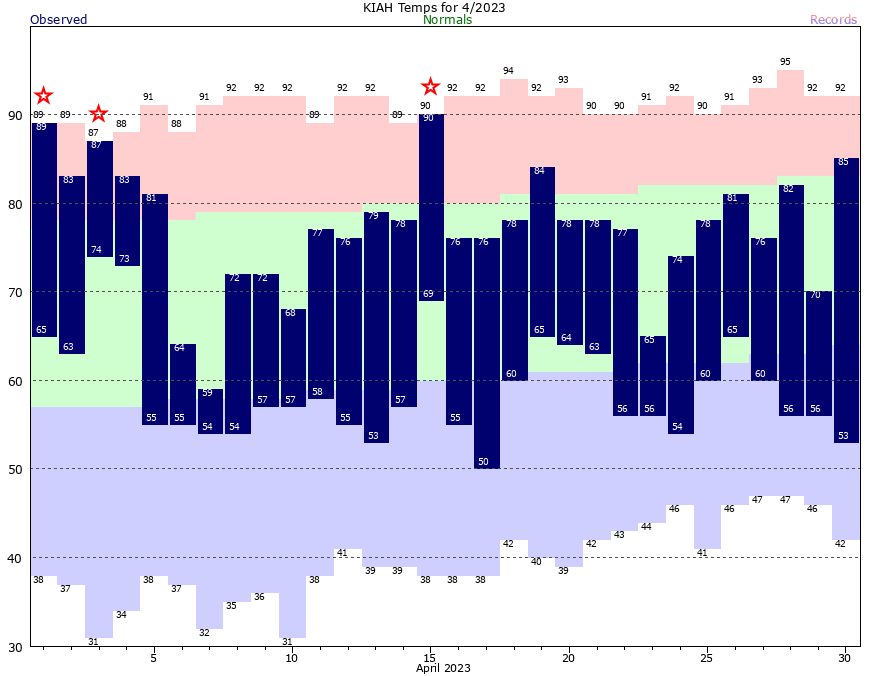
The temperature this morning has fallen to 63 degrees at Bush Intercontinental Airport, and I can’t help but wonder when we’ll see temperatures below 65 degrees in Houston again. Maybe in about 10 days, or maybe not until September? In any case, a much warmer and more humid pattern is coming with high temperatures near or above 90 degrees for the next week after today.
Thursday
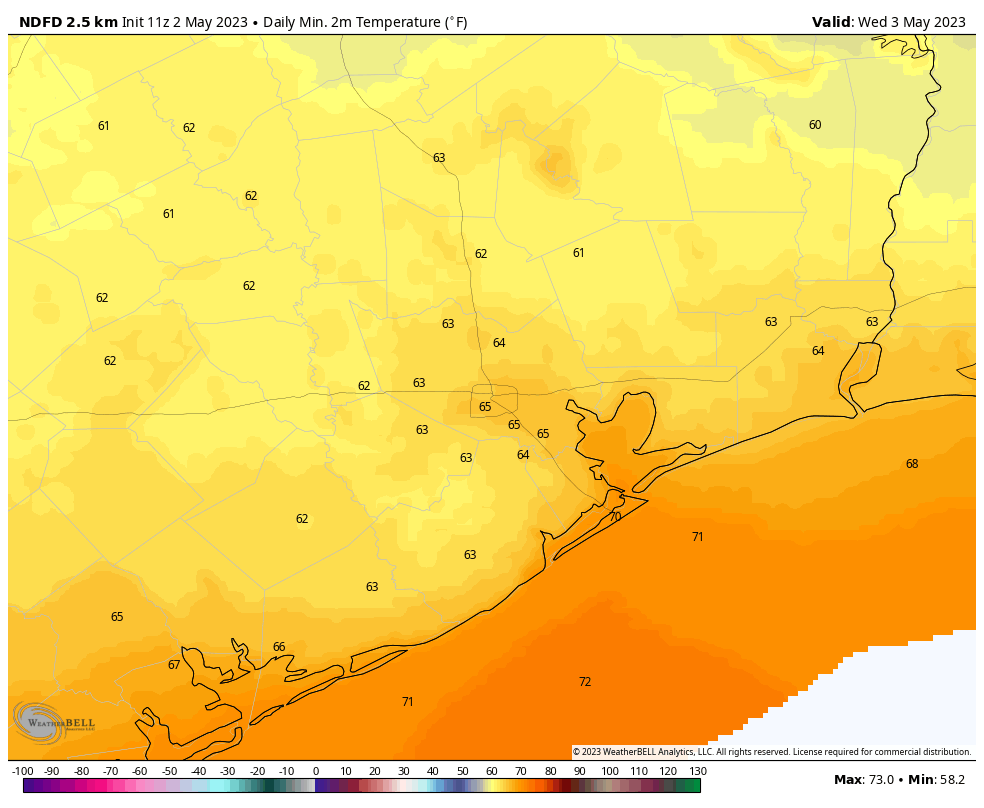
As high pressure slides away it will be replaced by a more pronounced onshore flow and a more unstable atmosphere. For today, that means partly sunny skies, with high temperatures in the mid-80s. Winds will be out of the south at 10 mph, with gusts up to 20 mph later this afternoon. There will be a chance of scattered showers and thunderstorms in Houston tonight, but the bigger threat for severe weather is well to the west of the metro area over central Texas and into the Brazos Valley. Overall rain chances in Houston tonight are probably 20 percent or so. Lows will only drop into the low-70s.
Friday
A slight chance of showers and thunderstorms will persist on Friday, but for the most part we’re looking at mostly cloudy skies and warm, humid weather. Expect high temperatures to reach about 90 degrees, with southerly winds. This day will really feel like “early summer” in Houston, and the sticky conditions will stick around for awhile. Lows Friday night only drop into the mid-70s.
Saturday and Sunday
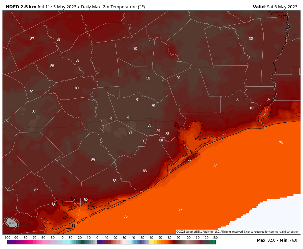
Expect more of the same this weekend. If you’re looking for sunshine this weekend, the middle of the day on Saturday is probably your best bet, when skies may become partly sunny for several hours. Otherwise, clouds will be more common than clear skies. Isolated showers are possible on both days along with the sea breeze, but I would peg their chances at only about 10 or 20 percent each day. Highs will be around 90 degrees, or in the low 90s, for both weekend days. Are y’all ready to sweat?
Next week
Next week will not yield much change in our weather, at least not right away. Look for high temperatures in the upper 80s to 90 degrees most days, with lows in the mid-70s. Rain chances are going to start out at 20 percent or so, but could increase significantly by the latter part of the week in response to changes in the upper atmosphere. But my confidence in that portion of the forecast is low. Just know that heat and humidity are going to be your best and constant friend for awhile.
A message from our sponsor, Reliant
As Eric has covered this week, it’s been a glorious spring in Houston, but summer is right on its heels, with rising temperatures expected in the coming days. As a longtime supporter of Eric and Matt’s no-hype approach, Reliant wants all Houstonians to feel prepared and informed on how to save money and energy during the summer heat. Check out our energy efficiency tips below:
- Follow the four-by-four principle. During the summer months, setting your thermostat four degrees higher when you’re away from home for more than four hours can help reduce electricity usage and costs. When your thermostat is set below 78°F, each degree cooler can increase your costs by up to seven percent. While the suggested temperature for ideal energy use in the summer is 78°, we know a comfortable temperature setting is a personal preference. No matter your preferred setting, the 4×4 principle will help you reduce your usage and ultimately save on your electricity bill.
- Schedule an HVAC checkup. Now is the time to schedule a tune-up with an HVAC service professional to ensure your system is running at its best. Just as you wouldn’t take your car out for a long road trip without getting serviced, you don’t want to operate your A/C system during the long, hot summer without proper maintenance. Schedule a multi-point checkup to ensure your system is running at its best.
- Reduce the temperature on your electric water heater to 120°F. You could save three to five percent in energy costs per year.
- Check air filters monthly and replace as necessary. A clean air filter can keep your A/C running at peak condition.
- Avoid using heat-producing appliances like the clothes dryer, dishwasher, or oven during the hottest times of day. These appliances can cause your A/C to work harder to keep your home cool.
- Install a programmable thermostat, like a Nest, and you can save an estimated 10 percent a year on cooling and heating costs. You can schedule it to only run when you’re home, so you don’t waste energy cooling an empty space. And, the Nest also learns your schedule, can sense when you’re away and automatically adjusts the temperature to help you conserve
- Use blinds or curtains during the summer to reduce solar heat gain. Sunlight can increase the demand on your air conditioner by as much as 30 percent.
Find additional energy efficiency tips by clicking here.