Good morning. I hope everyone enjoyed the not-too-hot and not-too-cool weather over the weekend. It provided a nice antidote to the rain showers last week which, in turn, provided a nice boost of moisture to help our yards and trees and flowers as we get deeper into spring. This week will see mild conditions before some uncertainty arrives for this weekend. While I don’t envision widespread storms, there is the potential for some rainfall, and possibly thunderstorms.
Monday
Our weather today should be a lot like Sunday, in that we will see partly sunny skies with highs in the mid-70s and a moderate amount of humidity. Winds will again be light, perhaps 5 to 10 miles out of the northeast. There is perhaps a 10 percent chance of a light shower later this afternoon. Low temperatures tonight will drop to around 60 degrees in Houston, with cooler conditions further inland, to go along with mostly cloudy skies.
Tuesday
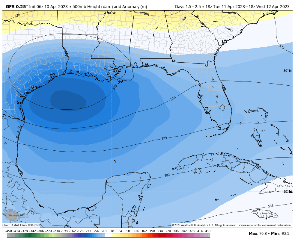
Our moderate weather continues. You may be asking yourself, why are we seeing a prolonged period of northeasterly winds? Should not the onshore flow resume at some time? The answer is that a low-pressure system is wobbling around off shore, in the Gulf of Mexico. This is not a major concern for us weather-wise, but it will give us a pleasant pattern through Wednesday or Thursday in terms of light easterly-northeasterly winds and moderate humidity.
However, there are some indications that the low may get close enough to the Texas coast on Tuesday and Wednesday to produce some scattered showers and perhaps a few thunderstorms, especially for areas south of Interstate 10. Overall chances remain low, however, in the 20 to 30 percent range. Highs will be in the mid-70s, otherwise on Tuesday. Lows drop to around 60 in Houston.
Wednesday and Thursday
Aside from a moderate chance of showers on Wednesday, these days should see temperatures in the upper 70s with mostly sunny skies. Lows may drop into the upper 50s under the influence of the northeasterly flow.
Friday
This day looks warmer, with mostly sunny skies and highs in the mid-80s. Lows Friday night will be warm, perhaps dropping to only 70 degrees.
Saturday and Sunday
We’re going to have to write the weekend forecast in pencil, I’m afraid. A front will be diving down through Texas, and some of the ingredients needed for a line of storms will be present, including instability. However at this point there is no slam dunk in terms of such conditions, and the front could pass through Saturday night or Sunday morning with a minimum of fuss.
The bottom line is that right now I can confidently predict warm conditions on Saturday, with highs somewhere in the 80s. There is also a healthy chance of rain. I’ll put in 50 percent as a placeholder, but it could go higher, during the daytime and evening, ahead of the front. Lows on Saturday night will depend on the timing of the front.
After the front’s passage, beginning Sunday and probably lasting through Tuesday, conditions look pleasant, with mostly sunny skies, highs perhaps in the upper 70s, and cool but not cold nights.