First off this morning, congratulations to NASA and those who have worked so hard on Artemis on a successful launch overnight!
We got the sun back out yesterday after a dreary Monday. We should hold on to at least some sun today, though clouds may at times block it out. The next 8 or 9 days will feature quick moving systems that impact the region every couple days, possibly culminating in a wetter period right around Wednesday and Thursday of next week. Those odds have inched up a bit since yesterday. More on that in a second.
Today
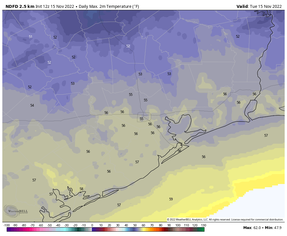
We aren’t expecting any adverse weather today, so you can confidently go about your plans without issue. You’ll see both clouds and sun but probably more clouds than sun overall. It will remain chilly with highs only in the mid-50s. A continued breeze at times, especially into tonight, will enhance the chill, with gusts of 20 to 25 mph near the coast.
Thursday
A chilly start to the day won’t get a whole lot better tomorrow. Clouds should dominate early Thursday with more sunshine in the afternoon. A system passing by overhead will bring a non-zero chance for some showers, sprinkles, or light rain, but it would seem most of that should fall well offshore. Highs will be in the mid-50s again.
Friday
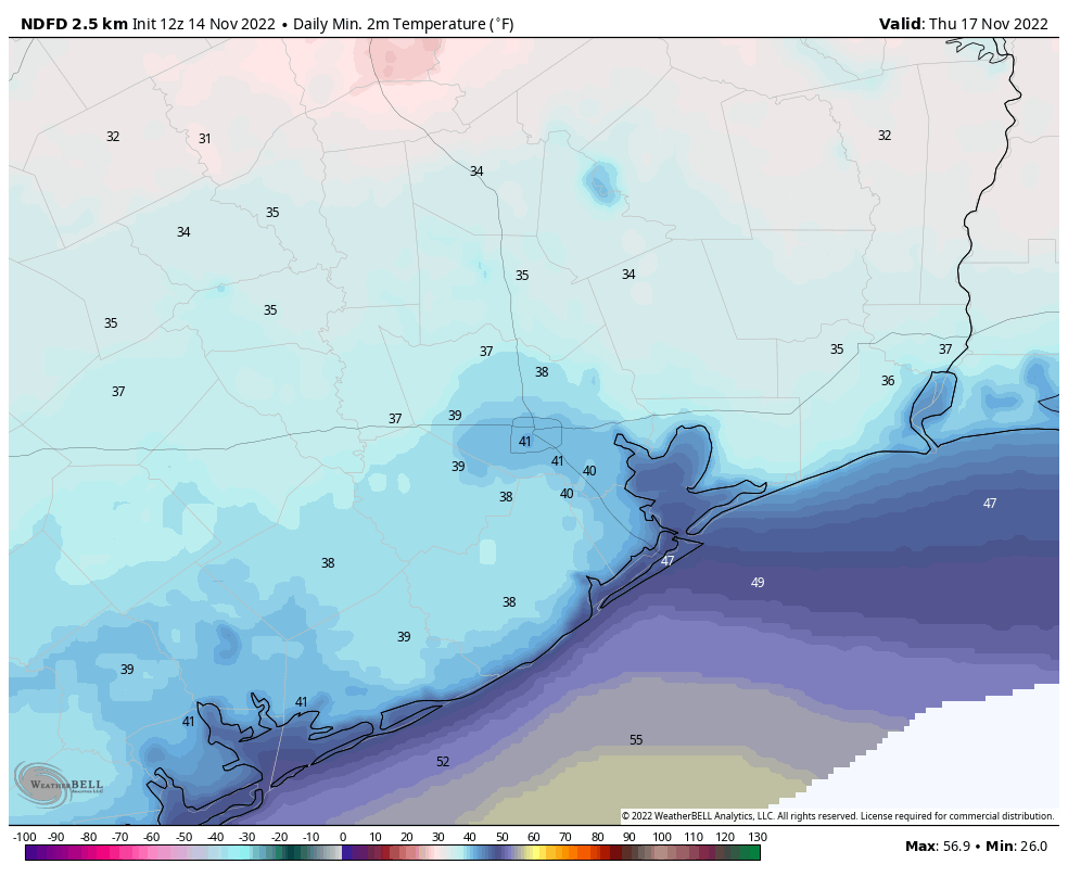
As systems continue to move along briskly, Friday should be a mainly quiet day between them. It will be quite cold in the morning.
We’ll warm from the 30s and 40s into the mid-50s. Sunshine should be around in the morning, but it may fade behind increasing clouds through the day. There could be a few showers very late in the day southwest of Houston, toward Matagorda Bay or into portions of Fort Bend and Brazoria Counties.
Saturday
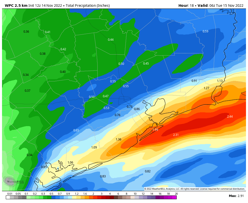
The forecast for Saturday is a bit trickier with a system passing just offshore. This looks like a farther south version of what happened in our area Monday. In other words, most of the heavier rain should stay offshore, but there will be at least scattered showers or periods of rain in the Houston area and points south. Places north of the Brazos Valley or Conroe may see little to no rain on Saturday. That said, trends in recent days have been toward slightly higher rain chances. Rain totals look to be about a quarter-inch or so in Houston, with higher amounts south and lower amounts north. We’ll watch to see if this changes at all.
Expect a good deal of clouds outside of that, with highs in the 50s. A breeze of 15 to 20 mph will be possible, especially near the coast once again.
Sunday
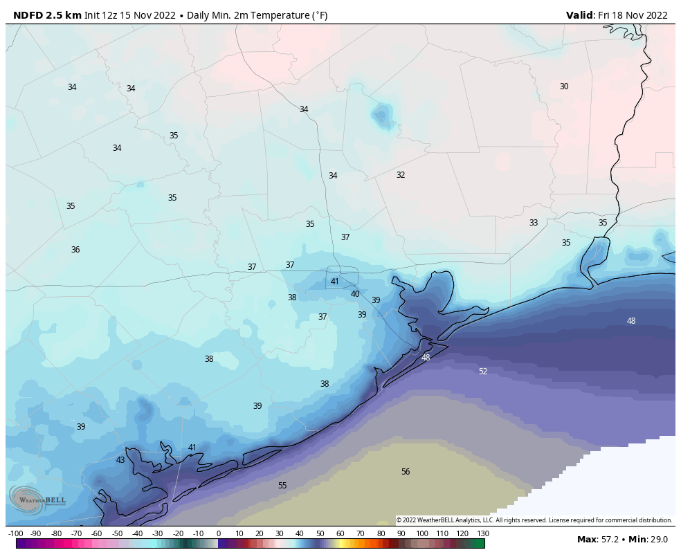
Clouds may linger behind Saturday’s system keeping Sunday cool but dry. Sunshine should gradually break back out though. We should do yet another day of (say it with me again) mid-50s after a morning in the 40s.
Next week
Let’s start with this: Confidence in any specific details for next week’s weather is fairly low. We can speak generally though. Monday looks a bit unsettled with a chance of showers as one disturbance swings through. Tuesday will probably be dry with winds shifting back onshore for the first time in a bit. That will bring clouds and shower chances to the region on Wednesday, especially west of Houston. All that congeals into a storm that drags a front through on Thanksgiving, turning us somewhat cooler for the weekend.
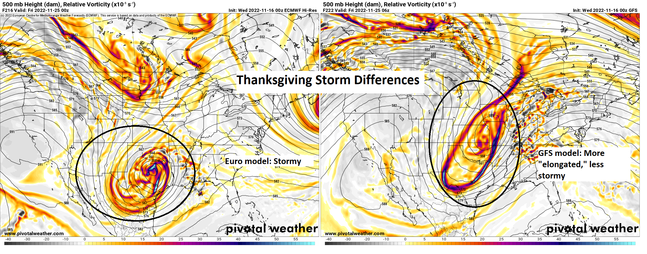
The problem right now is determining exactly how that storm behaves on Wednesday and Thursday, as that will ultimately dictate specifics. Models are split between a very aggressive storm with a chance for strong storms and heavy rain, especially Wednesday night (the European model) and a much less aggressive system with a chance of showers mostly (the GFS model). The European model would have meaningful impacts on travel and events. The GFS model would not. Truth be told, I think our confidence has increased a little in the last 24 hours that at least some portion of the holiday will be wet. Beyond that, we can’t say much else. Stay tuned.
Monday and Tuesday will probably see morning lows in the 40s and highs in the 50s or low-60s. We could push 70 on Wednesday or Thursday with humidity before turning cooler and drier into the Friday and weekend period.
Fundraiser
Our annual fundraiser continues this week. Thank you to all who have helped contribute to keep pushing us along for another year! You’ve still got time to purchase or donate to directly support our work. You can click here to do that. If you don’t wish to purchase merchandise and just want make a contribution, click here and check the box that says “I’d like to make a donation only.”