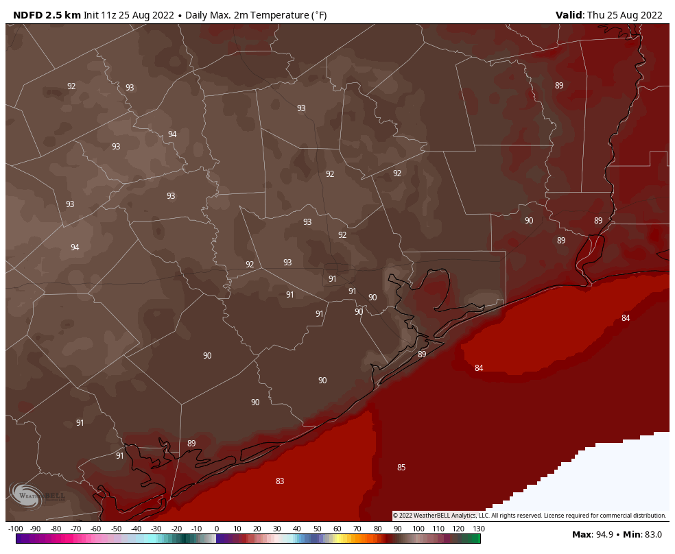
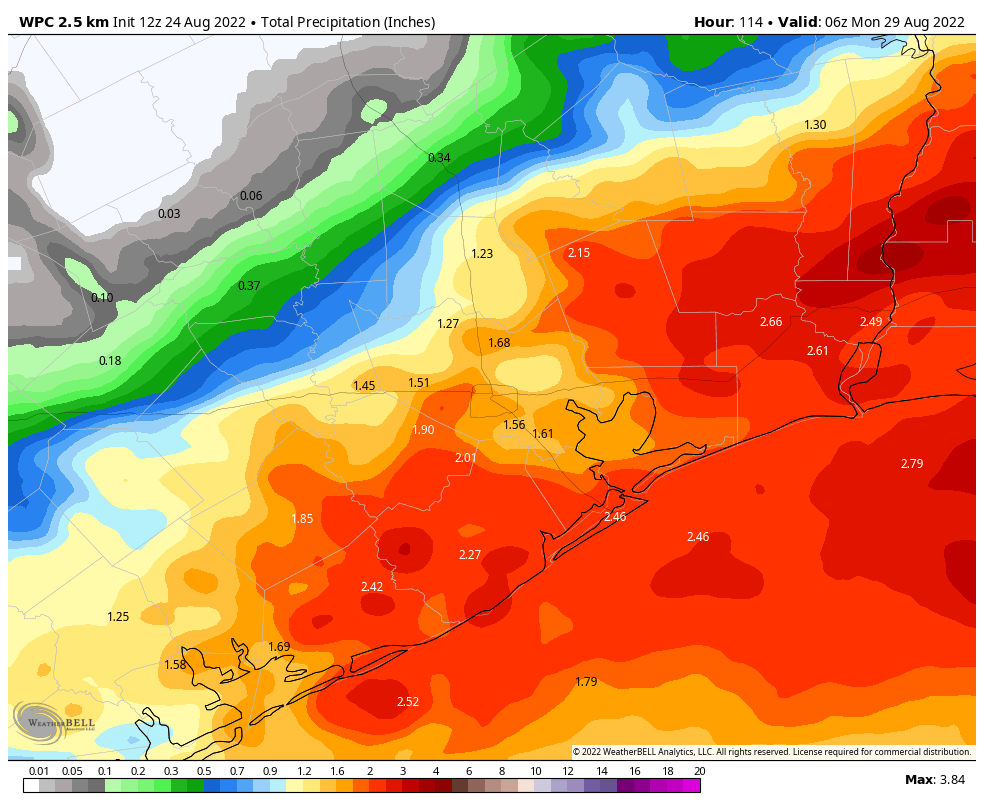
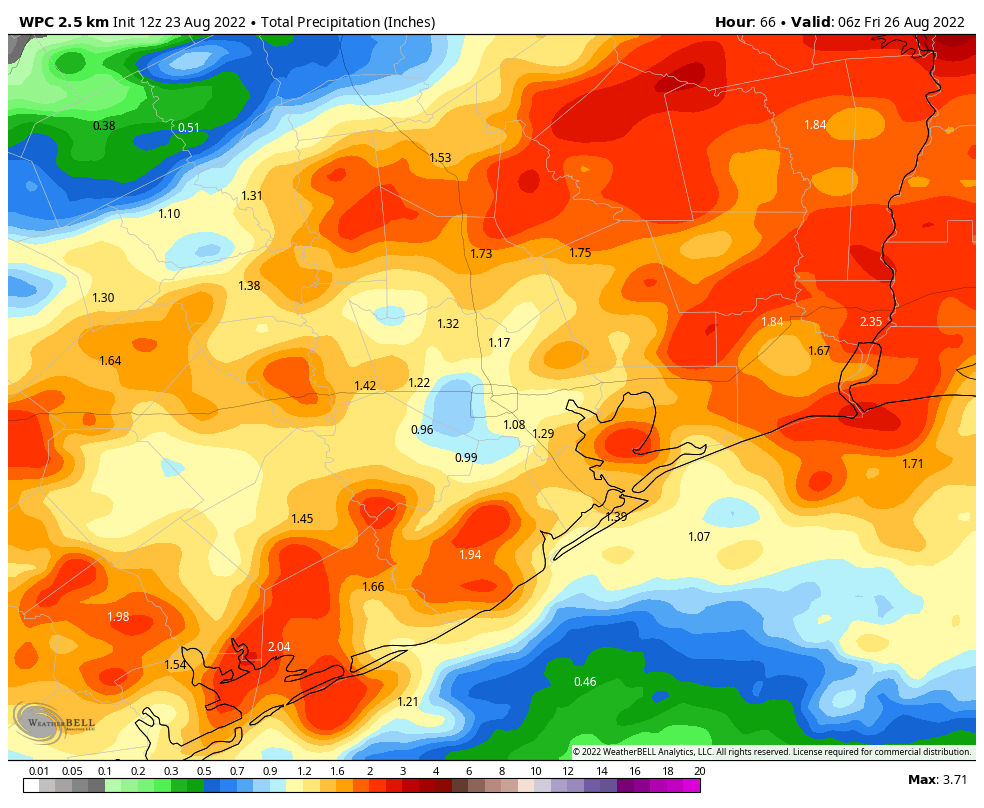
Good morning. Houston will remain in a wet, but not too wet, pattern for the next several days at the region lies between high pressure systems. Effectively this means we’ll have a healthy chance of rainfall for the foreseeable future, although perhaps only 40 to 60 percent of the region will see showers on a daily basis. We don’t have any flooding concerns as these should, for the most part, be showers of the variety that move in and then move out. Daily rain chances and partly cloudy skies should help to keep highs in the low- to mid-90s, which is near or slightly below normal for this time of year.
Friday
The boundary that sparked showers along the coast and, later, near downtown Houston on Thursday has started the process of lifting north today and is effectively dissipating. This means that while the atmosphere remains reasonably moist, there is less of a forcing function for showers. So I’d anticipate rain chances in the vicinity of 50 percent today for much of the area, but with accumulations well below 1 inch for all but a few areas beneath stronger thunderstorms. Activity will be most widespread during the afternoon hours. Highs will generally be in the low 90s, with partly sunny skies, and light winds out of the southeast.
Saturday
A similar pattern should be in place for Saturday, with hit or miss showers. Most of these will be garden-variety showers but with the moist atmosphere we simply cannot rule out a few stronger and more intense thunderstorms. Look for highs generally in the low 90s with partly sunny skies. Outdoor plans in the morning should be OK, but you’ll want to have a plan for passing storms during the afternoon and evening hours.
Sunday
If you like Saturday’s forecast, have I got a deal for you. Sunday will be much the same, with the similar threat of afternoon showers and thunderstorms. Some areas will get rain, some will not. Generally, areas closer to the coast and east of Houston will have better chances for more rain through the weekend. Most areas won’t pick up more than 0.5 to 1.5 inch through Sunday, however.
Next week
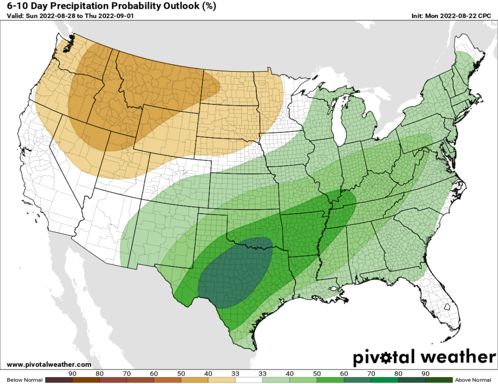
This pattern is more or less going to hold for much of next week, with highs generally in the low 90s. As late Augusts and early Septembers go, this is not a bad thing in my opinion. There will be healthy rain chances continuing, but again nothing threatening from a significant flooding standpoint. In the middle of next week we’ll see a front move down into Texas, and we’ll be watching to see whether it pushes up rain chances for areas north of Interstate 10 (no, we’re not going to see notably cooler weather, sorry). After that we’ll be watching the tropics and the Gulf of Mexico, as discussed below.
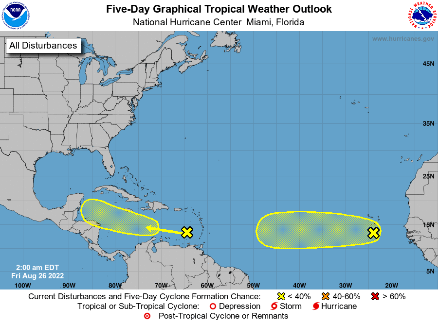
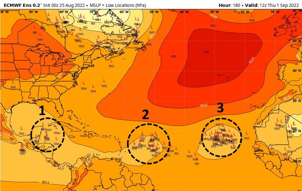
Tropics
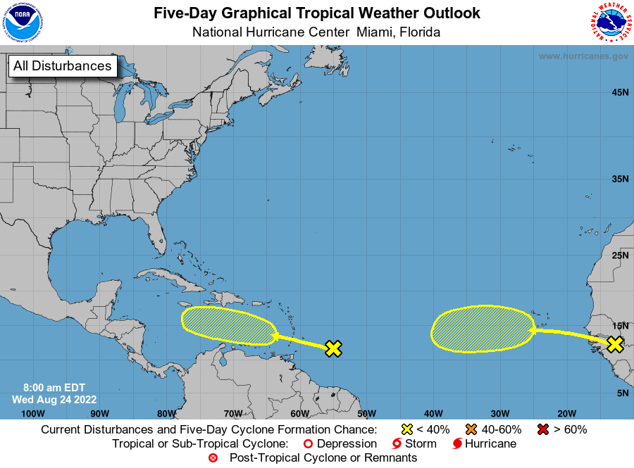
At present there’s still not much going on in the tropics, but that is going to change over the next week. The principal area we’re watching is an area of disturbed weather in the eastern Caribbean Sea. This will continue to move westward, and should push into the Gulf of Mexico next week. After that time it may find more favorable conditions for development; or possibly not. I’d love to tell you where it’s going to go once it gets in the Gulf, but with an undeveloped system, more than a week out, that is a fool’s errand. I still think Mexico, Texas, or Louisiana are the most likely destinations. If this does impact Texas’ weather, it would start to do so as we approach and get into Labor Day Weekend. For now, it’s certainly not something I’d lose sleep over. So why did I write a whole paragraph about it? Because you really don’t want to mess with low pressure systems in the Gulf of Mexico, in early September.
Elsewhere there are more tropical waves in the Atlantic, and about to move off of Africa into the Atlantic, but none appear to present a long-range threat to the Gulf of Mexico at this time.
Have a great weekend, everyone. Matt will be with you on Monday as I’ll be in Florida for the launch of NASA’s Space Launch System rocket. I’m excited to see this big rocket fly, and weather there looks favorable.