Good morning. Houston will experience warm, windy, and mostly cloudy weather before a strong-ish cold front arrives during the middle of the day Thursday to cool things off. Temperatures could bottom out in the upper 30s on Friday and Saturday morning in Houston, with somewhat chilly weather lasting through most of the weekend.
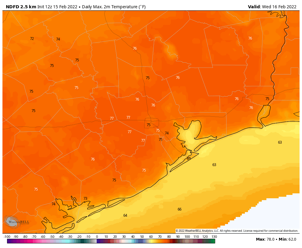
Wednesday
This morning’s highlight was the setting of a very nearly full Moon, but skies will now cloud over for much of the area. A persistent and warm southerly flow will allow temperatures to reach the mid-70s today. In response to low pressure over the central United States, these winds may at times gust to 25 or 30 mph this afternoon. As atmospheric moisture levels rise, a few isolated, light rain showers will be possible today, but the majority of us should stay dry. Low temperatures tonight may only drop into the upper 60s for most, with an ongoing, slight chance of showers. Winds will remain blowy, from the south.
Thursday
After a muggy start, the aforementioned front should move into areas northwest of Houston during the morning hours, the central part of the city around noon, and reach the coast an hour or two later. Some scattered showers are possible with the front, but a capping inversion should limit the threat of any serious thunderstorms. Daytime temperatures will be in the 70s, but the mercury will pretty quickly start to drop as sunset approaches. Overnight lows will drop into the upper 30s, with the usual suspects far inland possibly seeing a light freeze.
Friday
This will be a cooler, mostly sunny day with highs in the mid- to upper 50s. Winds will come from the north, but at a mild 5 to 10 mph clip. Lows Friday night will probably be a degree or two warmer than Thursday night.
Saturday and Sunday
Saturday should see mostly sunny skies, with high temperatures pushing into the low- to mid-60s. However, as high pressure moves off the onshore flow will resume, and this will allow for a warmer night in the 40s on Saturday, and highs perhaps around 70 degrees on Sunday. This onshore flow will probably lead to more clouds on Sunday as well, although any rain is unlikely before at least Sunday night or Monday.
Next week
You know the drill, temperature next week will continue to rise until the next front. In this case, I think highs may reach about 80 degrees by Tuesday, and perhaps Wednesday depending on the timing of the front. I’d pencil the next front in for Wednesday-ish, but not with a whole lot of confidence.