Well, Houston, we’ve made it to July. Historically, the next two months are the hottest of the year. And we’ll certainly be in the 90s the next couple of days. But our bigger concern in the forecast period will be triggered by a cold front of all things, which won’t bring cold air but will initiate a wet period beginning Friday night. There’s also a newly formed tropical system, Elsa, bound for the Caribbean Sea that we’ll discuss.
Thursday
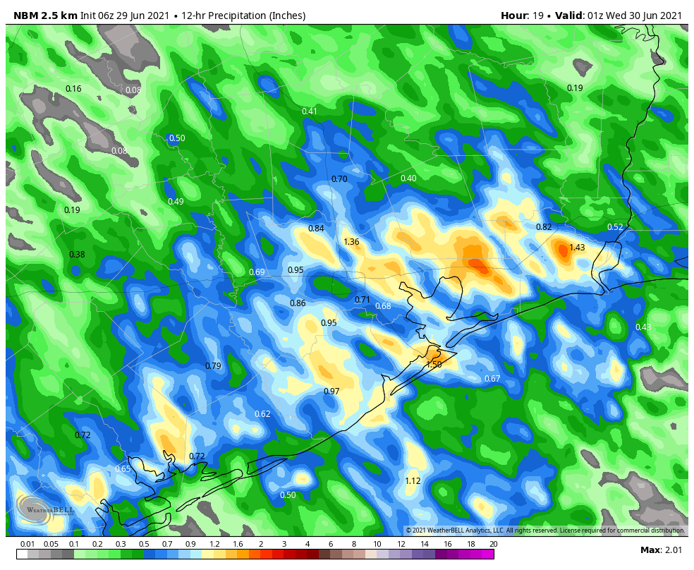
Today should bring mostly sunny skies for the region, and this will nudge high temperatures into the low 90s. A few showers may pop up this afternoon, along the sea breeze. The most likely focus for any storms will be south of Interstate 10, and anything that forms should be fairly short lived. Rain chances will slacken considerably as evening comes upon us. Winds will be very light most of the day, from the east. Nighttime temperatures will drop into the mid-70s.
Friday
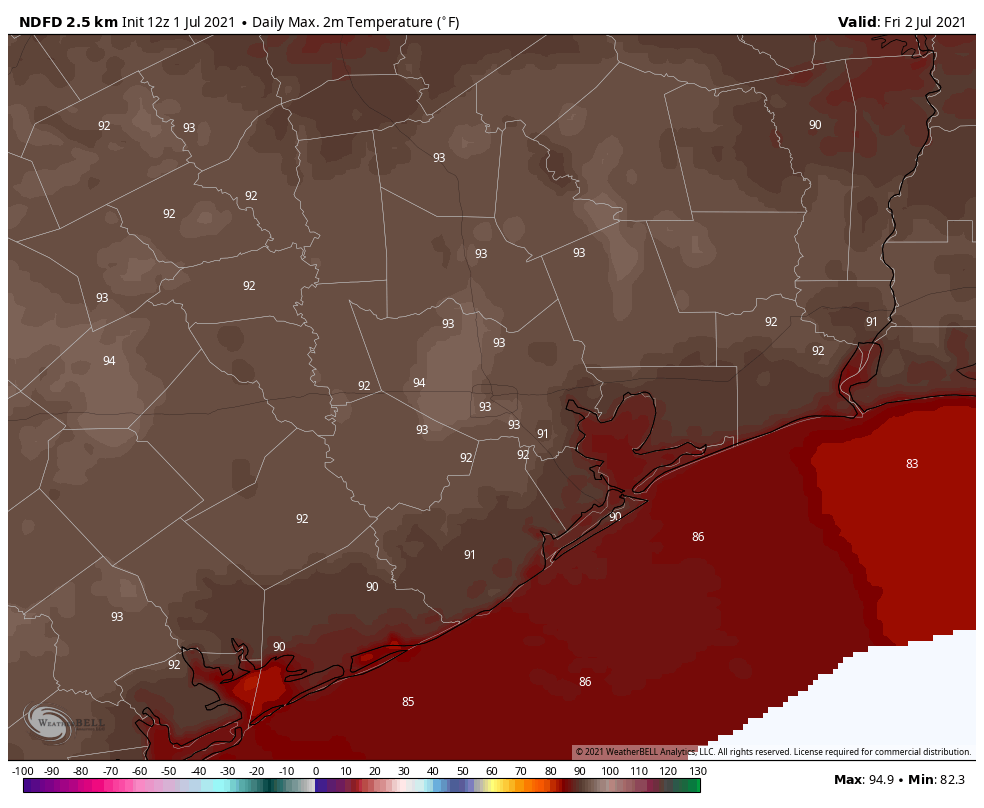
Friday looks to be the warmest day of the week, with highs in the mid-90s and lots of sunshine. Again, we could see some scattered showers along the sea breeze, but I think most of us will not see rainfall. This may begin to change on Friday evening or overnight, as the aforementioned front begins to generate shower activity.
Saturday and Sunday
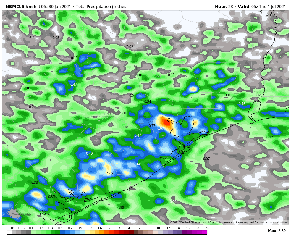
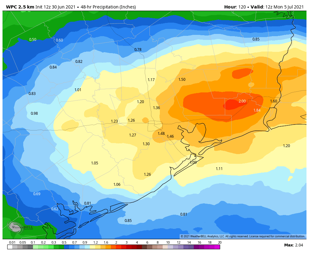
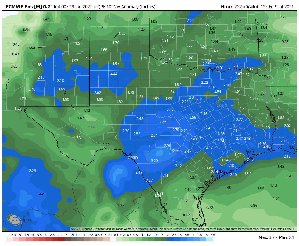
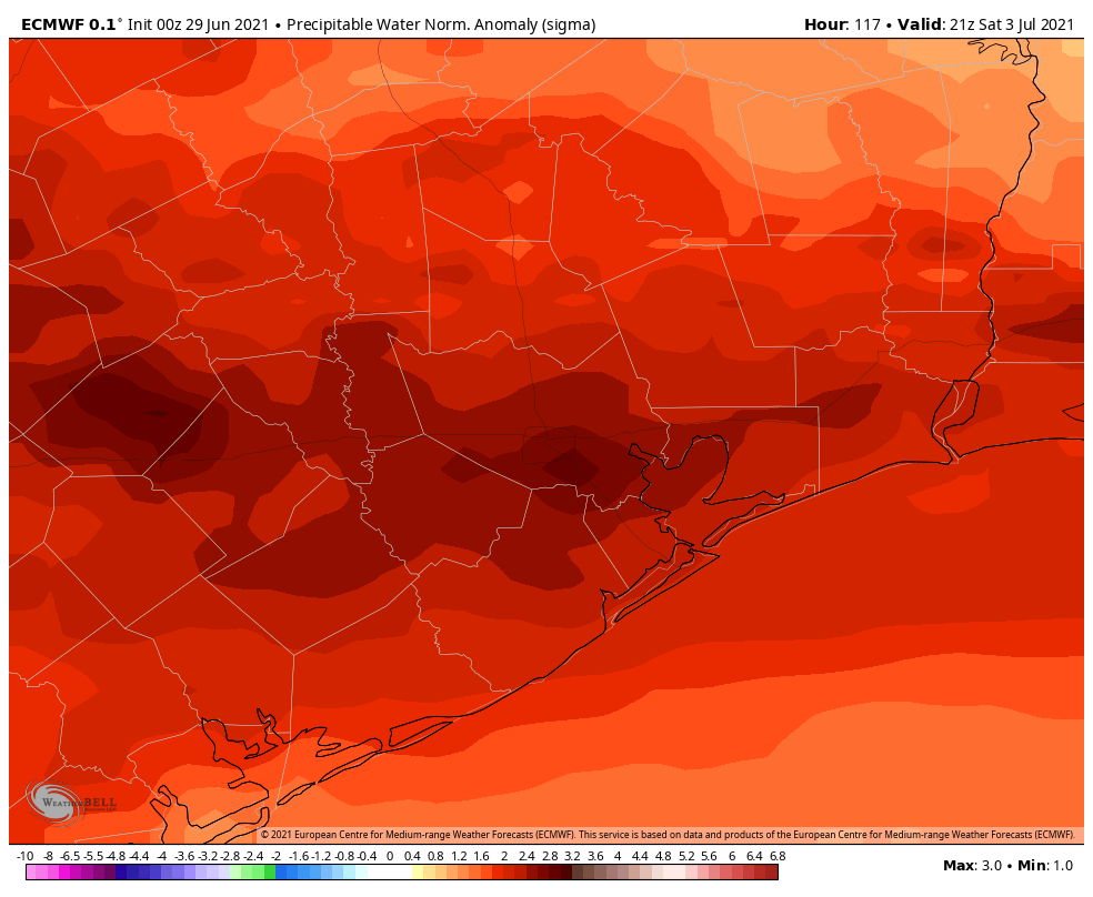
The holiday weekend looks fairly wet, I’m afraid. The stalling front, in concert with quite high atmospheric moisture levels moving in from the Gulf of Mexico, will open up our region to periods of moderate to heavy rainfall. Both Saturday and Sunday should see mostly cloudy skies, with highs in the upper 80s. I expect accumulations of 1 to 2 inches of rain for much of the area, but we may see higher bullseyes and this is our concern. This may put a damper on fireworks activities, or we may get a break on Sunday evening from showers, we just don’t know yet.
Next week
The first half of next week, at least, will see elevated rain chances above 50 percent each day. Given the setup, some localized areas may eventually find themselves in a situation prone to flooding—after having accumulated several inches of rainfall. Matt and I will be covering this over the weekend, if necessary, and may eventually need to issue at least a Stage 1 flood alert given the overall potential for heavy rainfall to continue into next Wednesday or Thursday. Bottom line? Enjoy the sunshine today and Friday before the holiday weekend brings us into a much wetter period.
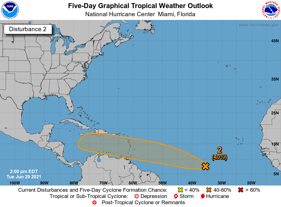
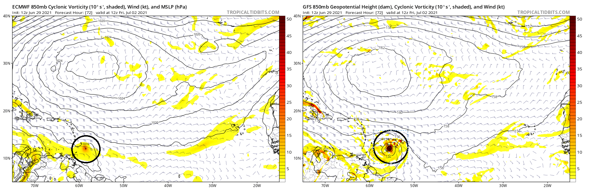
Tropical Storm Elsa
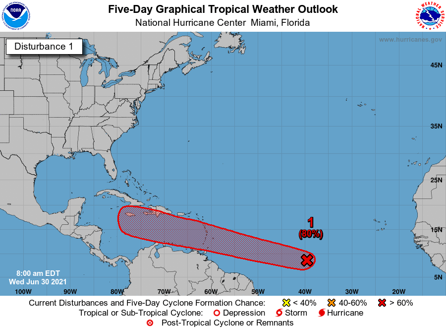
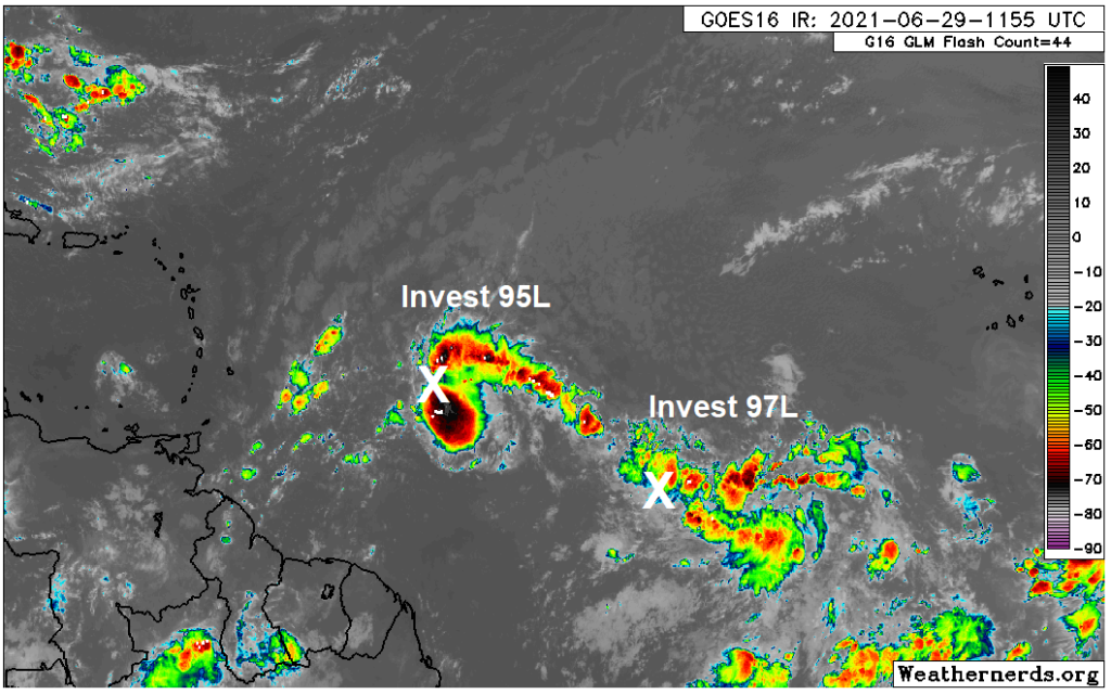
Far from being frozen, the tropics are continuing to remain active with the formation of Tropical Storm Elsa in the Atlantic Ocean. Elsa is moving rapidly westward, and will enter the Caribbean Sea on Friday, and approach Hispaniola or Cuba by Saturday. Due to this forward motion, I think Elsa will struggle to maintain its organization—it’s difficult for storms to maintain a consistent vertical profile, or essentially not become lopsided the faster they move. For this reason, there is a lot of uncertainty with the intensity forecast over the next five days.
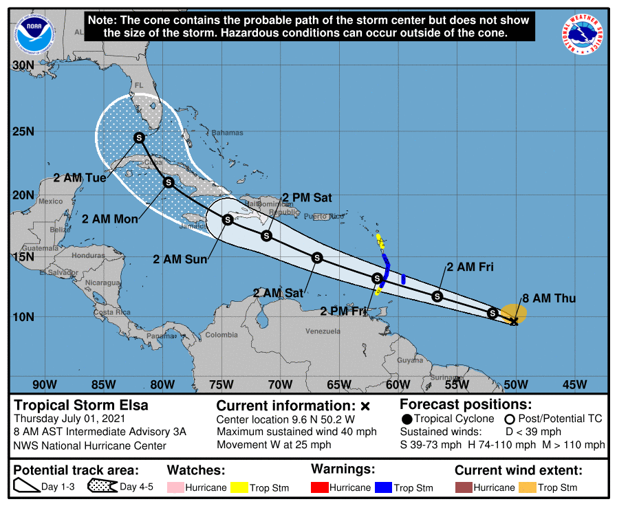
As for where Elsa ends up, anywhere from the eastern Gulf of Mexico, to Florida, to east of the Florida peninsula is possible next week. Texas is unlikely to see any winds from Elsa, but the overall setup may generate additional moisture later next week. We’ll just have to wait and see.