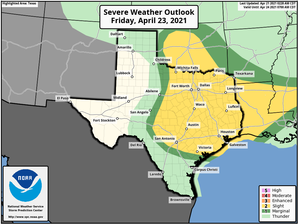
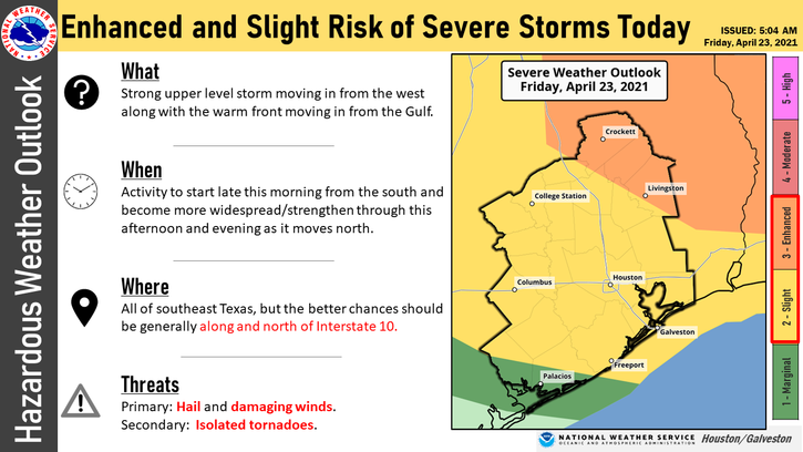
The main story in today’s post will be regarding the chance of strong to severe thunderstorms today. The Storm Prediction Center has most of the Houston area in a “Slight” risk (level 2/5) of severe weather today. Areas around Lake Livingston and Crockett are in an “Enhanced” risk (level 3/5) of severe weather.
Let’s walk through what to expect.
When will it rain?
We are already seeing a few showers across the area, with some localized downpours east of I-45 and lighter showers or light rain and drizzle elsewhere. Look for the coverage of showers to increase through the morning and continue off and on through at least mid-afternoon. It will not rain all day, and it may not even rain everywhere. But that chance is going to hang with us all day today, so it’s best to have an umbrella at the ready wherever you go. A second round of showers or storms is possible this evening, but confidence in what that exactly looks like is low. Rain chances will drop off and eventually end overnight after a cold front pushes through toward morning.
When is the best chance for severe weather?
There will be two chances at severe weather today. The first will be with a warm front lifting north across the area from late morning into early afternoon. That could produce individual thunderstorms capable of producing large hail or an isolated tornado. The relative highest odds of that occurring would be north of I-10 and east of I-45, particularly as you get closer to that “Enhanced risk” area northeast of Houston. The second opportunity will likely come with the “dryline” sweeping east late this afternoon or evening. Severe weather may occur in Central or North Texas as individual cells develop, eventually probably congealing into more a squall line and general strong, damaging wind threat as it sweeps east.
There is still a bit of uncertainty regarding exactly how things will play out today, but if it looks more serious closer to the Houston area we will keep you posted.
Will there be tornadoes? Hail?
As is often the case, the odds of any one location seeing significant severe weather today is quite low. But that said, hail and damaging winds will be the primary threat from today’s storms. But, yes, there is at least a chance for an isolated tornado, particularly with the late morning and early afternoon storms that develop mainly north and east of Houston. The best hail odds today will be with the storms developing in Central Texas, especially initially. As those approach the Houston area this evening, I would expect the hail threat to diminish and transition more to a damaging wind one.
When will it end?
There will probably be a lull late this evening or early in the overnight. A brief shower or storm can’t be entirely ruled out late tonight or very early Saturday morning as the cold front approaches. But for the most part, the rain chances and severe weather risks will end after this evening.
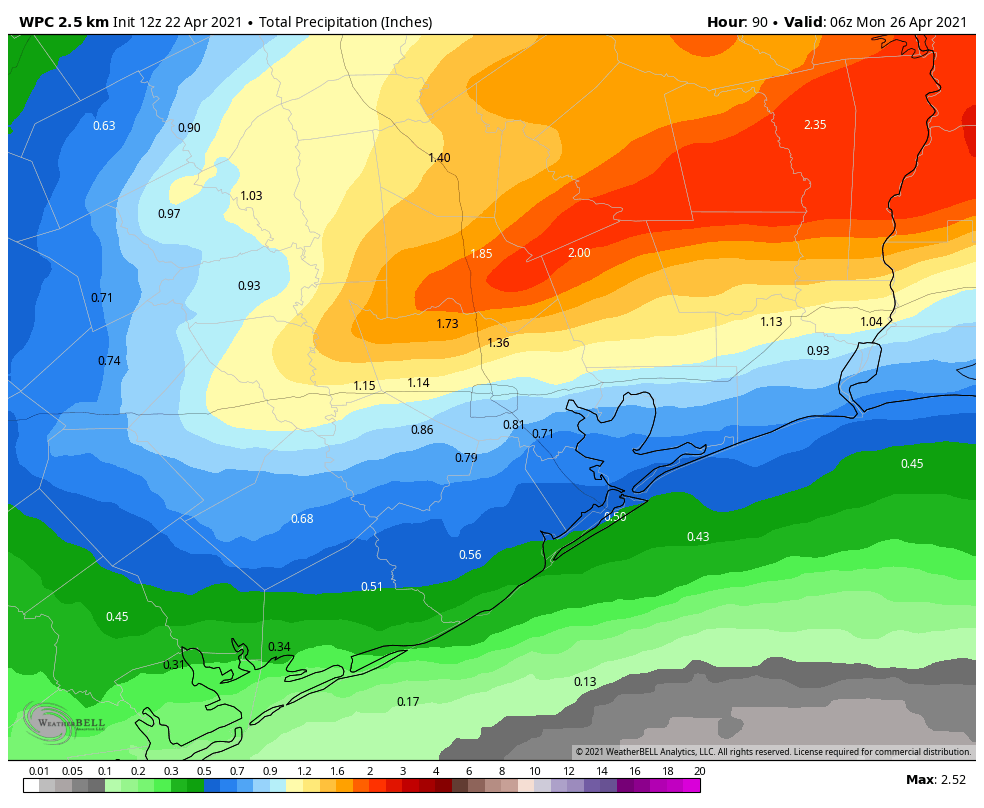
How much rain should we expect today?
It’s likely that rain totals are wildly variable across the region today. It’s possible some places see merely a few hundredths or a couple tenths of an inch of rain, while others could see 2 to 3 inches or more. The current NWS forecast is below.
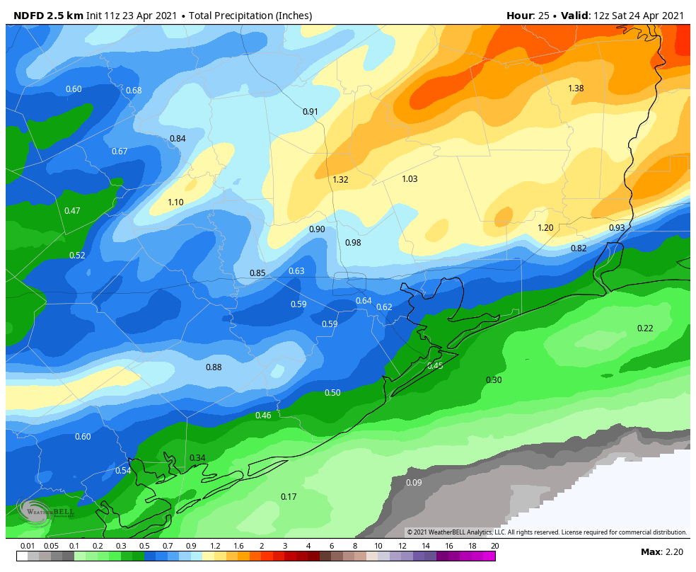
The more sustained storms north and east of Houston will likely allow for heavier rain, so those areas have the highest odds of seeing 1 inch or more. Areas south of I-10, where storms may struggle to get going this morning stand the best odds of seeing a quarter-inch or less. Some of our higher resolution models show some serious rainfall gaps south of Houston, with some places seeing next to no rain and others seeing almost an inch. So it’s going to be a roll of the dice today.
Weekend
For those able to enjoy weekends, you’re in for another winner. Saturday will see any lingering clouds in the morning quickly give way to sunshine. Saturday will start off quite warm and very humid. The front should sweep through mid-morning, and that will allow the air to dry out a bit. Drier air tends to heat up faster, so we should easily reach the mid-80s Saturday afternoon. I wouldn’t be entirely shocked to see some upper-80s out there either. At least the humidity will be dropping through the day.
Drier air tends to cool off faster too, so expect temperatures to drop quickly under clear skies Saturday evening into the 60s and eventually the 50s in spots.
Sunday looks warm as well, with highs in the lower to middle 80s and plentiful sunshine again. Humidity will remain low.
Early next week
Look for onshore flow to kick back in pretty effectively on Sunday night and Monday. You’re probably going to notice the wind kick up as well later Monday into Tuesday. Winds will probably gust to 30 mph at times, especially near the coast. We should see more clouds, more humidity, and maybe some light rain, drizzle, or a few showers. Nothing really substantial is expected through Tuesday night, however.
Later next week
Our next front is coming next week — sometime. Right now, the GFS model is bringing the front through on Wednesday night, about 12 to 24 hours faster than the European model. So we’ll split the difference and pencil in a front for later Wednesday or early Thursday right now. That should set temperatures back to comfortable levels for late April once again for a couple days. Enjoy it while we have it around!