Good morning. Skies are clearing across the metro area, and the region will now see a few days of sunshine before the arrival of yet another front brings the chance of showers and thunderstorms this weekend. But mostly, we’re just going to see cool, December-like weather in the days ahead.
Wednesday
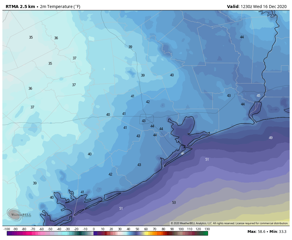
Winds are blowing out of the northwest this morning at 10 to 15 mph across the area, and this influx of colder and drier air will make for a cool day. High temperatures are unlikely to rise further than the mid-50s, despite the ample sunshine. Mostly clear skies and light winds will make for a cold night, with a light freeze possible north and west of Houston, with the urban center likely remaining several degrees above freezing.
Thursday
We can expect another splendidly sunny day, with temperatures a few degrees warmer as highs climb to around 60 degrees for much of the area. Winds will shift to come from the south later in the day on Thursday, and this will make for a warmer night, with lows likely only falling into the 40s for most areas.
Friday
We’ll start to see some clouds on Friday, and high temperatures should push into the mid- to upper 60s in response to the onshore flow. At this point I think skies will remain mostly sunny throughout the day, with any rain holding off until the evening or more likely overnight hours. Lows on Friday night may not drop below 60 degrees for some areas.
Saturday
The best chances for rain will come between midnight on Friday and Saturday before noon. Most areas will probably see only a few tenths of an inch of rain before a front arrives during the afternoon hours to dry the atmosphere out. We may end up seeing at least partly sunny skies on Saturday, in addition to the rain. Highs will probably reach 70 degrees ahead of the front before a chilly night.
Sunday
Expect mostly sunny skies, with highs perhaps in the low 60s. Sunday night may see temperatures drop into the low 40s for much of the area except for the coast.
Next week, and Christmas Day
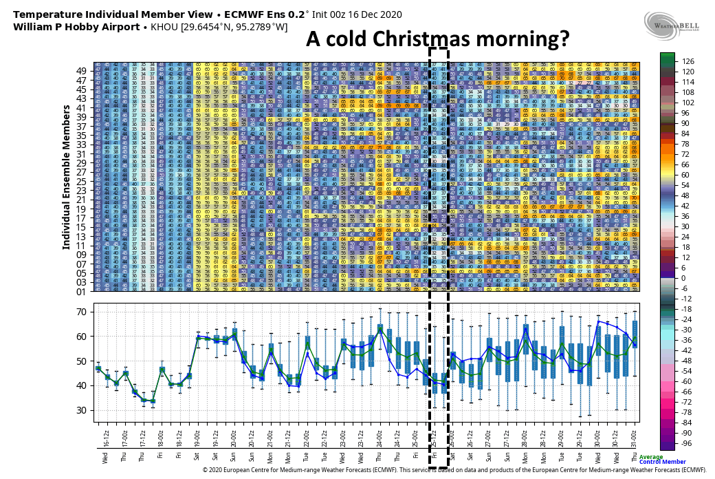
The region should warm up back to near 70 degrees by Tuesday or Wednesday of next week, and then it becomes a waiting game to determine the timing and strength of the next front that will determine our weather for Christmas Day. Right now, I think this front may arrive any time between next Wednesday, Wednesday night, or Christmas Eve. At this point, the bulk of the model guidance shows the coldest morning coming on Christmas morning, with the potential for lows in the low 40s, or even upper 30s, but it’s difficult to have much confidence at this point in precise temperatures. Some rainfall may well accompany this front, but it likely will end before temperatures get cold enough to produce any chance of wintry precipitation—sorry kids.

Thanks! Even though I don’t love cold weather, a cool, crisp Christmas is always fun! I remember 1 year, maybe it was 2004 or 2005? We had snow in Christmas eve. That was cool.