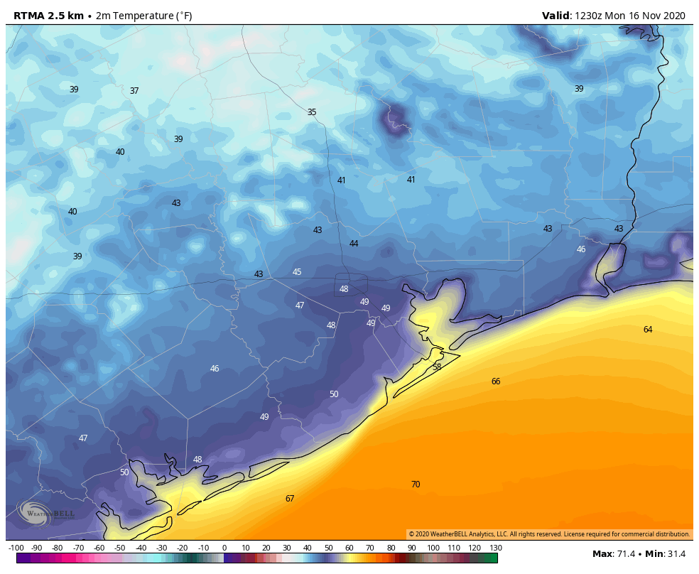
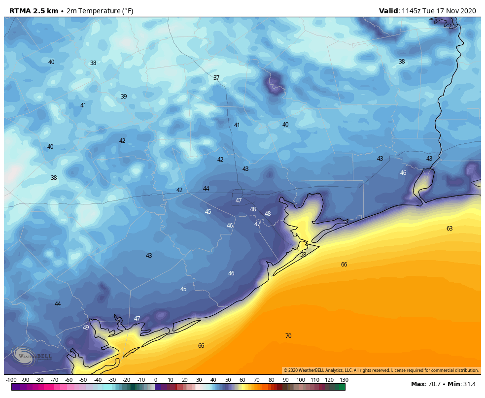
Good morning. We’re seeing some of the region’s coolest temperatures of November this morning, with lows in the 30s for outlying areas, and 40s in the city of Houston. We will see a gradual warming trend heading into the weekend, but after that the forecast remains somewhat uncertain. Note: Tomorrow’s post will arrive an hour or two late, which seems OK because not much is happening with our weather.
Tuesday
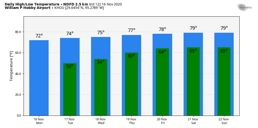
Conditions today will offer another fall delight for the Houston metro area, as sunny skies nudge high temperatures into the mid-70s. With light northeast winds, our air will remain very dry by Houston standards, as dewpoints crash into the 30s again this afternoon. This will not last, of course, but the region should experience one more cool evening, with temperatures perhaps a 3 to 5 degrees warmer Tuesday night than Monday.
Wednesday
Winds will shift to come more from the east on Wednesday, but this still will be another pleasant day with sunny skies and highs in the mid-70s. Lows on Wednesday night, however, may not fall below 60 for much of the region.
Thursday and Friday
The onshore flow begins to kick in on Thursday, bringing the region a pair of partly sunny days to end the work week, with highs around 80 degrees, give or take. Lows generally will be in the 60s as some humidity returns.
Saturday and Sunday
This weekend should continue the trend, in terms of partly to mostly sunny days, with highs in the general vicinity of 80 degrees. We can’t entirely rule out some rain showers, although chances for both days are probably only about 20 percent.
Next week
I’d love to be able to give you a confident forecast for next week, including the Thanksgiving holiday. Unfortunately, the pattern is not at all clear, and the model guidance is all over the place. Our first uncertainty is the progression of a cool front on Sunday night or Monday. How far does it get?
This may be another one of those situations where a front gets close to Houston and stalls, or actually makes it all the way to the coast. The next question is whether a reinforcing front makes it to Houston around Wednesday, and pushes all the way through. The latest, high resolution run of the European model, shown below, suggests that no fronts make it over the next 10 days, which would lead to a steamy Thanksgiving.
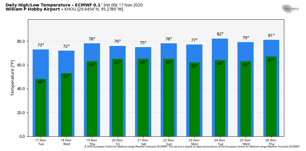
I don’t think this is going to happen, as I bet at least one front makes it through the region next week by Wednesday or so, and this probably would bring us cooler and drier weather for the holiday weekend. There is some support for this even in the European model’s ensembles, which I’ve included below. The bottom line is that we’re just going to have to wait a day or two, at least, to get some clarity.

Fundraiser
Our annual fundraiser to support Space City Weather is ongoing. Thanks for your continued support!