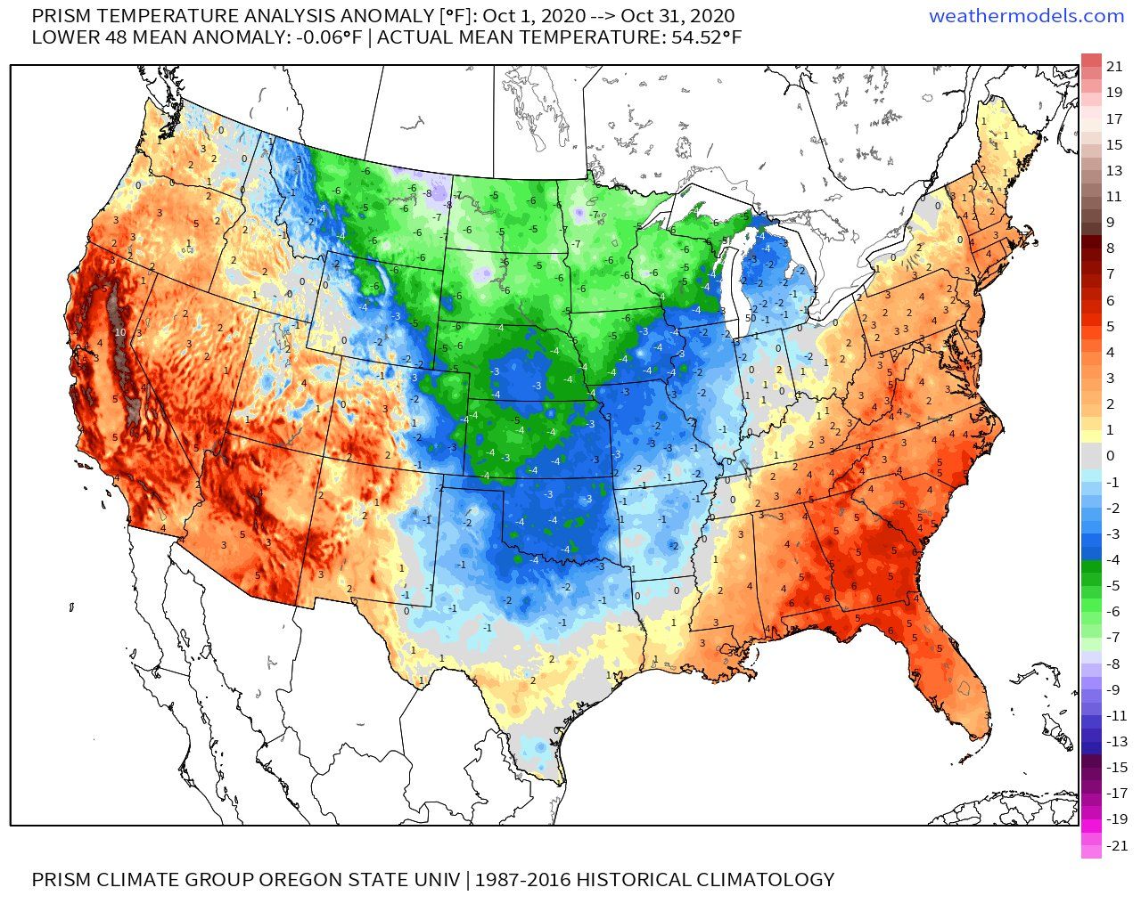
Good morning. October has come and gone. The first ten days of the month were near normal, in terms of weather, followed by a middle period that was very warm. Many sites recorded record highs in the low 90s. But the last week of the month was much cooler, generally with days in the 70s and lows in the 50s.
All in all, then, the Houston area ended with near normal temperatures. Here’s a map showing departure from normal temperatures for the month along with the rest of the country.
Monday
A cool front pushed into Houston on Sunday, and this has made for a cool night, with lows generally dropping into the 40s except for parts of the city, and near the coast. As a result, the region will enjoy splendid fall weather today, with highs in the low 70s beneath sunny skies. Expect another clear and cool night, with temperatures perhaps dropping a degree or two cooler than Sunday night.
Tuesday, Wednesday, and Thursday
We’ll see a slight warmup this week as winds shift to come from the east, and eventually the southeast. Still, we expect three mostly sunny days, with highs in the mid- to upper-70s for most. Nights will warm some, from the 50s on Tuesday night to around 60 by Thursday. This is really fall as it should be in Houston.
Friday, Saturday, and Sunday
The onshore flow will become a little more pronounced by this weekend, and this should allow temperatures and humidity to creep up somewhat. I still expect mostly sunny skies, and this should allow highs to reach into the low 80s, with nights warming into the 60s. We might even see a slight chance of rain as moisture levels continue to climb in the atmosphere—but the signal for this is fairly weak.
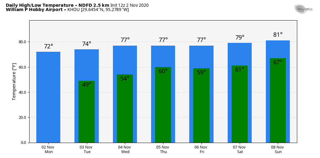
Next week
The overall pattern supports the passage of a cold front by around Tuesday of next week—but this is eight days into the future so it’s difficult to have too much confidence in this timing. This front, whenever it pushes through, will probably bring our region’s next real chance of rain with it as well.
Tropics
The season that won’t quit produced another hurricane this past weekend, with Hurricane Eta moving toward Nicaragua and intensifying. The 2020 Atlantic season is now tied with 2005 for the number of tropical storms and hurricanes that formed, 28. Eta, unfortunately, is going to bring plenty of misery to Central America in terms of winds, but the greater threat will come from heavy rainfall due to the slow-moving system. This will cause mudslides, swollen rivers, and plenty of devastation.
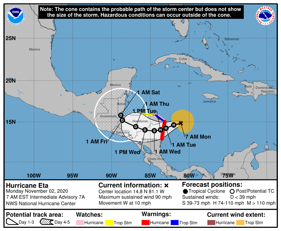
By the coming weekend, Eta probably will reemerge into the Caribbean Sea, and over the course of next week it may threaten Cuba, Florida, or elsewhere. This is something forecasters will have to watch for awhile, but it is not a storm that should concern us in Texas or even hard-hit Louisiana.