Historically, this week marks the statistical peak of the Atlantic hurricane season. This year looks to live up to the hype as well.
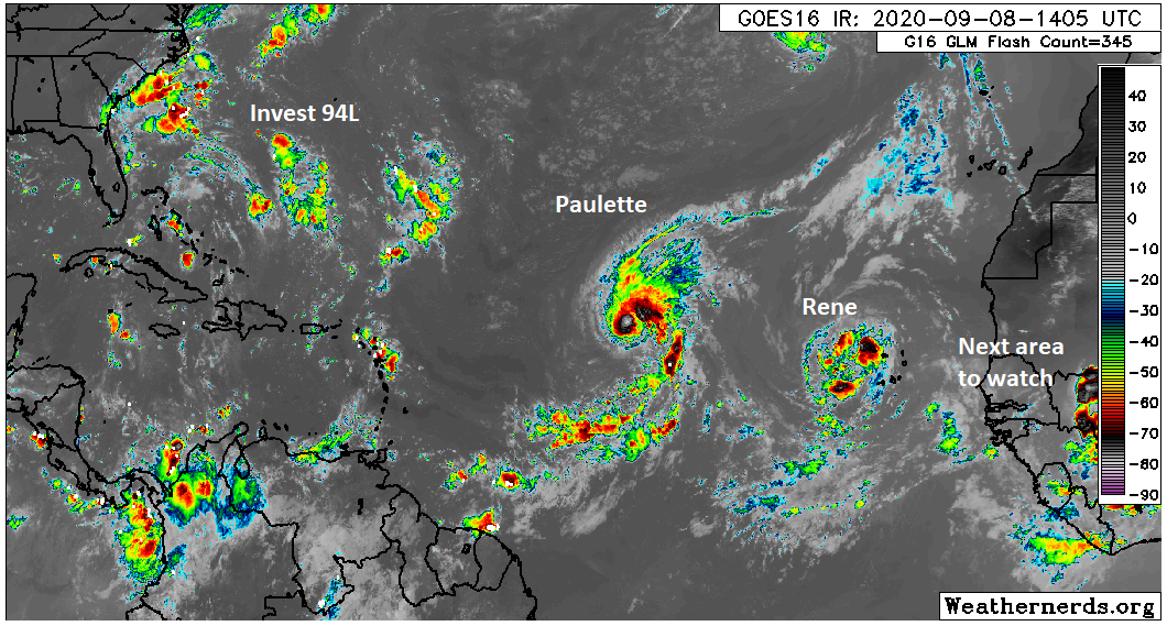
We have two tropical storms in the Atlantic today and there are likely to be at least a couple more before next week. We don’t think that any of these systems will seriously threaten the Gulf, however it is important to keep monitoring things, particularly with respect to the third system in line.
Tropical outlook in a sentence
Tropical Storms Paulette and Rene will likely be followed by a third system this week off Africa, and while none looks especially likely to make it to the Gulf, it would be wise not to write them off completely, particularly the third system, given the recent model difficulties we’ve seen.
Tropical Storm Rene
I want to get Rene out of the way first because I think this one has the least future of note, as it relates to the U.S.
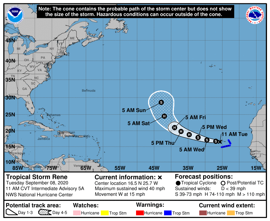
Tropical Storm Rene has 40 mph maximum sustained winds, and it is impacting the Cabo Verde Islands today. It is expected to track west and then turn northwest and north as it finds a “weakness” in the upper air pattern. The pattern does get a bit convoluted late, so Rene seems to strike me as a storm that could hang around in the open Atlantic for awhile, possibly taking a weird track as it does so. But it will not be a threat to the U.S. or Caribbean.
Tropical Storm Paulette
Tropical Storm Paulette has winds of 50 mph, so it’s a bit stronger than Rene. It’s also farther west. Paulette’s future is a little more difficult to project.
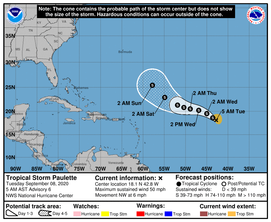
Paulette is going to be steered back to the west a bit by a building area of high pressure in the upper atmosphere. The storm will then have an opportunity to escape off to the north by the weekend as another area of high pressure off the U.S. East Coast gets eroded by a system moving through New England. I think Paulette’s track is of slightly lower confidence by this time. My doubt rests in Paulette’s intensity. With this pattern, I do wonder if Paulette’s weak intensity this weekend will allow it to escape underneath all that nonsense off the East Coast, which would allow it end up farther south and west of the forecast. In that situation, Paulette’s turn out to sea might wait to commence until it gets between the U.S. and Bermuda, rather than east of Bermuda as currently shown. While it would still likely end up out to sea, it could potentially create a bit more heartburn for folks on the East Coast. We’re about a week away from Paulette getting west of Bermuda if that were to happen, so it’s a lot of speculation. For us in the Gulf, Paulette probably poses no meaningful risk, but I’d at least keep a slight eye on this if I lived on the East Coast.