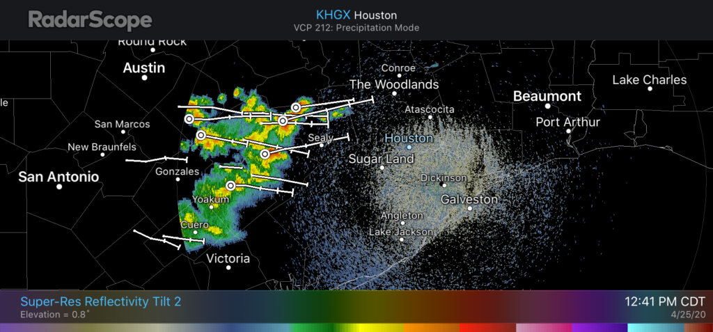
For the second time in four days Mother Nature has delivered a surprise. In today’s case, a capping inversion that was expected to hold sway over the Houston region during the daytime Tuesday is breaking. Thus, a cluster of strong thunderstorms is now moving into the region from the southwest along with an upper-level disturbance.
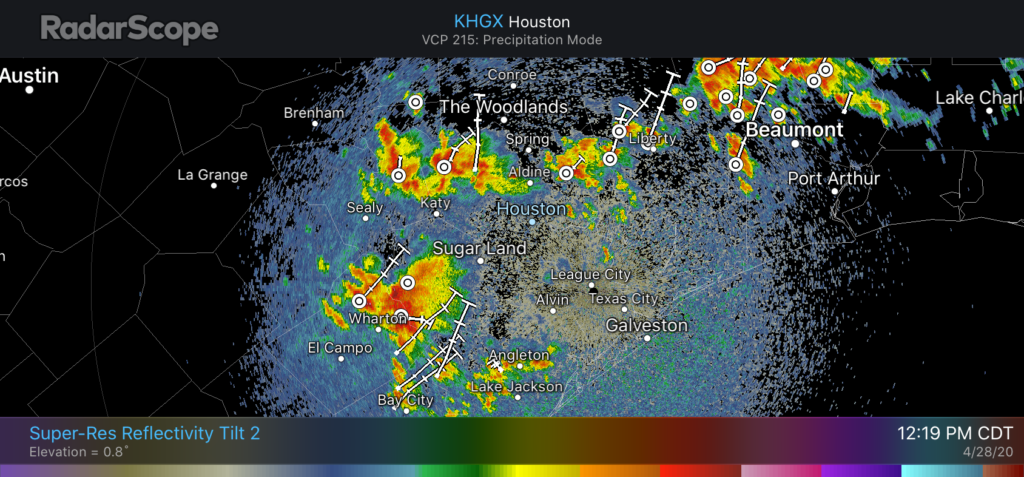
With the cap breaking and plenty of moisture, it seems likely that this threat of heavy rainfall and thunderstorms may be with much of the metro area throughout the daylight hours today. Because of the high rainfall rates in some of these storms, we may see localized flooding throughout the afternoon hours. Storms should ebb this evening.
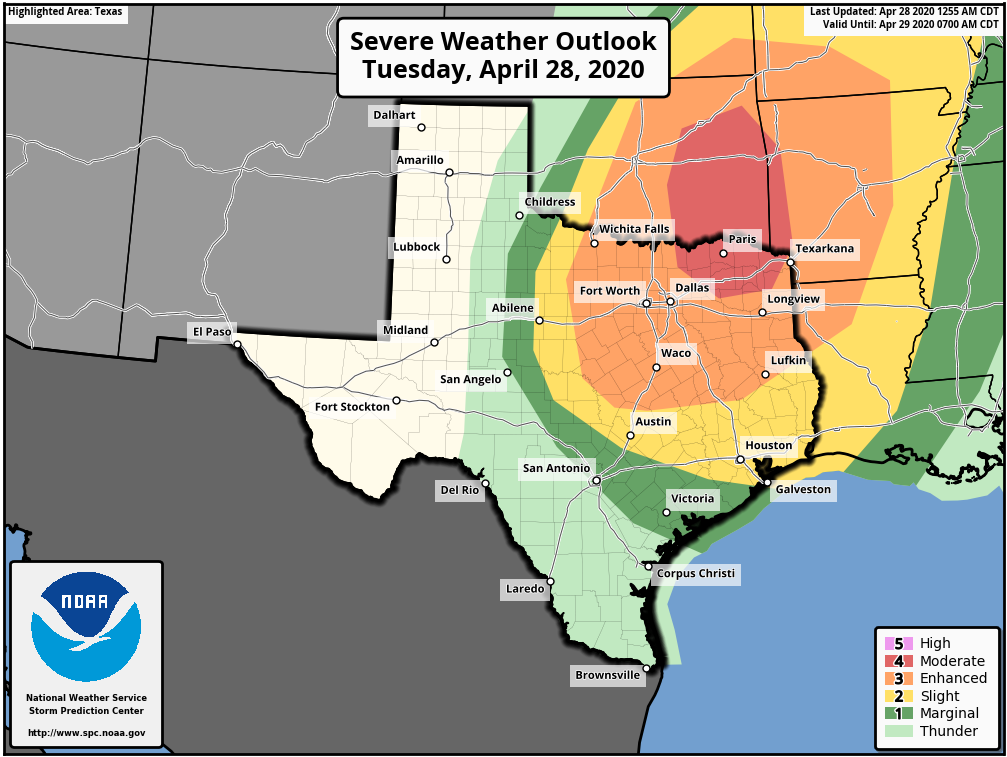
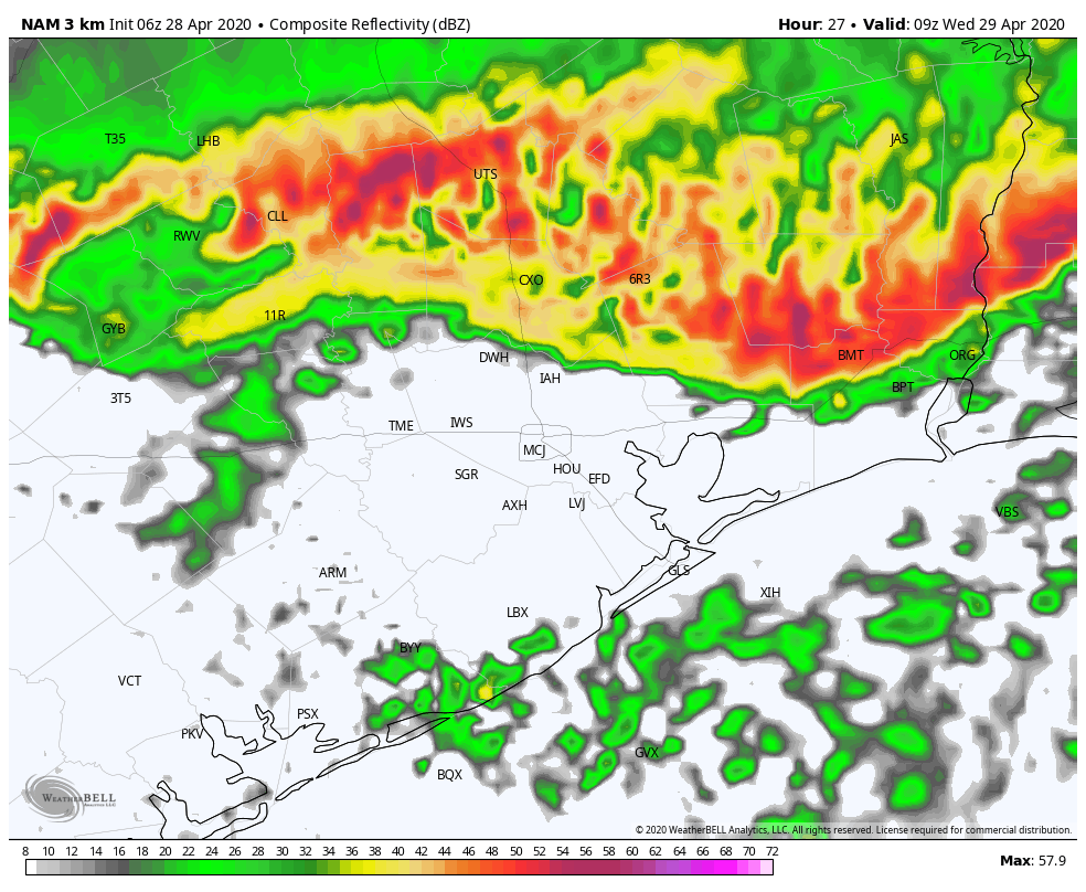
It still appears as though a bow-line feature will move through Houston after midnight, and push through the region from north to south, with the worst of it offshore by around sunrise or shortly thereafter. We still expect this system to deliver the kinds of severe weather we discussed in this morning’s weather post.