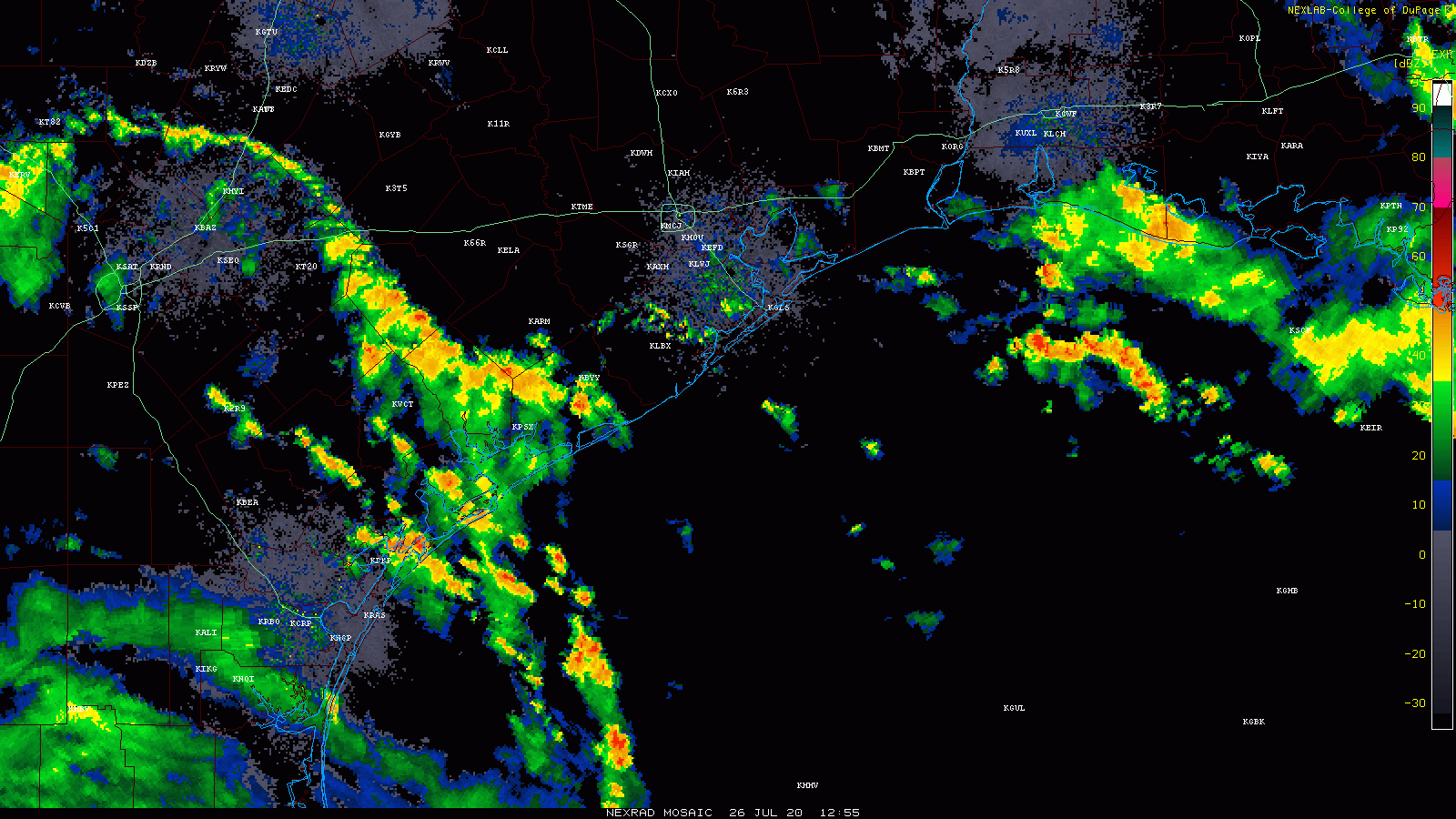
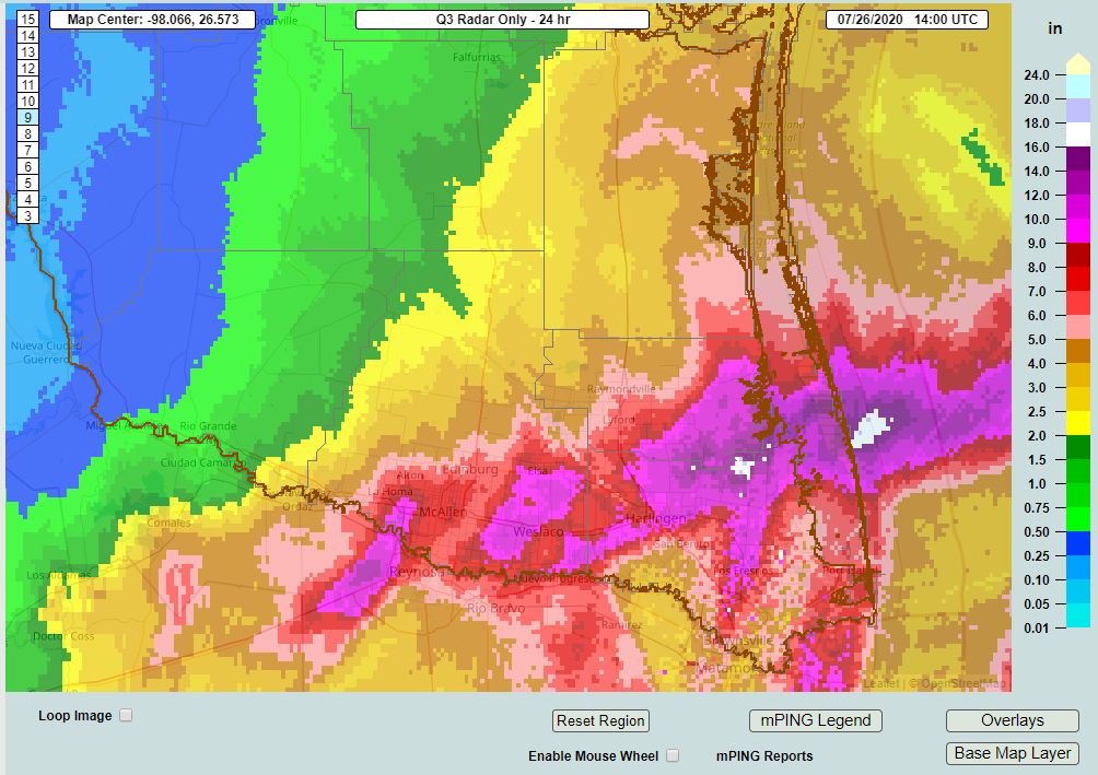
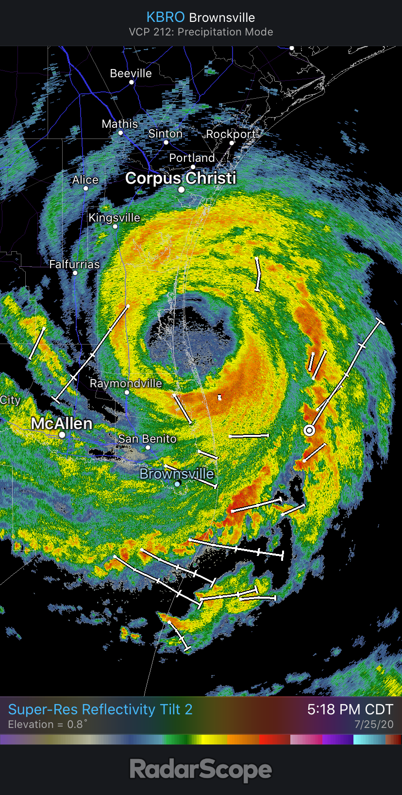
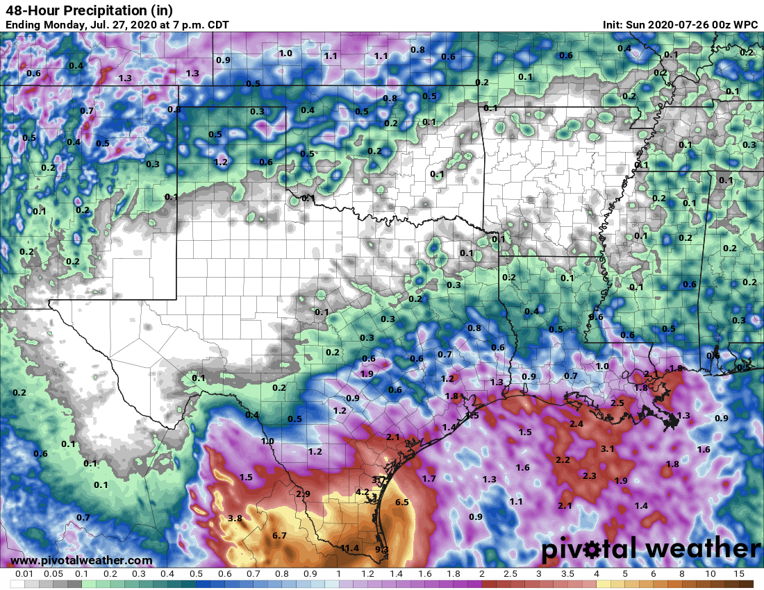
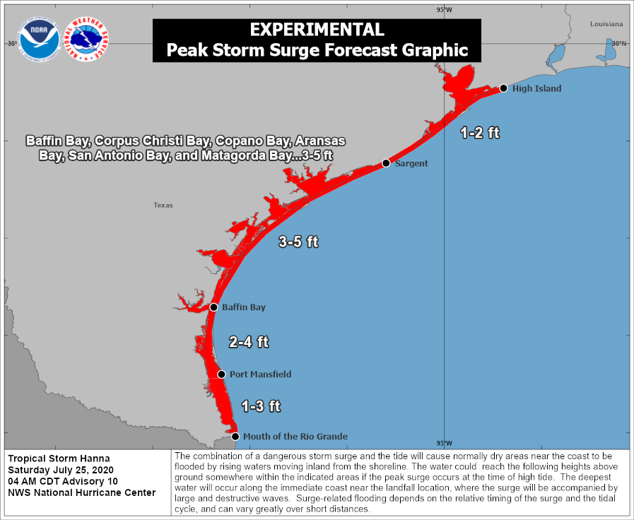
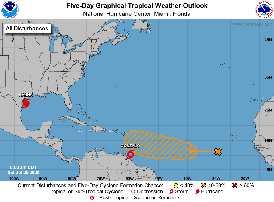
As expected, Houston saw periodic heavy rainfall this weekend from the outer bands of Hurricane Hanna, but totals were more than manageable. The heaviest rains came near the center of the storm, which moved inland near Port Mansfield and proceeded to drop as much as 15 inches of rainfall over South Texas, leading to widespread flooding. Hanna has now become a depression in northern Mexico and should dissipate today. Despite our region’s dynamic weather over the last week, we have more to come.
Monday
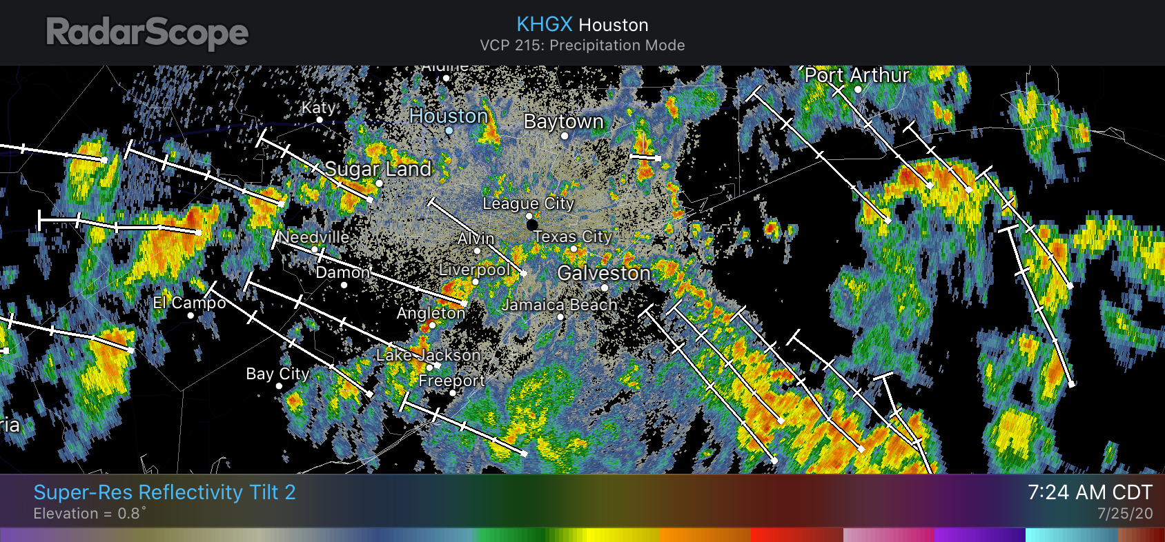
For the next couple of days our weather will be determined, to some extent, by “cutoff low” in the upper atmosphere. Presently this atmospheric disturbance is east of Houston, producing widespread showers over southwestern Louisiana and over the Gulf of Mexico. This upper low should slowly sag toward Texas, bringing a healthy—50 percent chance of rain—later today. Some of these storms could briefly produce heavy rainfall and lightning. The potential for showers and thunderstorms this afternoon should help limit high temperatures to about 90 degrees, with partly sunny skies. Winds will be light for most of the day and rain chances should slacken overnight—but not entirely go away.
Tuesday
This should be another day like Monday, with the atmospheric disturbance again influencing our weather. Storms likely will again develop over parts of the metro area during the late morning hours, and into the afternoon. These storms will have the potential to produce locally heavy rainfall but should be progressive enough to not lead to flooding. An unsettled atmosphere should again limit high temperatures to about 90 degrees.