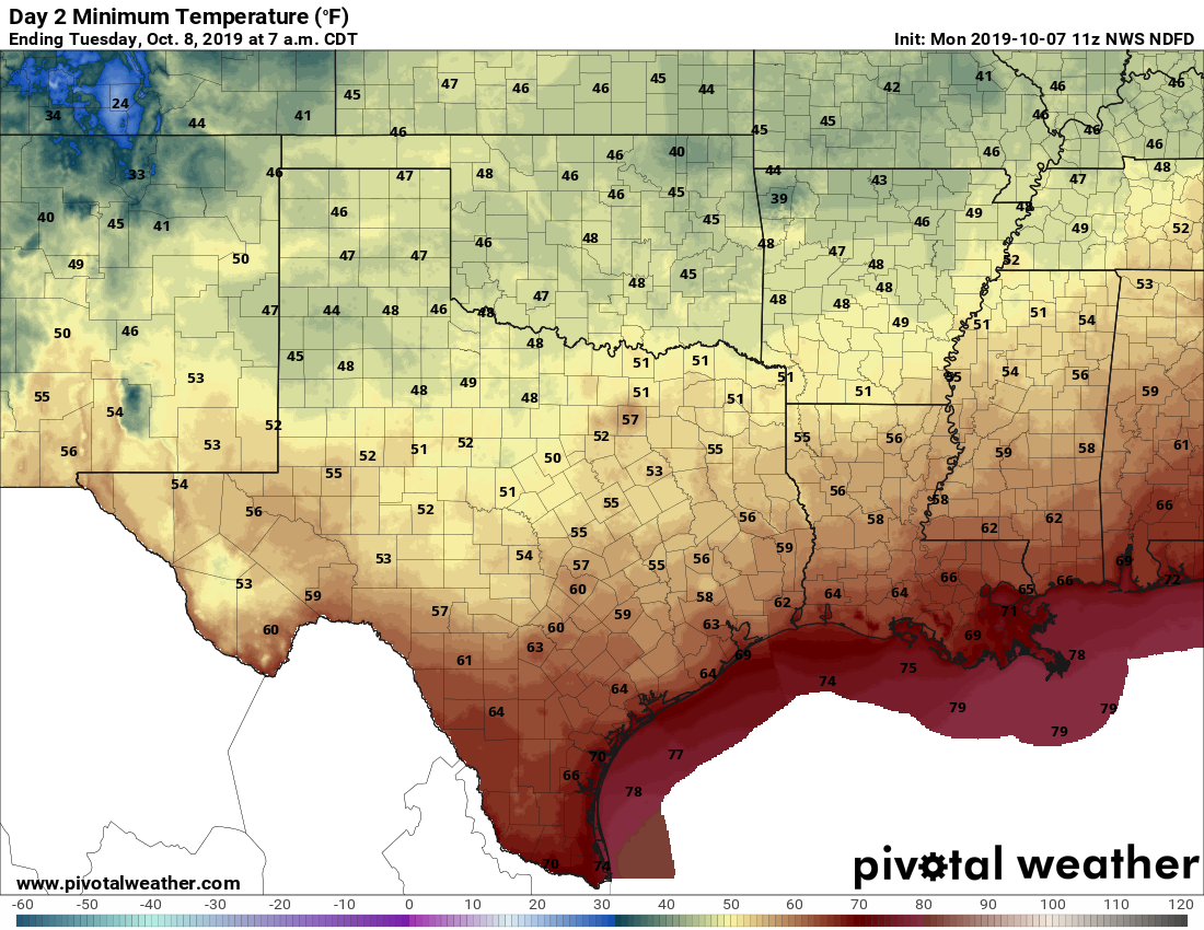
Good morning. It seemed to take forever, but a genuine cold front did drag into Houston on Monday. As the sun dropped, so did temperatures, with overnight lows ranging from about 60 degrees in northern areas such as Huntsville to around 70 degrees along the coast. It’s not cold, per se, but it’s cooler than we’ve been and the air is noticeably drier. A stronger front will follow to set us up for a beautiful fall weekend.
Tuesday
Skies should clear out later this morning, leading to a mostly sunny afternoon across the area. Highs will be in the low- to mid-80s, with a continuing light northerly wind. This evening should be splendid, with overnight temperatures Tuesday night perhaps a degree or two cooler than Monday night.
Wednesday
By Wednesday morning, we’re going to begin transitioning back toward warmer, somewhat more humid weather as the onshore flow resumes. It won’t be unpleasant, for sure, but high temperatures should climb into the mid- or (more likely) upper-80s under sunny skies. Overnight lows will struggle to fall below 75 for much of the area.
Thursday
Briefly, we’re going to return to the summer-like weather we experienced for most of September and the first six days of October. Look for highs of around 90 degrees with another warm and humid night, under mostly sunny skies.