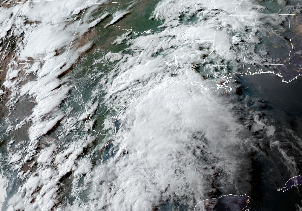
Storms that fired up on Tuesday afternoon have died down this evening, in part due to the loss of daytime heating. Unfortunately, this is just a lull, as the tropical disturbance that will make for wet conditions through Thursday morning remains in the Gulf, roughly centered near the border between Texas and Mexico. This pre-sunset satellite image captures the size of the tropical system, and amount of moisture it can potentially bring into Texas and Louisiana as it moves north-northeast. Fortunately, it appears the heaviest rains will probably remain offshore, but we’re still definitely in watch-and-wait mode.
Our best tools to forecast rain totals over the next 24 to 36 hours, high-resolution models, have not done a tremendously good job so far today, and they’re not initializing well. This means that even 1 or 2 hours into an individual model’s run, it already is pretty far off what is actually happening on radar. So, to some extent, we’re flying blind in terms of forecasting.
Still, with high atmospheric moisture levels (precipitable water values will rise above 2.2 inches over the next day or so, which is a prerequisite for high hourly rainfall rates) and low pressure at the surface we’re all but guaranteed heavy rainfall for at least part the metro area. After the present lull, it appears as though rain showers will build back up sometime after midnight offshore, and begin to migrate inland again. It’s quite possible that Wednesday morning’s commute will be a soggy one, and with the potential for flooded streets please check road conditions before heading out. We’ll have an update before sunrise.
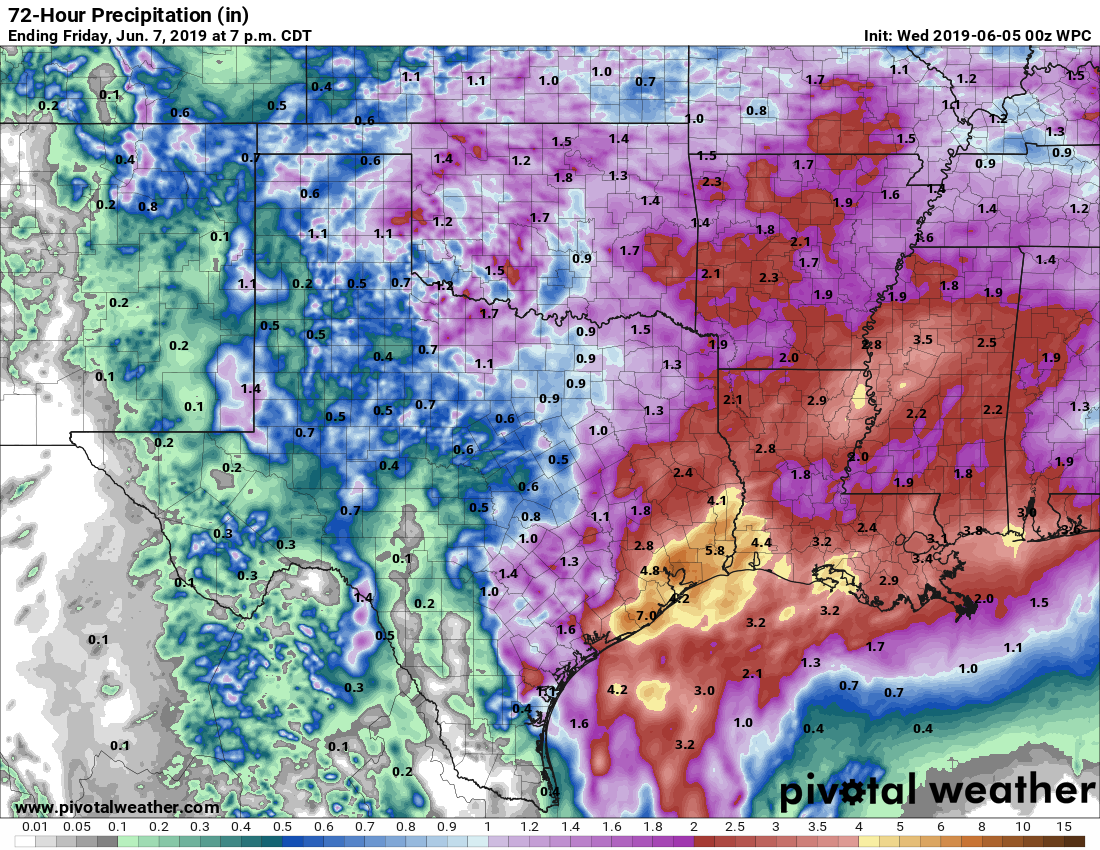
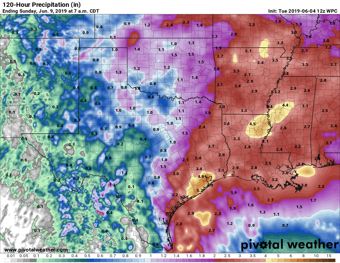
NOAA rainfall total estimates for now through Friday evening. (Pivotal Weather)In terms of storm totals, as mentioned, the forecast models are all over the place, but areas around Galveston Bay, including southeast Harris County, probably are at the most risk for heavy rainfall that will quickly flood streets. We’re still looking at likely rainfall totals of 2 to 4 inches for most areas, with higher localized amounts of 6 inches or greater. The region’s bayous are in pretty good shape and should be able to handle most of that. It still appears as though the heaviest rains will clear out of the area by or before noon on Thursday.