After yesterday’s rain and storms, we cleared out, and this morning we’ve cooled off a good bit.
Today and tomorrow should feature Chamber of Commerce weather for all of Southeast Texas before we warm up and reintroduce rain chances next week. Let’s jump in.
Today and Saturday
Wall to wall sunshine should be expected for both days, with nothing worse than a few passing clouds. If you’re looking for something to complain about, you could probably be a bit perturbed by the wind today, which will gust at times around 25 miles per hour inland or even somewhat stronger at the coast. Wind Advisories are posted for Friday along the coast.
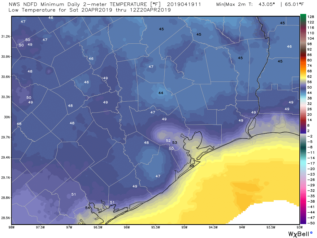
Otherwise, it should be relatively sublime. Expect temperatures to warm into the lower or middle 70s this afternoon. We’ll have another cool, pleasant night tonight, with temperatures dropping into the 50s in Houston and near the coast. Some of the northern and western suburbs and more rural locations will probably dip into the 40s tonight.
On Saturday, we should warm up to about 80 degrees or so. Humidity should stay comfortable through Saturday afternoon.
Easter Sunday
We expect sunshine to continue for Easter Sunday. Look for morning lows to start in the low-60s. We will warm up to around 80 degrees once again. The difference between tomorrow and Sunday will be the humidity, which should be a bit higher and slowly increasing through the day on Sunday.