In brief: In today’s post we review the last six months of precipitation across Texas (spoiler alert, it’s been very dry). We then look ahead to warm and muggy weather for the rest of the week, and spiky rain chances this weekend.
We could use some rain
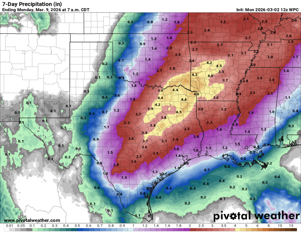
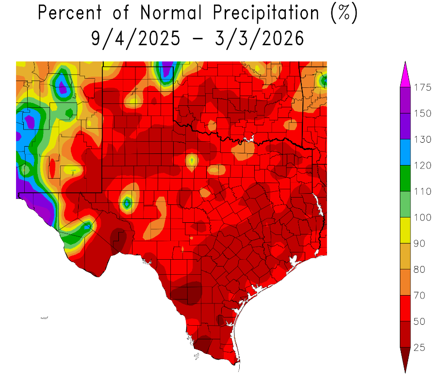
We’ve been banging on it for awhile now, but the greater Houston region continues to remain in a very dry pattern. During the last six months large chunks of the metro area have received just 25 to 50 percent of normal rainfall (see map below), leading to a drought. This has not caused serious problems yet, because the drought has coincided with the coolest time of year. But as we get deeper into spring, if we do not get rain soon, the dryness of our soils will start to accelerate as days get longer and hotter. Anyway, I write all of that to say I don’t believe this weekend’s rains will significantly dent our drought, but they could still help.
Wednesday and Thursday
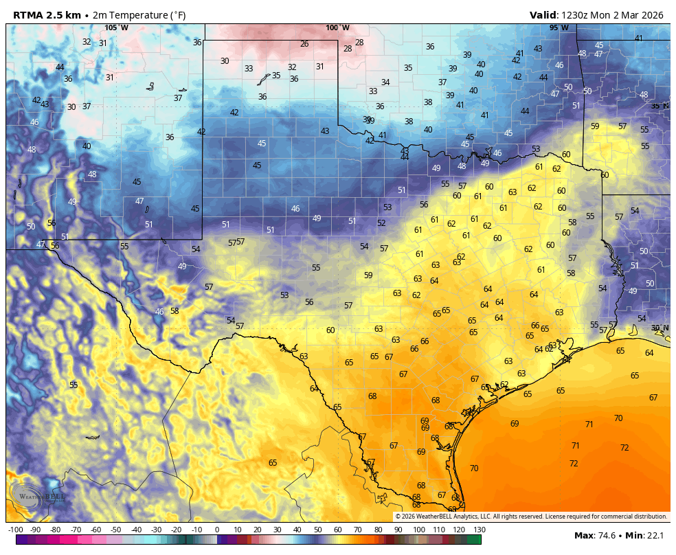
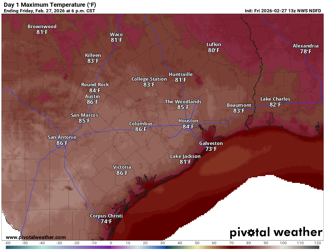
The next two days will be pretty much carbon copies of one another. We are starting out this morning with overcast skies and very warm temperatures for early March, not having fallen below 70 degrees in some locations. Winds are fairly light this morning, but will become gusty this afternoon, perhaps up to 20 mph. High temperatures across the region will generally vary from about 80 degrees right along the coast to mid-80s for inland areas.

Rodeo forecast
If you’re headed to the party this evening you can expect mild temperatures in the 70s. Although we may briefly see some sunshine this afternoon, I expect clouds to be building back by early evening and remain persistent through the night. Overnight lows will once again only drop down to around 70 degrees across the region.
Friday
This day will also be a lot like Wednesday and Thursday, in terms of mostly cloudy skies, temperatures in the low- to mid-80s, and plenty of humidity. There will also be the ongoing chance of fog overnight, near the coast. However the one difference starting on Friday will be a slight chance of some showers, more likely later in the day, as a cool front sags toward the area. Any rain would likely be light in nature.
Saturday and Sunday
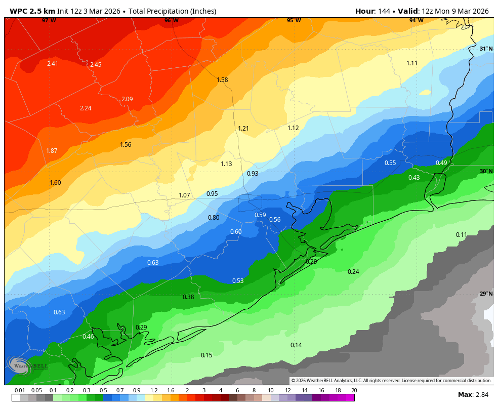
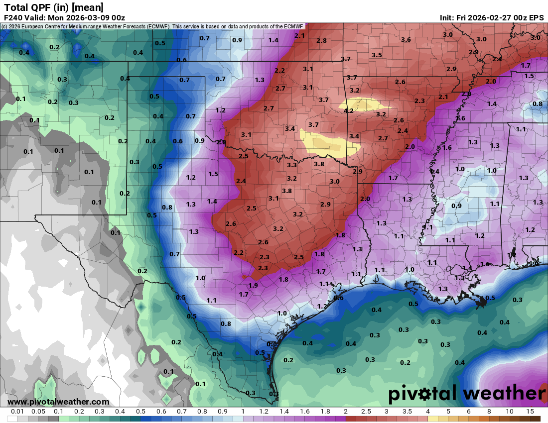
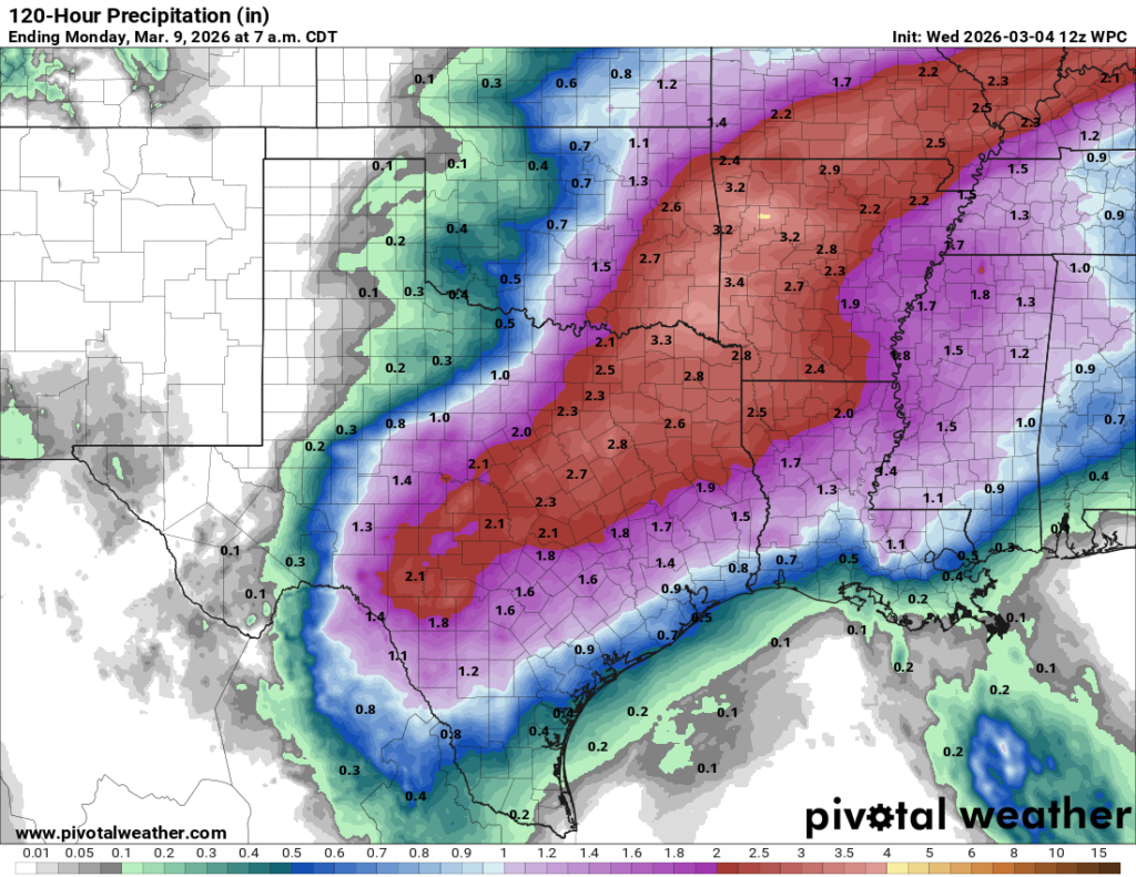
Alright, so what does the weekend hold? We are going to see a battle in the atmosphere between an approaching disturbance from the northwest (which will bring plenty of rain into central and northern Texas) against lingering high pressure to our east. There will be plenty of atmospheric moisture. It is going to come down to where the frontal boundary stalls, and for now this appears likely to happen north of the Houston area. Accordingly the greatest likelihood of rain is there as well. I continue to predict that most of our region will pick up 0.5 to 1.5 inches this weekend, but I’m more confident of that occurring inland of Highway 59/I-69 than I am for coastal areas, further away from the stalled boundary. Temperatures this weekend should remain warm, in the low 80s, with plenty of clouds and humidity.
Next week
Our abnormally warm weather will continue into next week before the arrival of a front, probably on Wednesday, brings us back to March-like weather for a few days. I believe there will be additional rainfall with this front, perhaps some decent showers and thunderstorms, but at a week out any predictions are not made with confidence.