Good evening. The last round of sleet and snow is marching through the Houston area, and by around 8pm the precipitation should be done for Houston today. For the next 24 hours there are three issues I want to discuss—icy roads this evening, frigid temperatures tonight, and when roads will clear on Wednesday.
Icy roads Tuesday night
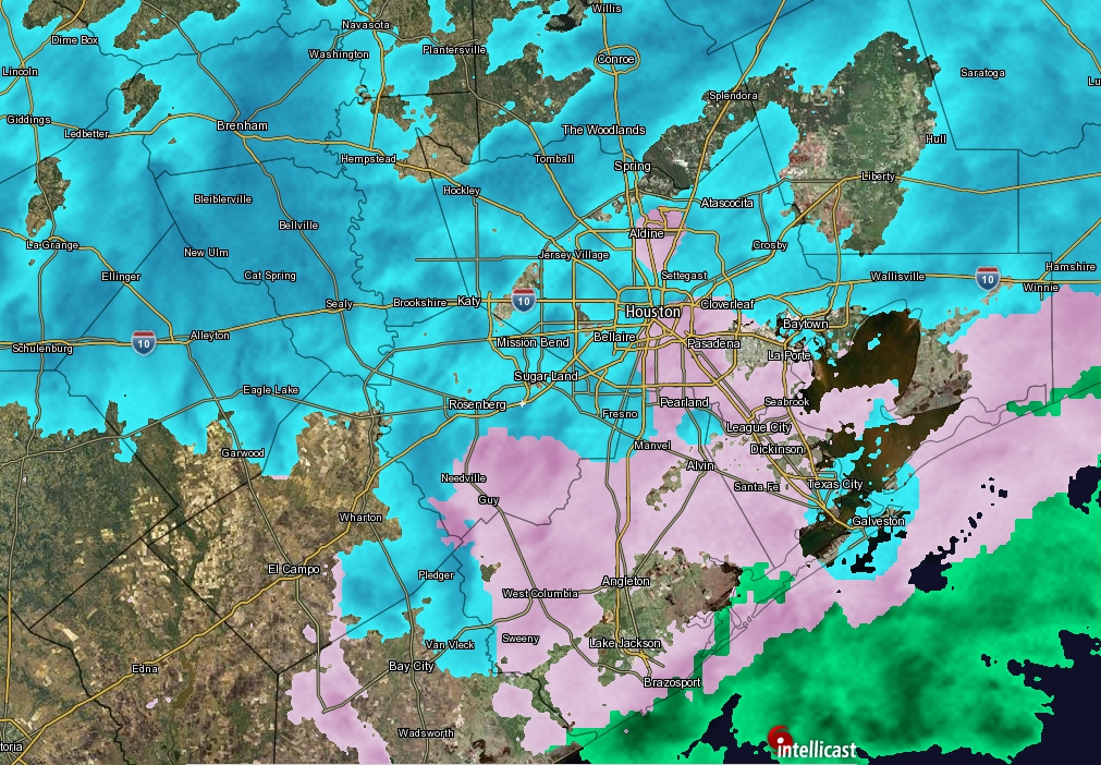
Road conditions continue to worsen across the metro area this evening, and with sub-freezing temperatures and the loss of sunlight, there will be no real opportunity for concrete and asphalt to dry out. Already, Houston Transtar has reported 100 locations on major area roadways with ice, and that tally should continue to rise. Please do not venture out this evening or tonight, if at all possible. Sure, there is a chance you will make it to your destination without a problem. But there also is a chance you will not, and then place yourself, your passengers, and first responders in additional danger.
Overnight lows
Houston faces a very, very cold night. Clouds this evening should help trap some of the heat, but some models predict that skies will begin to clear after midnight, and the earlier this occurs tonight, the better the chance for temperatures to really bottom out. The forecast shown below, from the National Weather Service, reflects what I think is a realistic worst-case scenario for lows tonight.
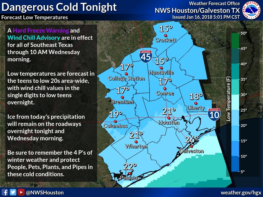
You may have some concerns about pipes, given the cold temperatures. This site provides some good, general advice for a freeze like Houston will experience tonight. By the way, the record low for Jan. 17 in Houston is 15 degrees, set in 1930.
Wednesday’s roads
School districts faced a difficult call in regard to Wednesday. On one hand, it is going to be decidedly frigid on Wednesday morning, and some roads will certainly be icy in the Houston metro area. On the other hand, at some point Wednesday the ice is going to melt and it will be business as usual for Houston. Moreover, kids in most districts have already missed at least 12 days due to weather-related closures. In the end, almost every school district opted for the safe choice, and closed their doors.
Frankly, I’m not sure what conditions we’re going to see Wednesday morning. I think a fair number of roadways will be passable, but at the same time untreated bridges and overpasses will be deceptively dangerous. The big question for me is how much of the metro area’s elevated roadways will be treated with a solution to effectively melt the ice? I don’t know.
What I am confident in is that, sometime between 10am and noon on Wednesday, as the Sun comes out, and temperatures rise to above freezing, Houston’s roads will melt and dry pretty quickly—for good. By this weekend we should see highs rebound to the 60s, and we should remain there for most of the rest of the month.