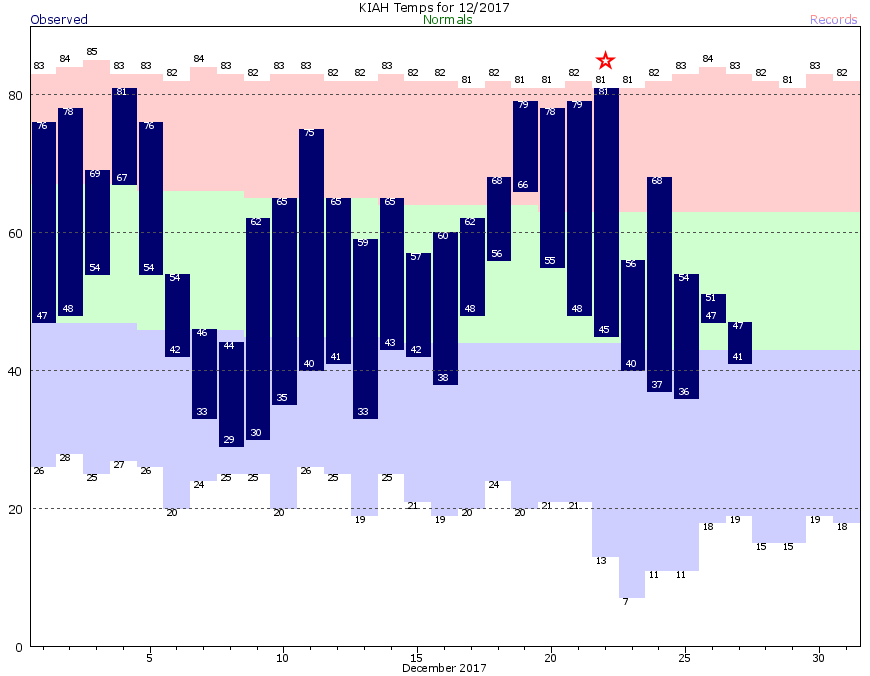
On Friday, Dec. 22, Houston’s high temperature reached 81 degrees. Since then a series of cold fronts have kept highs below 70 degrees—and it seems unlikely that the high temperature will reach 70 again at least for the next week to 10 days, if not quite a bit longer. We truly are in the depths of winter, and it looks as though we’re only going to get colder in the days ahead.
Thursday and Friday
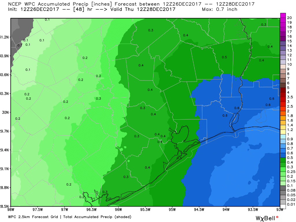
For most of us, the drizzle is probably over for the next couple of days. However, skies will remain mostly gray—there’s a chance of some patchy sunshine on Friday—and this will confine high temperatures to the upper 40s or lower 50s. Lows will be about 10 degrees cooler as clouds prevent radiational cooling at nighttime.
Saturday
An onshore flow resumes, briefly, on Saturday. Effectively this means the region will see some warmer weather, with highs likely in the low- to mid-60s. With this, some rain chances will return, especially during the afternoon and evening hours. Accumulations should be slight, regardless.
(Space City Weather is brought to you this month by the Law Office of Murray Newman)