Winter has come to Houston, and along with it we’re seeing widespread light rainfall for a couple of days before sunny and cool weather.
Wednesday
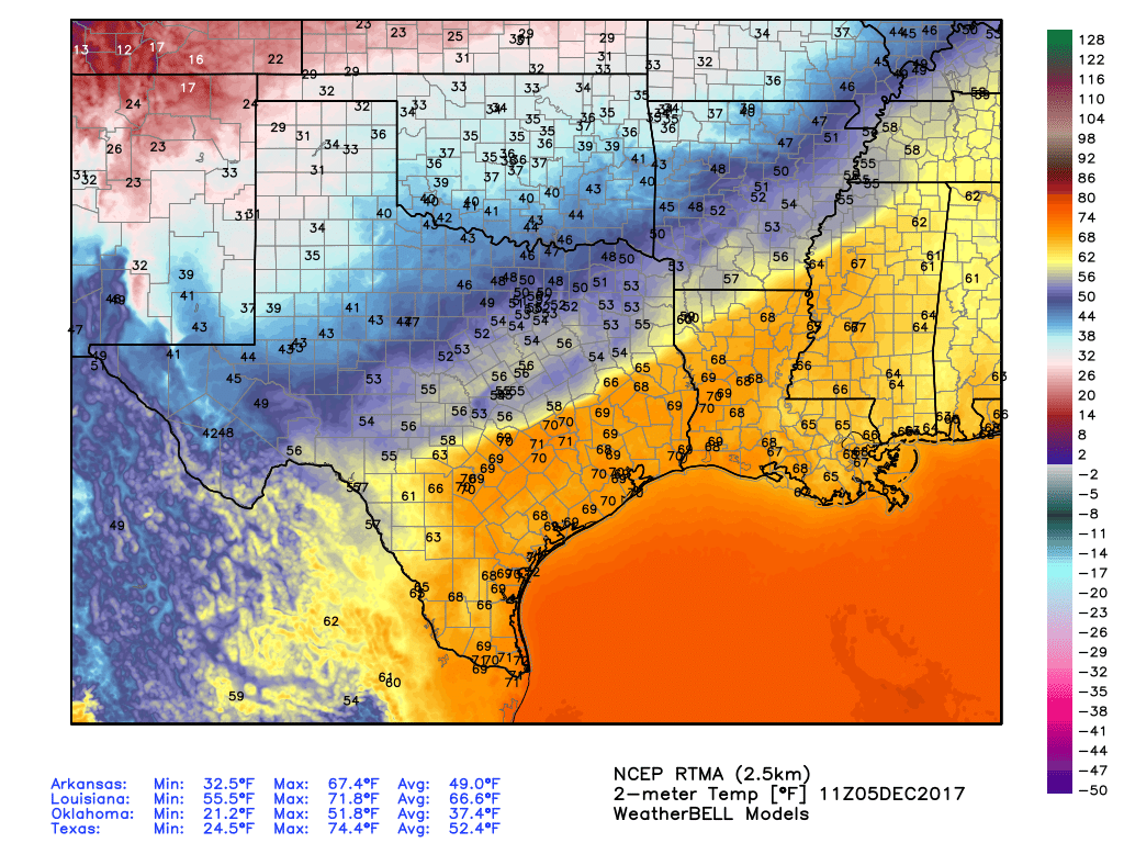
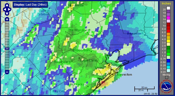
Today is definitely winter coat weather—even if you’re one of those hardy souls from the north who mocks those of us accustomed to Houston weather. High temperatures will probably top out in the mid- to upper-40s today, and a 10 to 15-mph northerly breeze will keep things brisk, with higher gusts along the coast. Clouds are likely all day as well, with intermittent light rain showers adding to the fun. I’m not worried about accumulations, as most areas should see less than 1 inch of rain. But my, this will be a dreary day.
Thursday
Some northern areas have a slight chance of sleet (tiny, clear pellets of ice) on Wednesday night—I’m thinking of areas like Washington, Grimes, and Walker counties, and points north of there. However, the ground is warm enough still that any such wintry mix should melt on contact. In Houston, we’ll just see cold rain. This day should be a lot like Wednesday, albeit with slightly warmer temperatures and diminishing rain coverage later in the day.
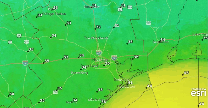
Some clearing skies (generally from the northwest to the southeast) should allow temperatures on Thursday night to get a bit colder, perhaps in the upper 30s for the Houston area, but a freeze seems unlikely in the city.
(Space City Weather is brought to you this month by the Law Office of Murray Newman)