Cooler air, clearer skies, coming to a Bayou City near you

Good morning. Today’s the day we begin to descend further into winter for the rest of the week, and we’re also going to see an end to the gray-clad skies that have been with us for a long time.

TODAY

A large upper-level low pressure system over the Midwestern United States is going to be the driver of Texas’ weather today. As this system moves eastward, it will usher in a colder air mass, drier air and — eventually — clearing skies.

Visible satellite image of the United States at about 5:30 a.m. CT. (NOAA)


Some additional light rain will be possible with this system as it moves through this morning, however even this modest precipitation should end by the afternoon hours. For clearing skies we will probably have to wait until tonight, or Wednesday morning.

See full post

Why was it so gray this weekend? And when is the Sun coming back?

Good morning. Today I want to look back at this weekend’s oddball cold front, and ahead at what will be a very winter-like week.

PAST WEEKEND

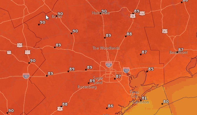
Remember all the uncertainty last week about the will-it or wont-it make it cold front? It did make it through Houston late Friday and early Saturday — but only barely. Even this morning, two days later, if we look at temperatures we can see the front stalled about 50 miles or so to southeast of Houston. We only narrowly missed high humidity and 80-degree temperatures this weekend.

The cold front only barely made it through all of Texas this weekend. (Weather Bell)

See full post

Winter-like conditions return to Houston, and they should stay awhile

Well, the front actually made it through Houston during the overnight hours.

This means Houston will have a cooler weekend, with highs in the 50s to low 60s today and Sunday, and lows around 50 for most of the area. The region will see on-again, off-again light showers during this time period as well, but I’m not expecting accumulations greater than about one-half inch for the metro area. The heavier showers will remain well to the northwest of Houston.

As of 9 a.m. the front had made it to all but extreme eastern and southern parts of Texas. (Weather Bell)

See full post

Gray Friday and a gray weekend

I hope everyone had a wonderful Thanksgiving! If you choose not to burn calories fighting shoppers today, you’ll have clouds and humidity to contend with in and around the Houston area.

TODAY

I’ve been apt to describe this weather pattern as “obnoxious,” because it is. It’s a lot of clouds, a lot of humidity, tricky temperatures, and some light rain. It makes forecasting and planning for each day a little annoying. Anyway, today will be similar to Thanksgiving: Warm, humid, cloudy, and a few showers around (nothing major).

Forecast radar for 4 PM Friday; a few showers around. (Texas Tech)
Forecast radar for 4 PM Friday from one computer model; a few showers around, heavier rain near Dallas. (Texas Tech)

We hit 77° on Thanksgiving, making it the warmest Thanksgiving Day in Houston since way back in 2012 when we also hit 77° that day. We’ll end up somewhere around that number today too.

See full post