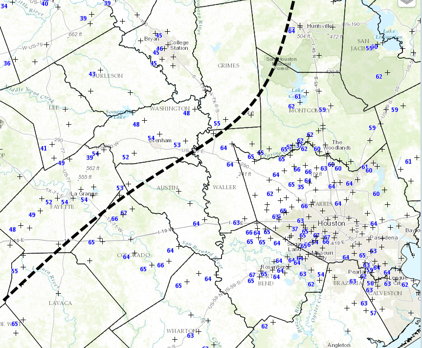
It feels more like April or May out there this morning, with lows in the mid- to upper-60s across the region and fairly humid air. Some dense fog has formed. However a front moving through will bring some cooler weather with it later today, making it feel more like February.
Today
As of 6:30am CT, the front is still about 20 miles to the west-northwest of Harris County, but it should reach most of the area by around noon today. Expect mostly cloudy skies with some scattered light rain showers this morning and early afternoon, and temperatures tonight should fall into the low to mid-50s as the front packs a little bit more of a cooling punch than previously anticipated.
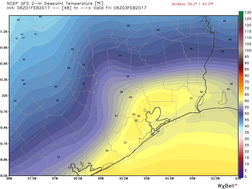
Friday and Saturday
A couple days of north and northeasterly winds will make for a slightly cooler end of the week, with mostly cloudy skies and highs in the mid-60s. Some very light rain will be possible both days, but accumulations will be nothing to write home about. Saturday morning could drop into the upper 40s for some inland areas north of Interstate 10.
(Space City Weather is sponsored this month by Darrell Lee’s The Gravitational Leap)
Sunday
The front’s brief reprieve will probably start to wear off by Saturday evening, or so, as warmer and more moist air returns. Look for highs in the low- to mid-70s during the day and run up to the start of the Super Bowl. Some of the latest forecast models have indicated at a decent chance of sprinkles during the day on Sunday—with accumulations of less than a tenth of an inch—but this might be just enough to force the closure of NRG Stadium’s roof.
Next week
This warmer pattern with a chance of light rain will continue from Sunday through next Tuesday or Wednesday, and it’s entirely possible that we’ll hit 80 degrees on one of those days. A front will probably arrive on Wednesday or Thursday, dropping temperatures back toward seasonal norms, with highs in the upper 60s, and lows somewhere in the 40s.
A lot of people have asked about freezes and planting. I am pretty confident that areas south of Interstate 10 have seen their last freeze for the season, however, it is simply too early in the year to make such a pronouncement for inland areas. I do not expect any freezes for the metro Houston area through the first half of February, however.
Posted at 6:40am CT on Thursday by Eric