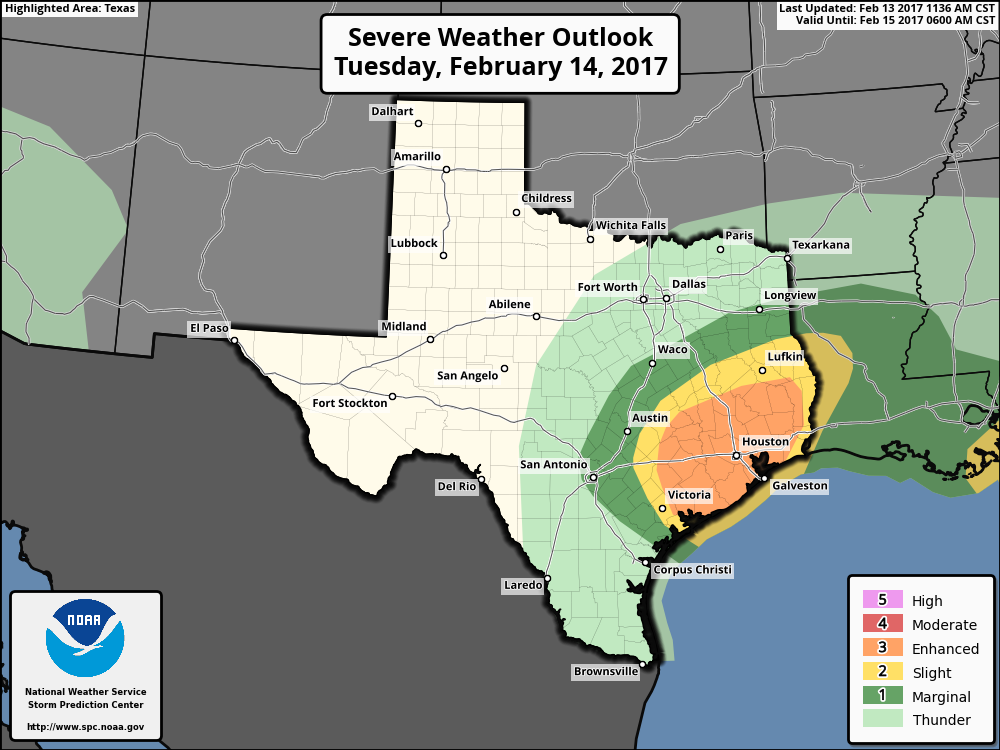
NOAA’s Storm Prediction Center has upgraded the risk of thunderstorms in Houston on Tuesday from “slight” to “enhanced.”
(NOAA/Storm Prediction Center)
This means the following for the Houston area:
Numerous severe thunderstorms are possible across the Houston region, with the greatest chance most likely along the Highway 59 corridor.
A few of these storms may be particularly intense, capable of spawning weak tornadoes, damaging winds or hail.
Some moderate street flooding is possible where thunderstorm training occurs, but for the most part these storms should move through at a good clip, from west to east.
The most likely time for storms will be from 10am to 2pm CT, with clearing likely during the late afternoon hours.
After a weekend of record-setting high temperatures—85 degrees on Saturday and 86 on Sunday—the region will cool down a little today, and a lot on Tuesday. The big concern, as noted my Matt, is the possibility of storms and severe weather on Tuesday afternoon.
Today
A very weak front will slowly move southward through Houston, and likely get hung up near the coast. This will create mostly cloudy conditions, and bring a chance of sprinkles to the area, but no major rainfall accumulations are likely. An easterly wind should help limit high temperatures to the mid-70s. Lows tonight will be in the mid-60s.
Temperatures this morning are in the upper 60s across the Houston metro area. (Weather Bell)
Tuesday
On Tuesday a stronger front will move through Houston, and with a deep source of moisture streaming in from the Gulf of Mexico we’ll likely see some rain showers and possibly some severe thunderstorms with the front. Given the setup it’s likely that most areas see 1 to 2 inches of rains from storms as the front passes through—probably between about 11am CT and 4pm CT on Tuesday. A few areas might see as much as 3 to 5 inches of rain, which could cause some street flooding problems.
After a weekend which has seen two record high temperatures broken in Houston, we turn our attention to thunderstorms and the possibility of severe weather on Tuesday. There’s been some “noise” about that being a possibility, so we want to give you a quick synopsis. Eric will have the latest in the morning.
Cooler Weather to Come
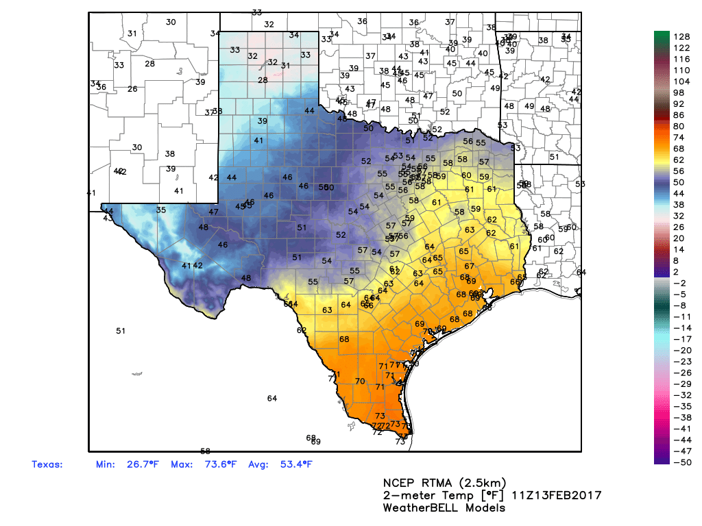
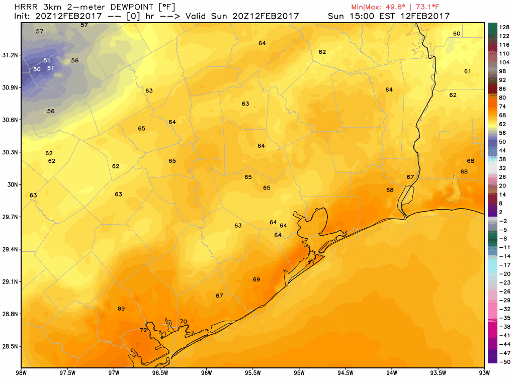
We hit 85° on Saturday, breaking the record of 82° from 1999. We exceeded that Sunday, hitting 86° and breaking the 95 year old record high of 84° from 1922. A weak cold front will push through tonight, and that will end the record warmth. This is evident when you look at dewpoints. The HRRR model below shows the higher dews getting blunted back southward as the front rolls through.
A cold front will wipe out the record heat and humidity overnight, as seen by dropping dewpoints after midnight. (Weather Bell)
So tomorrow is a transition day. We’ll see a mix of clouds and sun, maybe a shower, and temperatures peaking in the low 70s. Meanwhile, an area of low pressure will develop in West Texas, bringing places like Lubbock (that hit 91° yesterday) a chance of snow. That becomes our weather-maker for Tuesday, bringing us rain & thunderstorms.
The pendulum of weather this winter has been fierce and rather erratic at times. While not as extreme as what we saw in January, another strong shift of the pendulum is underway, back in the warmer direction.
Today & Weekend
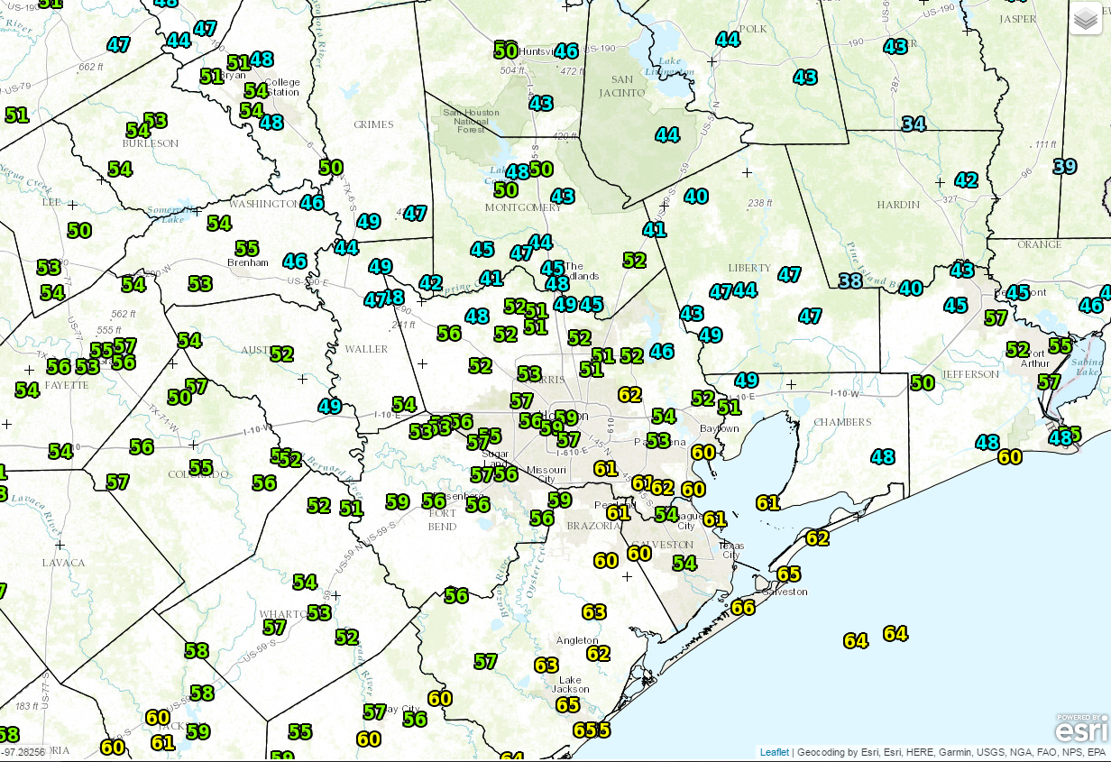
We have an interesting variety of temperatures across the region this morning.
Temperatures are being impacted by low clouds and range from the 30s and 40s north to the 50s and low 60s south and along the Gulf. (NOAA/NWS)
We have a band of low clouds oozing up from South Texas this morning, and that’s keeping places south of Houston mild. However, if you go north of the metro area, clear skies and light winds have allowed temperatures to drop into the 40s and a few 30s in ideally sheltered spots.
Low clouds should give way to a bit of sun, before new clouds arrive later today. There is a very slight chance of a shower or some light sprinkles, primarily south and west of Houston this afternoon.
The majority of the weekend should be problem-free. We will see clouds around, interspersed with sunshine. An isolated shower or a little light rain is possible but probably nothing you need to plan around.
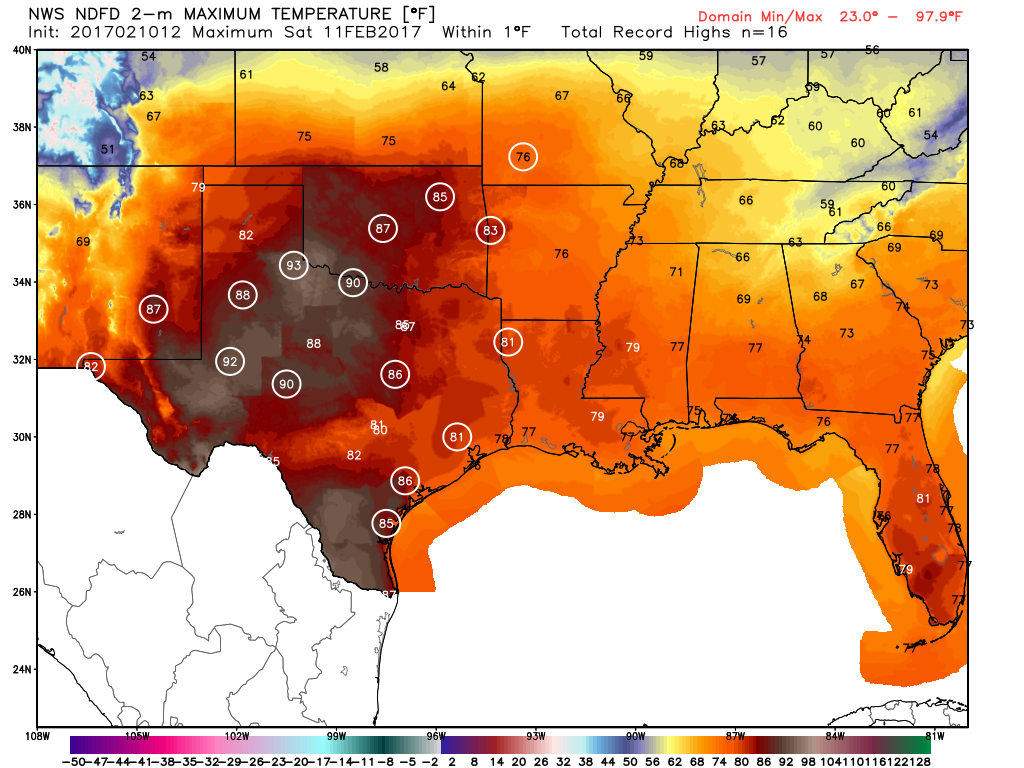
Temps are going to surge again however. While it shouldn’t be quite as warm as we saw earlier this week, there is a good chance we see that Saturday and perhaps Sunday reach the 80 degree mark. As Eric pointed out earlier in the week, Houston is going to at least threaten the record of seventeen 80+ days in meteorological winter (December 1-February 28). We are at 14 now, and if Saturday and Sunday both hit 80°, we’ll be at 16 days. That will give us over half of February left to tie or break the record of 17 days. What’s winter?
Official forecast high temperatures for Saturday show record highs being tested all across Texas and Oklahoma. Houston’s record high on Saturday is 82°, set back in 1999. (Weather Bell)
No other issues this weekend, but watch for the potential of fog in spots, especially near the coast by Sunday.