The rain is over. After days of being tortured by Mother Nature (and, you know, tigers), we can at least turn the faucet off for a bit, as drier weather builds into Southeast Texas for the weekend.
TODAY
As the upper level storm partially responsible for repeated rains finally begins to pick up some speed as it exits the Mid-Continent, that will allow for high pressure to settle in over our region for a couple days. That means we should have a good bit of sunshine today. Temperatures will pop into the low to mid 80s.
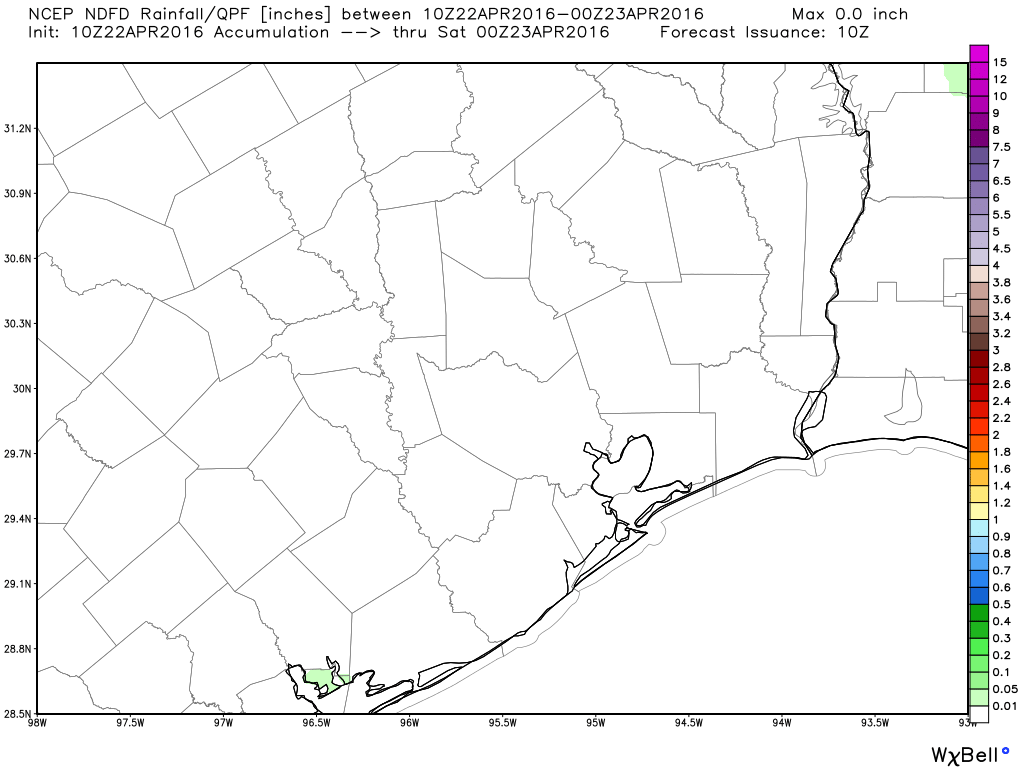
No complaints about today’s rainfall forecast for Southeast Texas. (Weather Bell)
No, the flooding misery for hundreds of thousands of Houston residents hasn’t ended, from the western edges of Harris County (see latest information on Addicks Reservoir), to the northeast around the San Jacinto River, and the southwest near Wharton (which got less than 5 inches of rain, but is feeling the effects of upstream Colorado River flooding).
At least swollen bayous and neighborhoods will no longer be insulted by additional downpours for a few days.
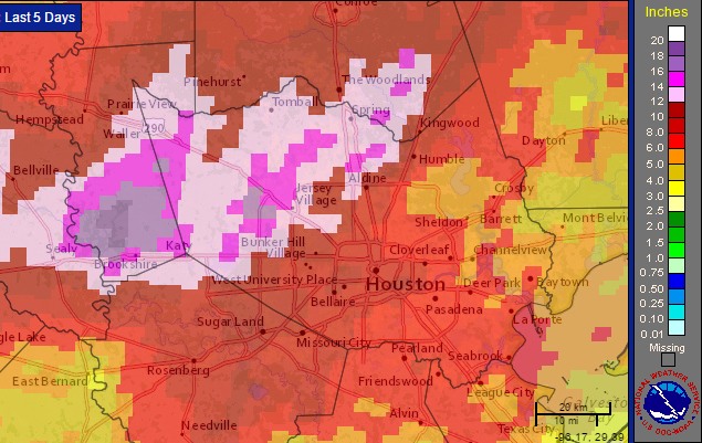
This event has rightly been characterized as the region’s most severe rainfall event since Tropical Storm Allison, and correctly so. It rained a heck of a lot across southeast Texas during the last five days. Here’s a map of satellite rainfall estimates through 1pm CT Thursday.
Rainfall totals for the five days preceding Thursday at 1pm CT. (NOAA)
Will Southeast Texas finally catch a few rain-free days? It looks that way, but we still have today to get through: One more round of rain and storms, but then we’ll see a couple days off.
TODAY & FLOOD UPDATE
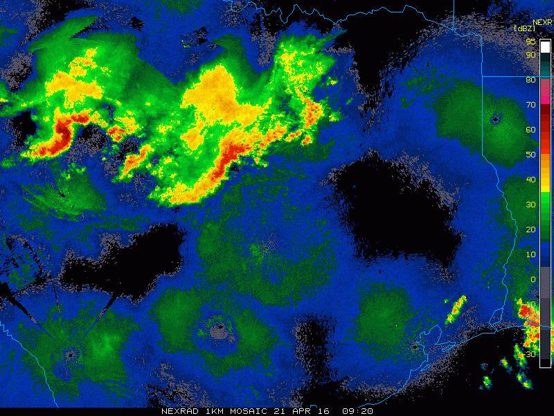
The radar this morning looks somewhat similar to the way it did 24 hours ago at this time: A cluster of thunderstorms was dropping south toward Austin and College Station and in our general direction.
Radar loop shows rain and storms dropping southeast across Texas this morning. (College of DuPage)
As the morning goes on, these will move toward us. I suspect based on models and extrapolating this radar that they’ll arrive around mid to late morning again, perhaps a hair faster than yesterday.
The good news is that similar to yesterday, the rain should continue moving, so it won’t rain for too long over the area. That said, any rain at all will cause minor street flooding in spots and exacerbate some ongoing flooding north and west of Houston. But the bayous, etc. can handle this.
Any lingering showers will end this afternoon, and that should be it for organized rain for a couple days.
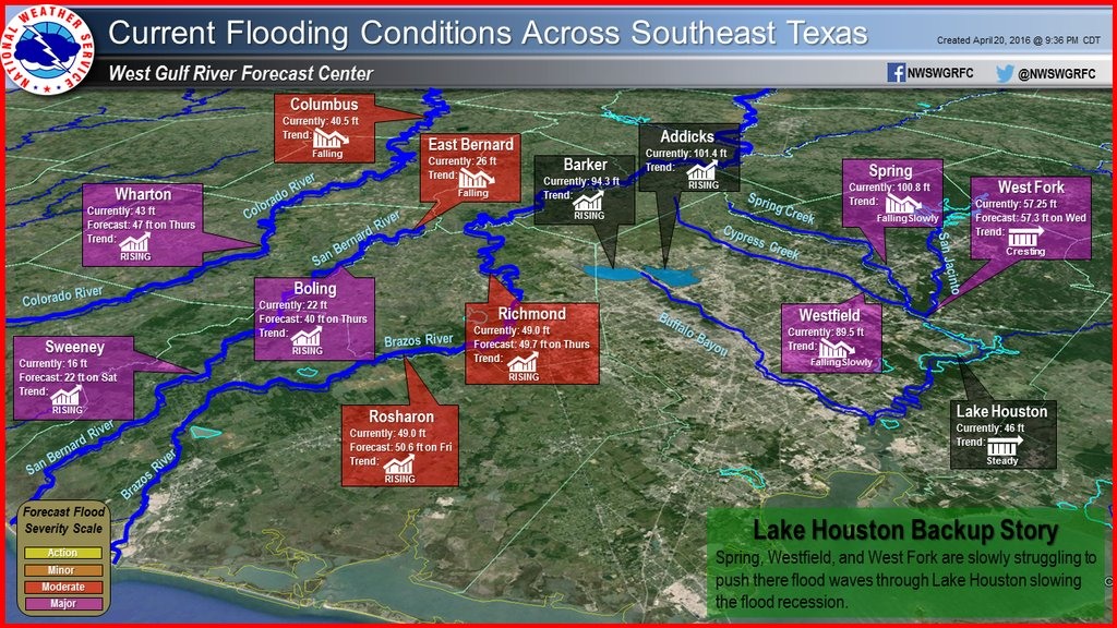
The National Weather Service posted a sobering graphic this afternoon showing major area reservoirs still under flooding pressure from very heavy rains Sunday night and Monday. The US Army Corps of Engineers also said today that water continues to rise in the Addicks and Barker reservoirs in west Harris County, threatening to add additional waters into surrounding neighborhoods.