In brief: Houston will see spring-like weather for as far as the eye can see, with generally moderate temperatures and plenty of sunshine. The only blemish will be the potential for foggy mornings through Thursday before a weak front ushers some drier air into the region.
Tuesday
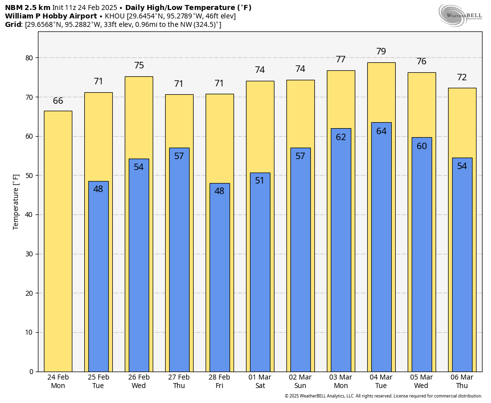
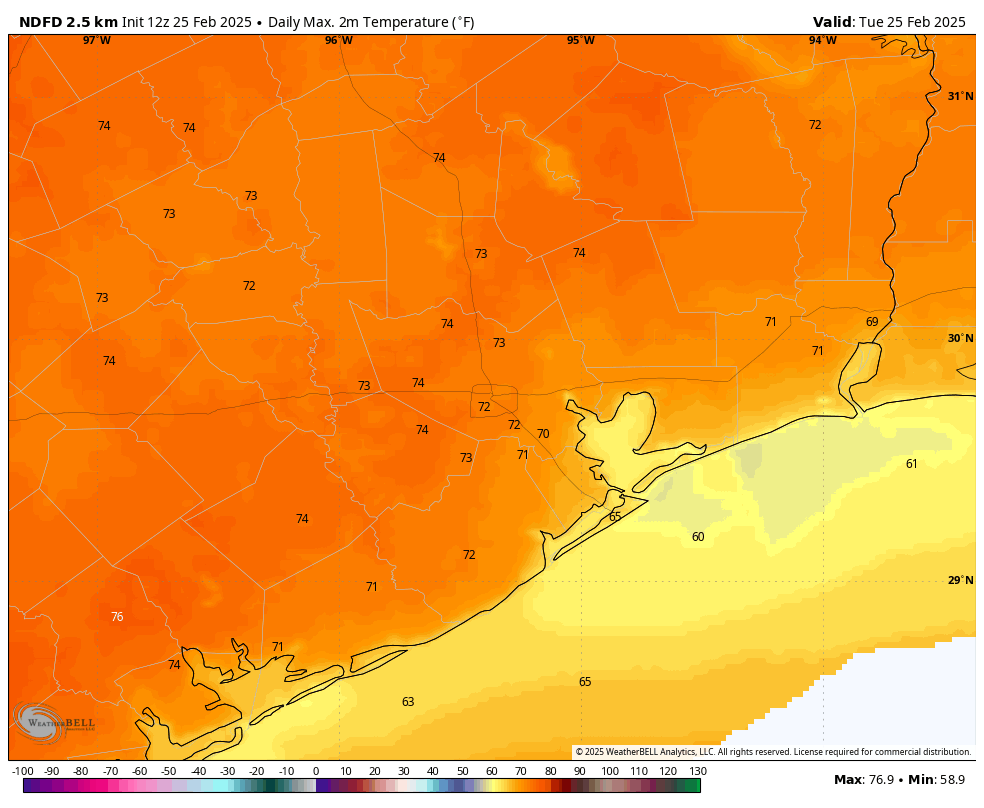
We are seeing widespread fog again this morning, and this pattern will repeat itself again on Wednesday morning, so be prepared. However as temperatures rise this morning, the fog will dissipate and we’ll be left with sunny, brilliant skies. High temperatures today will generally reach the lower 70s, with reasonably dry air. Winds will be light, from the southeast at 5 to 10 mph. It’s hard to beat this kind of weather, so if you can snatch a few moments outside this afternoon, you should. Lows tonight will drop into the low- to mid-50s, with fog developing again after midnight.
Wednesday
After the fog lifts on Wednesday we’ll see another mostly sunny day, with temperatures a bit warmer, in the upper 70s. Humidity will be a bit higher on Wednesday, but it won’t be unpleasant. Lows will be warmer, generally in the upper 50s. Fog development is likely again on Wednesday night before a cold front slides into the area on Thursday.
Thursday
The front’s arrival is likely to be a non-event aside from the development of some clouds on Thursday morning, possibly into the afternoon hours. While we cannot entirely exclude the possibility of a few light showers, I think the front’s arrival will be dry. Highs will be a bit cooler on Thursday, perhaps around 70 degrees. Lows on Friday night will likely fall to around 50 degrees in Houston, with cooler conditions for inland areas. With lower dewpoints, we should finally be rid of the fog for a bit.
Friday
We can expect another sunny, pleasant day with high temperatures in the vicinity of 70 degrees. Lows on Friday night will, again, fall to around 50 degrees, or a tick warmer.
Saturday
The first half of the weekend looks gorgeous. We can expect mostly sunny skies, and high temperatures generally in the low- to mid-70s. Some clouds will start to build during the afternoon and evening hours, and this will herald a slightly warmer night, in the mid- to upper-50s.
Sunday
This will likely be a partly to mostly cloudy day, with highs in the 70s. As the overall flow turns more southerly and the atmosphere more disturbed, we could see the possibility of a few light showers at some point on Sunday or Sunday night or Monday. But this is far from a slam dunk. Sunday night will be warmer, with lows possibly falling only to the lower 60s.
Next week
Our weather turns more humid on Monday and Tuesday, with high temperatures likely pushing up toward 80 degrees. Rain chances look to be modest, but non-zero. At some point, possibly on Wednesday, a front will push through to bring temperatures down. Even so, we are probably looking at nighttime lows around 50 degrees after the front, so it will likely be mildly chilly, rather than cold.