Good morning. It’s a fairly mild morning across the region, with temperatures generally in the low 60s. Our forecast remains more or less the same with warming weather through Thursday, before a strong cold front arrives on Friday to chill us down for the weekend.
Today
Houston remains stuck between higher pressures to the west and lower pressures to the east. For today this should allow for a modest northerly wind which will keep our air a bit drier today. After a high temperature of about 80 degrees, we should see lows tonight around 60—lower for inland areas and a few degrees warmer closer to the coast. All in all it should be a nice, sunny day.
Wednesday and Thursday
These will be days where a lot of us are waiting eagerly for the front. I say that, because humidity levels will rise some, and temperatures could climb into the low 80s. Also on Wednesday, and especially Thursday night, lows won’t fall much. For some areas, Friday morning’s low might only bottom out at about 70 degrees. That’s sticky for mid November, but fortunately it’s not going to last. Both days should be mostly sunny.
Friday front
Our cold front arrives. The timing remains a bit uncertain, but right now my guess is that it comes through during the middle of the day. This should be the fall season’s first “real” front in the sense that there’s an immediate wind change along with the passage, and an influx of cooler and drier air almost immediately. There’s some question as to how much rain we’ll see, but I’m going to guess it is significantly less than an inch for most areas. The atmosphere just doesn’t look that disturbed, or moist enough, to pump out widespread storms. Lows Friday night should fall into the 50s.
The weekend
Oh, hello. Look for highs on Saturday and Sunday in the mid- to upper-60s, and lows on Sunday and Monday morning in the 40s except for areas immediately along the coast. This is essentially a perfect late-fall weekend for Houston.
Thanksgiving
The forecast for Turkey Day remains very much in flux, but right now it’s trending a bit cooler, with highs in the upper 60s. It’s dependent upon the arrival of another front next week, the timing of which remains unclear.
Posted at 6:35am CT on Tuesday
Hey Eric, I’ve moved to Alabama but still read your blog. Big fan! We’ve gone 57 days (previous record was 53 I think) w/o rain here with no end in sight. From the little info I get here, I guess the jet stream isn’t normal this year. Is there any guess when it might normalize? Or is this pattern likely to stay through winter?
Pretty sure temperatures will normalize by December, but can’t say for sure about the rain.
In the latest Browning World Climate Bulletin, it says we are going to have slightly warmer than average winter. What is your take, especially with the jet stream preventing arctic fronts from getting into even Canada (not Europe though)?
Seems reasonable. But the latest climate forecasts suggests December could be a little cooler than normal for Texas.
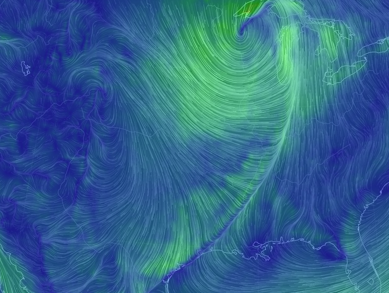
So beautiful; I am going to frame that GFS model image.
Bring it!!
Eric…what is the meaning of the shades of green and blue background?
Brighter, deeper greens represent stronger winds. You can really see the circulation of the cyclone across the upper Midwest, and see the front reaching the coast at noon (northerly winds colliding with southerly winds).