I mean, seriously, this is like the rain version of “Groundhog Day.” I wish I had better news for you tonight, but unfortunately, today’s rain was merely Act I for the Houston area. We have some serious concerns going into tomorrow, and I’ll touch on those here in a second.
WHAT FELL?
Rainfall totals were very sporadic across the region, but they hit hardest in the worst possible places: The Woodlands, Spring, and Northern Harris County, places that simply can’t handle much water after last weekend.
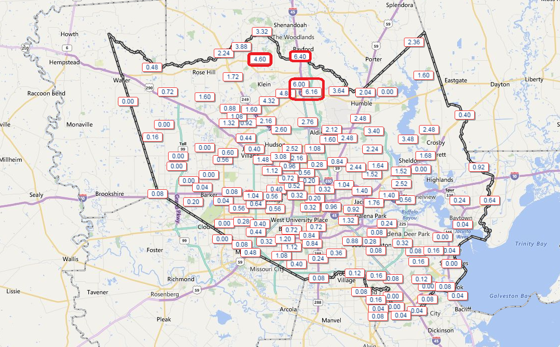
This inevitably led to widespread street flooding. That sort of flooding was worse than usual because it fell so fast (3-4″ in an hour in spots), and it overwhelmed drainage systems.
NEXT FEW HOURS
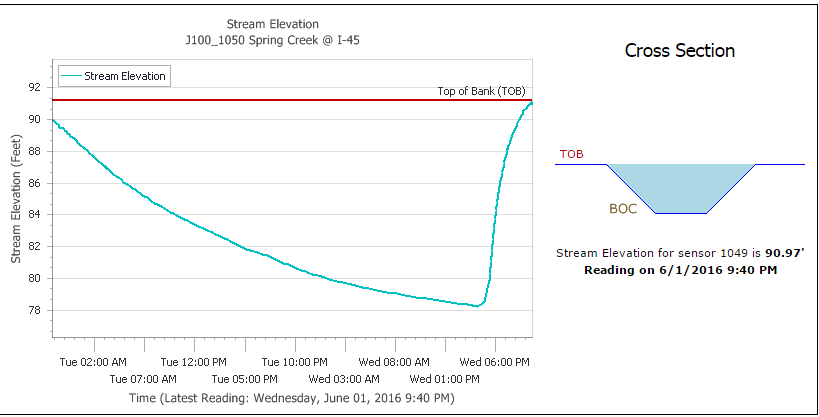
In terms of flooding concerns in the immediate term through the early overnight: Spring Creek at I-45 came to the top of its banks, though as I write this, it appears it may have crested at 91′ there (for comparison, over the weekend it crested at over 108′).
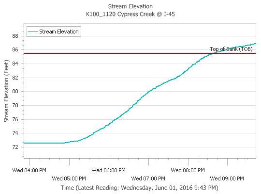
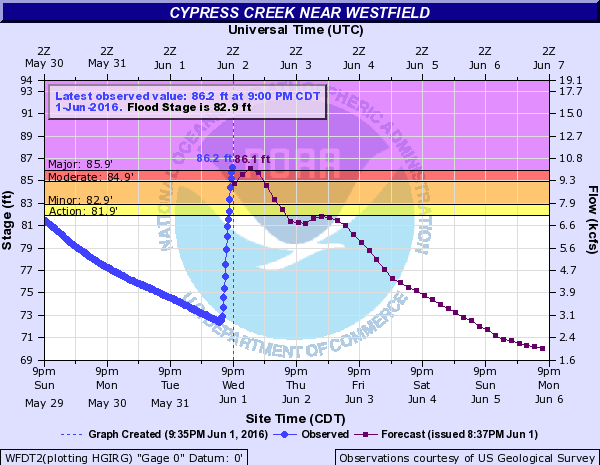
Cypress Creek at I-45 came out of its banks, and is running close to one foot higher than the weekend as I write this. The rain was worse a little further south tonight than we saw over the weekend.
Cypress Creek flooding will continue and push major levels this evening. We’ll see low lying areas along the creek and low streets flood, but houses should be safe. We may see minor flooding along Willow Creek, Little Cypress Creek, and the lower end of Spring Creek, but nothing like we saw this weekend overnight.
The San Jacinto River will see all the runoff from this, and it’s likely to revert back to major flood stage again. The Brazos continues to run higher than anyone expected. It may have crested, but it’s not clearly dropping. We’re in a prolonged, flat crest. And it’s likely to not improve. Here’s why…
WHAT’S NEXT?
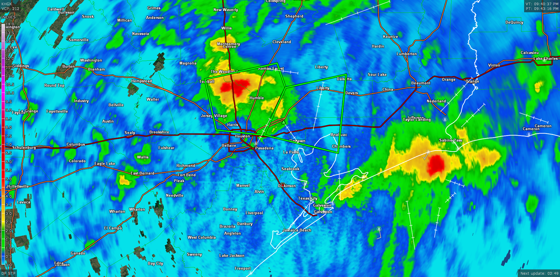
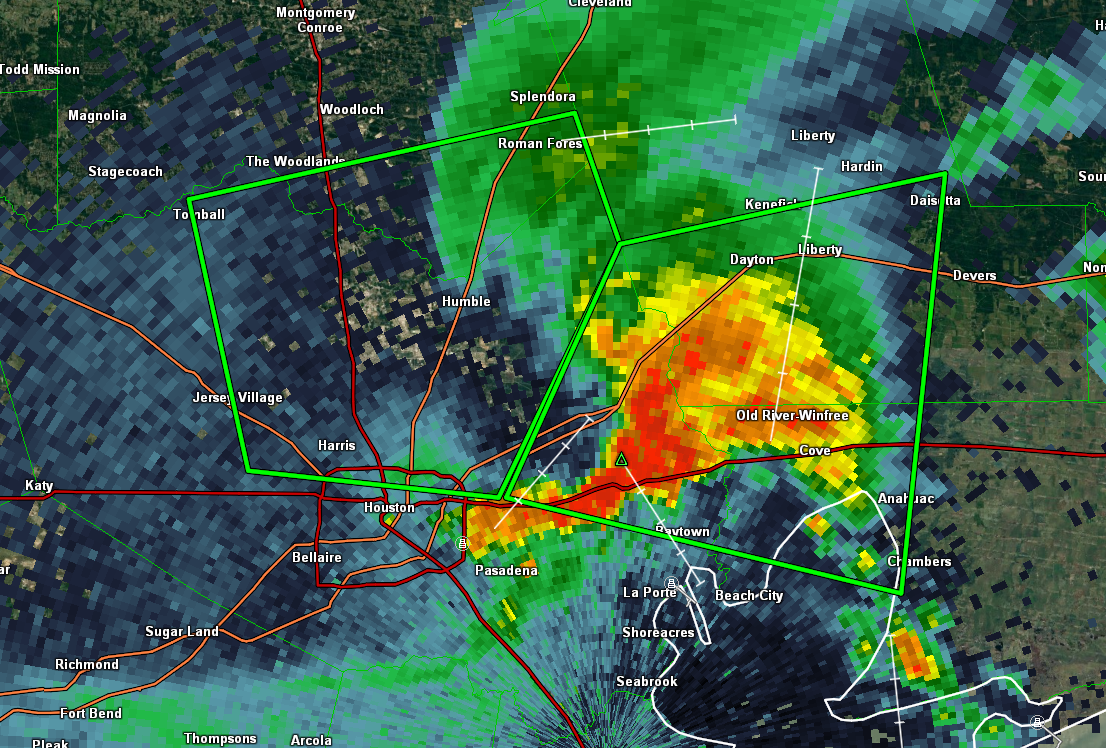
Radar at 10 PM shows thunderstorms over Eastern Harris, Liberty, and Chambers Counties, with a Flash Flood Warning until 11:15 PM for those areas.
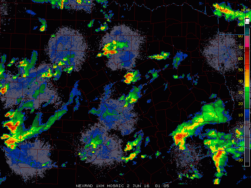
I am growing extremely concerned about what may occur overnight and toward morning. As of 10 PM, numerous showers and storms were menacing Central Texas. The technical term for the radar image below is “a mess.”
Weather models have been nothing short of “very aggressive” in organizing these thunderstorms overnight into a more orderly cluster. These are slated to arrive in the Houston area late tonight and Thursday morning. Given leftover boundaries from tonight’s storms, a air mass that in place that is only getting more moist, and already organized storms, there is a good chance that a significant amount of rain will fall somewhere tomorrow. I think most areas can easily see 1-3″ more from this, and there will likely be pockets that see upwards of 4-6″ of rain. Most of the city and points south and east can absorb this sort of rain without a ton of severe issues. But, should the heavier rain fall, say, over the Brazos or north of the 610 Loop in Northern Harris County or Southern Montgomery County or along the San Jacinto River, it is likely that major problems will ensue.
The best advice I can give you is this: If you need to travel places Thursday, give yourself extra time. If you have to travel through some of those harder hit areas I mentioned on Thursday, make sure to pack a *lot* of extra time, patience, and have a backup plan in case you get stuck. We certainly don’t want to overhype this event, but if things come together as the best available weather model guidance says things will, Thursday is going to be a very long day in Southeast Texas. We will keep you updated every step of the way.
We have additional updates on social media as well.
Find us on Facebook
Follow our Twitter account
Matt is on Twitter
Braniff is on Twitter