In brief: In today’s post we review the state of the Atlantic hurricane season, which normally is taking off at this time of summer. Also we look ahead to a few more sizzling hot days before a slight cooldown this weekend to go along with some spotty shower chances. We take what we can get in late August.
Status of Atlantic hurricane season
Well, we’ve officially reached the point of summer when activity in the Atlantic Ocean typically starts ramping up. So far this year is off to a slow start, with just three tropical storms. How slow? When we look at a metric useful for gauging overall activity, “accumulated cyclone energy,” activity to date is just 14 percent of normal levels. Since 1950 only seven years have started off with less overall action in the Atlantic, Caribbean, and Gulf.
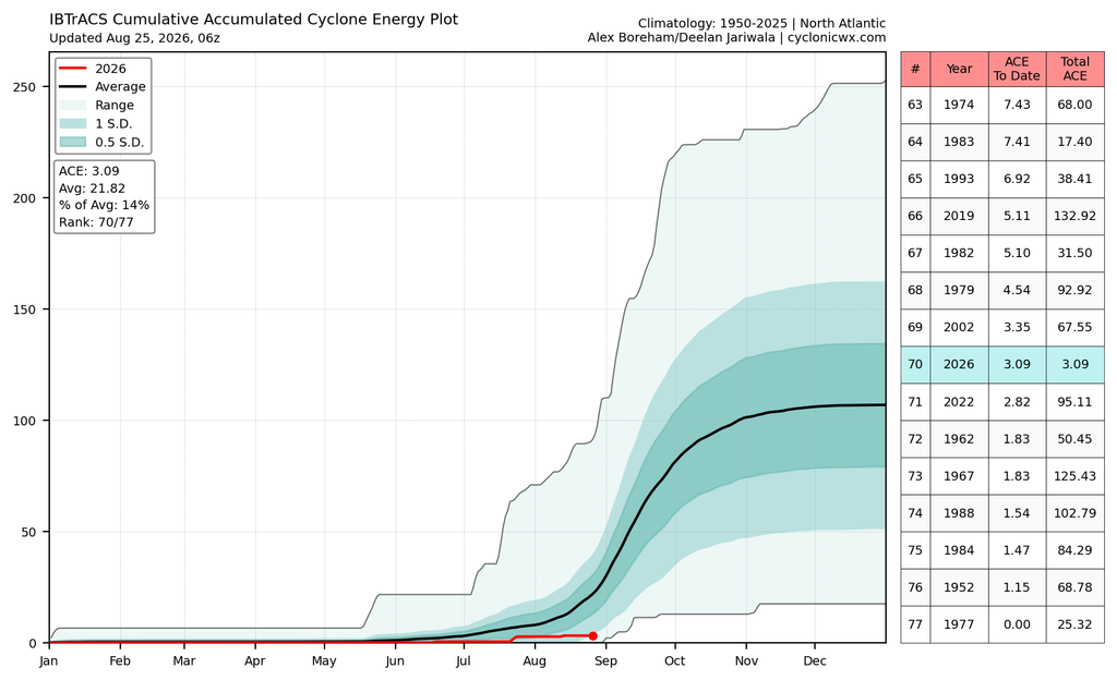
Now I want to be clear: I am not taunting Mother Nature with the following words. But in reality, the runway for the rest of this hurricane season, and the state of Texas, does not stretch endlessly toward the horizon. Rather, realistically, we have about one more month before the odds of a hurricane strike on the great state drop significantly based on historical norms.
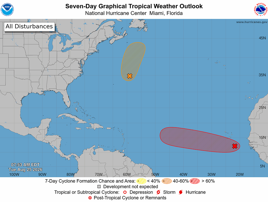
We can be pretty confident that no storms are going to move into the Gulf during the next 10 days (a promising tropical wave that recently moved off of Africa, if it develops, almost certainly will not come this way). That leaves about three weeks in September—which is quite literally the peak of the Atlantic season—when we’ll need to keep a close eye on things. Will El Niño continue to suppress activity? Some of our latest sub-seasonal modeling indicates that this is likely to be the case, but we won’t know for sure until we actually get into September. With that said we are in about as good a position as one could be, regarding hurricanes, in late August.
Tuesday and Wednesday
The very hot and sunny conditions we’ve experienced of late will persist for the next couple of days. We can expect highs in the vicinity of 100 degrees, plenty of humidity, and warm, sultry nights. Winds will be light during the morning, but gust up to 15 or 20 mph from the southwest during the afternoon hours.
Thursday
Some time on Thursday the high pressure ridge that has been dominating our weather during the second half of August will start to pull back to the west. I’m not sure this will happen in time to impact temperatures on Thursday, which still should reach near 100 degrees. But we may start to see a few more clouds, and by Thursday afternoon or Thursday night there might be some modest rain chances returning.
Friday, Saturday, and Sunday
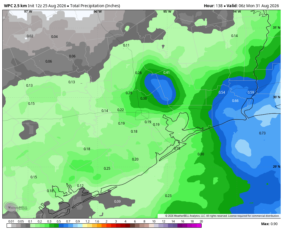
The weekend will bring weather that is more typical for late August, which is to say high temperatures generally in the mid-90s and spotty showers. Rain chances won’t be high, perhaps 20 or 30 percent each day. But that’s higher that we’ve seen in a while. Skies should remain mostly sunny, and any showers that pop up probably won’t last too long.
Next week
Most likely our temperatures will remain in the mid- to upper 90s for much of next week, with mostly sunny skies and slight chances of afternoon showers. Early September is typically not much different than late August.
