First off, shout to all of you who posted your amazing sunrise and sunset pictures in the comments yesterday on Facebook. Seriously, this is one time where reading the comments section is encouraged. Some great stuff from y’all there, so thank you. We will work to integrate more of your photos more often, so please share with us as you see fit…sunrises, sunsets, storm damage, gratuitous and absolutely necessary dog photos! We don’t want to overpromise, of course, but we will do our best.

Facebook is an option for sharing with us. Twitter/X is an option as well. Instagram is an option (just message us). Good old fashioned email works too. ([email protected] and [email protected]).
Alright, let’s get into the forecast, which will feature a brief roller coaster ride with a little spring and a little autumn and winter.
Today
Much like yesterday, today should feature sun and passing high clouds. There may be a bit more cloud cover at times today, especially later. Maybe we can still eke out another good sunset. Either way, it will be a cordial golf clap sort of day. Highs will be well into the 60s and a few spots may even crack 70 this afternoon.
Friday
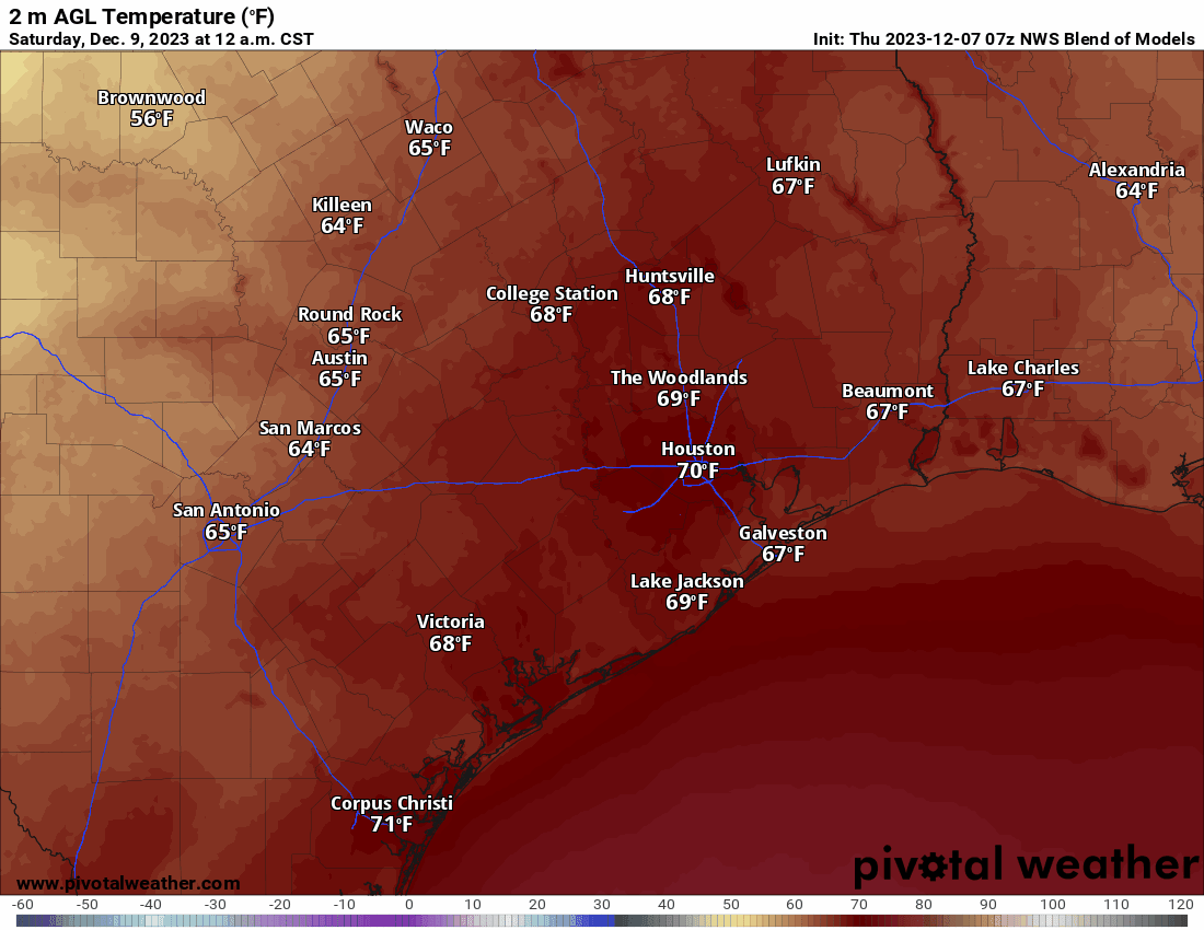
As a more assertive push of humid air lifts north into our area tomorrow, we should see clouds and a few passing showers. I don’t think we’re going to see a ton of sun tomorrow, but especially in the afternoon hours it’s possible. Any rainfall should be fairly brief and mostly just conversational in nature. Morning lows will be in the 60s (about 15 to 20 degrees warmer than today), and we will warm well into the 70s tomorrow.
Saturday
The morning should start off fine on Saturday with low clouds and muggy conditions. Morning lows will likely be in the mid-60s in most spots. I can’t rule out some areas of fog Saturday morning either. We could even see a little coastal fog in the afternoon down near Galveston.
The afternoon should start fine enough, but then a line of showers and thunderstorms with our much discussed cold front will push through the area. I expect this to occur in the latter half of the afternoon, probably after 2-3 PM. The line of showers and storms will start as just some scattered activity northwest of Houston, so places in the Brazos Valley and north of Conroe may see just some brief downpours or even nothing at all during the early afternoon. As the front passes through the Houston metro area, the line will be gradually congealing but even here it may still struggle a bit. The good news for anyone with plans on Saturday is that the precipitation should be moving fairly quickly. I can’t see more than an hour or so of rainfall at any one spot as this thing pushes through. Showers should reach the coast by 7 to 9 PM.
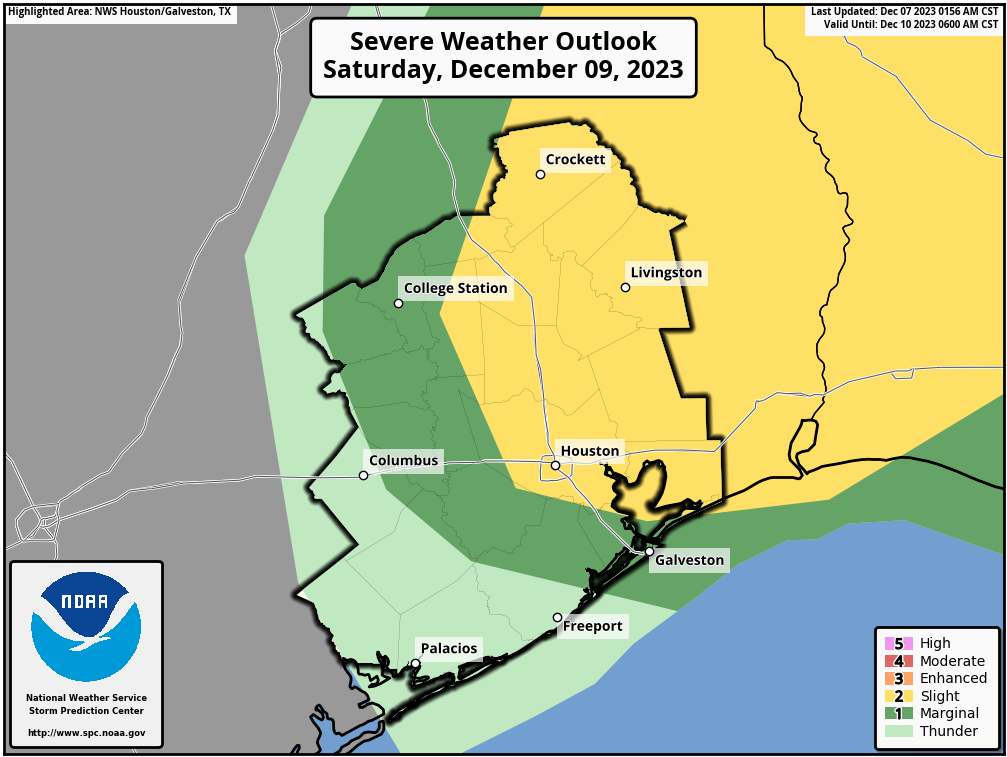
The best chance of any severe weather is likely to stay northeast of most of our area. But with these kind of fronts, there’s always a chance something pops before it exits the area. With a pretty strong “cap” in place on Saturday, however, it seems like strong storms from the Houston metro to the coast seems like a very low risk.
The main story with this front will be temperatures.
We will see high temperatures rise into the low to mid 70s in north and northwestern reaches of the area on Saturday. From Houston south, because the front is later in the day, highs well into the 70s with a few spots near 80 degrees will be likely. Behind the front, we’ll drop through the 60s and into the 50s relatively quickly, settling into the 40s on Sunday morning. In addition, winds will be quite blustery Saturday night into Sunday morning with gusts of 20 to 30 mph likely.
Sunday and Monday
Unlike our last few fronts it seems, this one will break through and clear us out. Expect plentiful sunshine on Sunday and Monday. After our chilly and windy start, Sunday will only warm into the mid to upper-50s.
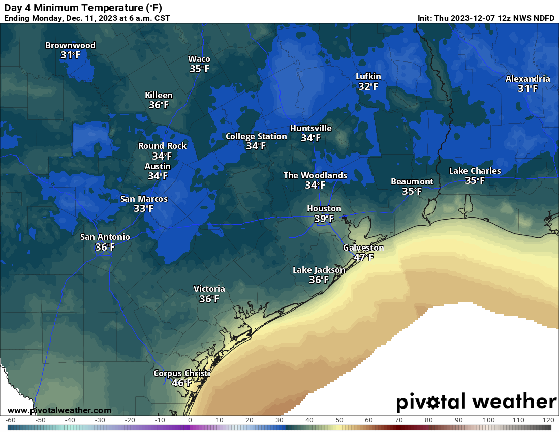
The coldest morning will be Monday with upper-30s likely, and even some mid-30s in the outlying, more rural areas. We should poke back up above 60 on Monday afternoon.
Rest of next week
We should warm up through midweek, along with a return to some clouds. Another cold front may time toward late week or the weekend with showers and storms and colder temperatures. These types of El Niño-ish patterns usually feature cooler days and cool to cold night — but not intense cold. No sign of freezing temperatures for Houston on the horizon for now.


We need those freezing temperatures (as in “hard freeze” level) for the mandatory mosquito genocide.
No mosquitoes here in Magnolia area (on 5 acre property), so no, no freezing required
Nobody in TX would wish for a hard freeze even if it meant less mosquuitos
What the heck is a “cordial golf clap”??
Depends on situation.
https://www.golfputting.org/what-is-a-golf-clap.htm
Thanks guys (Jason and Aggie), I wasn’t familiar with that term. Long, slow, non sarcastic clap for y’all 👏🏼
I think that means the way that the people who are watching a golfer on the course gently and briefly clap when the golfer sinks a putt.
Getting married on the 29th, so the sooner you can firm up the end of moth forecast, the better. 😉
I have joked that it will snow on the day. Fiancé is calling for highs around 60° with clear skies!
⚘ Congratulations! ⚘
I wish you life-long peace, love & health 💓
🤗
Argh…I was really hoping for decent rain. Only had .5” last time. We are way behind at our house a few miles NE of IAH. Way behind IAH rainfall also, maybe 6” less than that station.
This cool and sunny is freaking grand. And thanks for the higher temps on Friday so I can wear flip flops to my pedicure. 😉
It would actually be kinda nice if we didn’t get a hard freeze this winter. The pipes in my house are pretty old. I’ve been lucky so far, but I don’t want to keep testing that luck. Plus these harsh cold snaps we have been getting the past few winters keeps damaging our Jasmine vines to the point that they are not putting out flowers during the spring. I hope to smell the wonderful scent that those flowers put out again this spring.
Well, as usual it looks like we missed another chance of getting a good potent cold front in here during the day. And I was also looking forward to getting a good rain. But no!!! I’d be a rich man if I were betting on daytime or nighttime frontal passages.
I just received a FB reminder about the snowfall we had on this date in 2017!