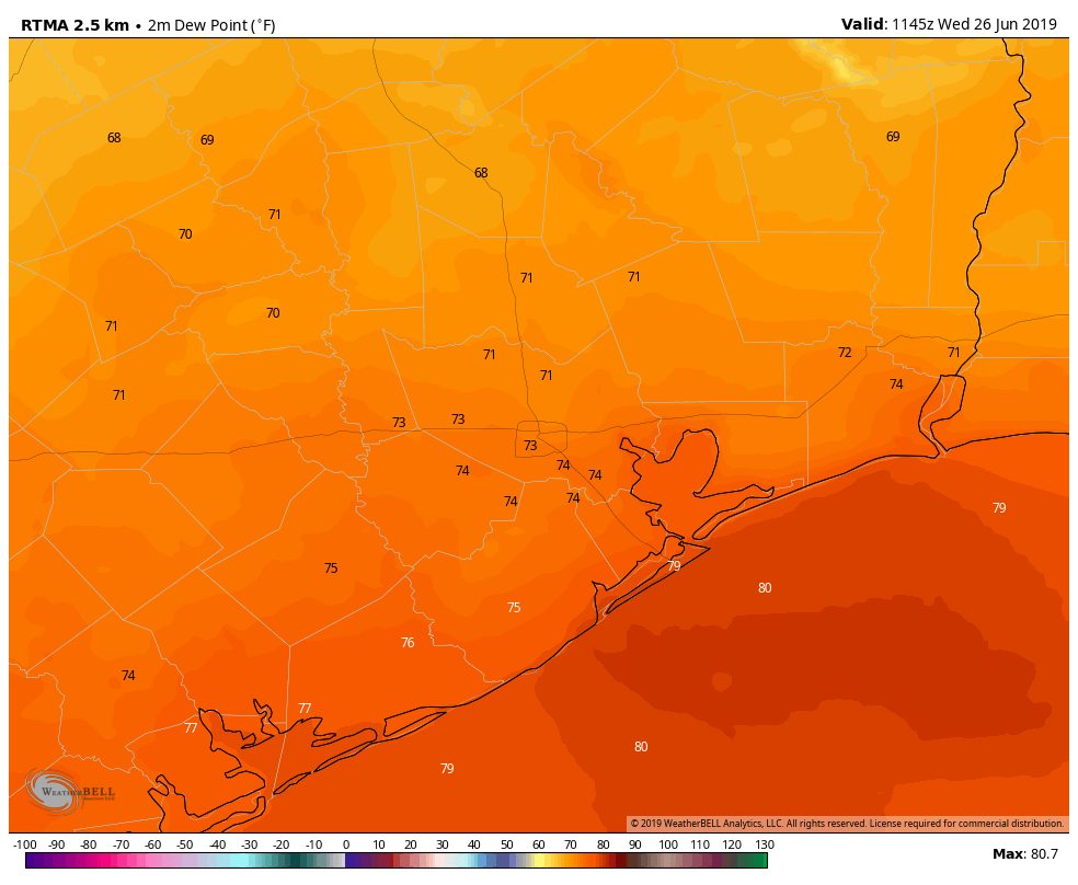
Good morning. The radar is a bit quieter this morning, so before jumping into the forecast I wanted to note a dubious record the city set last weekend. According to World Climate Service on Twitter, Saturday was the most humid day on record at Houston’s Bush airport (which has recorded hourly data since 1969), with an average hourly dewpoint of 79.7 degrees Fahrenheit. The four days from June 20 through June 23, in fact, ranked as four of the top six spots for daily mean dewpoint in Houston. As a reminder, here’s how Matt recently characterized dewpoints, and how they feel:
- 70s means uncomfortable, or typical summer
- 60s means humid, but not terrible
- 50s means mostly comfortable
- 40s or less means very comfortable or dry
Now, on to the forecast.
Wednesday
In case you were wondering, dewpoints this morning are generally in the low 70s. We’re going to see another day with scattered, daytime showers across Houston. Accumulations should be less than Tuesday, but we can’t rule out some areas seeing a 1 inch or so of rainfall, with a higher bullseye under the slowest-moving storms. Most of the area will probably see 0.25 inch or less. Highs will get up to around 90 degrees, although local temperatures will depend upon the extent of sunshine your area receives. High pressure should begin to build in this evening, shutting down rain chances area-wide.

Thursday and Friday
Under a building ridge of high pressure situated over West Texas, these days should see partly to mostly sunny skies, with highs in the low- to mid-90s. Rain chances won’t go away entirely, but I would not expect more than about 10 percent of the area to see any precipitation. These will be fairly classic late June days, weather-wise.
Saturday and Sunday
High pressure will retreat to the west by this weekend, and this will allow a more moist air mass to move into the region. This in turn will drive up rain chances to about 50 percent for both days. Right now accumulations don’t look too serious, and most of the area will probably see about 0.25 to 0.75 inches across both days. This won’t be a washout, but any fast-developing thunderstorms could ruin outdoor activities as you shelter from lightning. Highs should hold around 90 degrees for both days.

Next week
The early part of next week, at least before the July 4th holiday, looks fairly wet with low pressure lingering near the coast. The threat will come from slow-moving showers and thunderstorms. Right now the forecast models aren’t indicating anything too extreme, but we’ll be watching it as this kind of coastal moisture can definitely produce some heavy rains.
I love you guys. I count on you for intelligent info and appreciate the lack of drama very much. One question: I don’t really understand dewpoints. We used to talk about humidity levels, 40%, 80%, etc. That I understand. But I am getting old and there seems to have been a switch. The comfort descriptions you provide are not really helpful for me because your comfort is not universal. Many of us like some humidity and heat. (that is my only critique of your reporting: you assume comfort levels that don’t reflect the reality of the diverse experiences out here.)
That said, could you please explain dewpoints and humidity levels? I’d be very appreciative.
Keep up the good work!
JoAnn
JoAnn,
People are definitely more familiar with “humidity” but that value is really “relative humidity” (RH). The reason it is relative is that it changes with air temperature. As temperature increases, the air is able to hold more water. And the inverse is true in that as temperature falls, the air’s ability to hold moisture decreases. So if the air held the same amount of moisture, at 90 degrees the RH might be 30%, but as the temperature falls during the evening hours, the RH will go much higher than 30%, and will be at 100% when the dew point temperature is reached. Relative humidity depends on temperature.
Dew point does not have this variation with temperature. It varies with barometric pressure. Air is a gas and its ability to hold moisture depends on the pressure it is under. Given this, the dew point is a better measurement of how much water is in the air, regardless of the temperature. And the higher the dew point goes, the more humidity.
As a real world scenario which of these would feel “humid”?
If it was 30 F and 100% RH, or if it was 80 F and 50% RH?
In this scenario, the dew point on the 30 F day is 30 F. But the dew point on the 80 F day is 60 F.
And as per Matt’s Space City Weather Dew Point Comfort chart, 60 F dew point is humid but manageable. Where a 30 F dew point is dry/comfortable. But the humidity levels wouldn’t tell you that.
Excellent explanation. But I’m with JoAnn – getting older. And I do find the science interesting but comfort is relative, subjective, and seldom to be found in this area from June – September. But this New England Yankee transplant would find 30F/100%RH time for a nice cup of tea. An when temps hit 90 any dew point over my current age means iced drinks indoors. 3 Months + until the possibility of comfortable weather returns. 🙂
The dew point is the temperature the air needs to be cooled to (at constant pressure) in order to achieve a relative humidity (RH) of 100%. At this point the air cannot hold anymore water in the gas form. … The higher the dew point rises, the greater the amount of moisture in the air.
https://www.weather.gov/arx/why_dewpoint_vs_humidity
Thanks for the dew point primer! Very helpful and news we don’t get anywhere else.
I do not mind the rain if it helps keep the temps down. This summer so far actually seems a little more mild than past years with all the rain, clouds, and “cool” fronts we’ve been seeing.
I’ve thought the same thing, it hasn’t been that bad so far this late spring/summer. But I wouldn’t mind some good ol’ high pressure to take over as we get into late July and August, to steer hurricanes away from us.