Good morning. We are now in the second half of May, a period I like to call “early summer,” when we first start to see 90-degree temperatures with some regularity, but some nights in the 60s are still possible, and there’s still the thinnest hope of a weak front. That weak front is coming Saturday, and it will bring us a few days with slightly drier air. After that? Well, we’ll be at the end of the month with June right around the corner.
Surely you know what that means?
Thursday
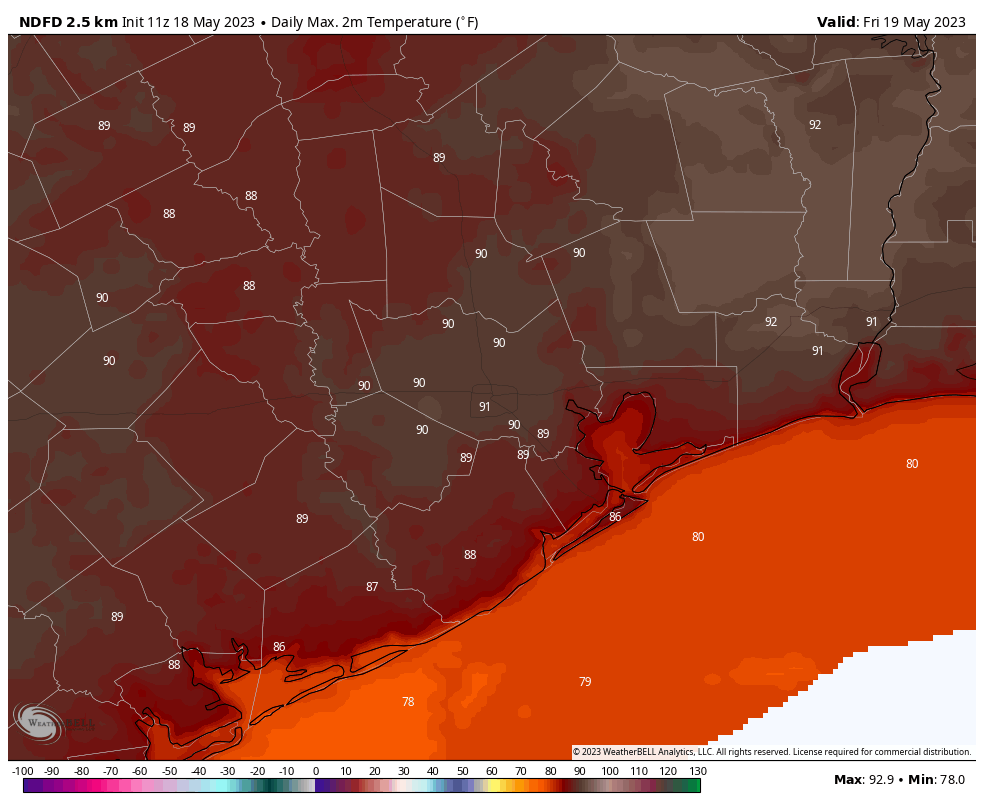
Today will be sunny and warm, with high temperatures around 90 degrees. Winds will be light and variable. Lows tonight will drop to around 70 degrees.
Friday
Did you like Thursday? Good, because Friday and Friday night will be pretty much the same, with only a slight uptick in winds, now coming from the south.
Saturday
A weak front should cross the region on Saturday afternoon and evening. There is not going to be a whole lot of instability for the front to work with, so at this point I’d peg the chances of a shower or thunderstorm at any given location in Houston at about 20 percent during the daytime or evening. Highs will reach about 90 degrees, with partly to mostly cloudy skies.
Sunday
Clouds will linger for much of Sunday, but highs will be slightly cooler in the wake of the front, with highs in the mid-80s. That back-burner, 20 percent chance of rain will linger throughout the day before things clear out Sunday night. Lows should drop into the upper 60s.
Next week
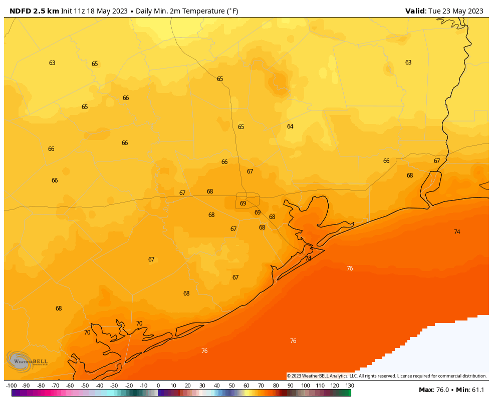
The first two or three days should see highs in the upper 80s and lows in the upper 60s, with partly sunny skies. The air is not going to be dry, but with dewpoints in the low- to mid-60s, this is going to be as dry as it gets for about four months. Temperatures warm to about 90 degrees with muggier air during the second half of the week. In terms of rainfall, it doesn’t look like there will be much.


Your top paragraph is always repeated, same statement appearing twice, for the last few months.
Also, no one reported the hail that fell in Sugar Land late Tuesday afternoon. About 4 pm at the intersection of Williams Trace and 59. Pea size hail was really pounding on the roof of the medical office I was in.
Should they also report every instance of gusty winds and loud thunder throughout the Greater Houston area?
Let’s be grateful that Eric and Matt provide a clear, concise, no-nonsense yet often humorous weather update for all of us nearly every single day of each and every year?
Thanks for the continued good work on providing a forecast for our extended metro area! Even a weak front is welcome at this time of the year.
“Early summer” seems to have arrived early but I’m hopeful that it will plateau and not ramp up to a brutal summer level.
I do recall some nice dry fronts that came in May and in June some yrs ago similar to what we are seeing now. These “weak” fronts feel great BTW.
For the life of me, I can’t figure out why you chose Texas as your home. The way you lament the coming of summer is truly tragic…
We lament the same as those in places like majority of the North lament having to shovel the snow their driveway for the next 4-5 months. Gotta take the good with the bad, we all can’t be as temperate at LA and San Diego weather all year long, and we can’t all live there.
Because thats is the reality of Texas summers kelly, lol